1900s (20th Century) Maps of Greenwood, South Carolina
Explore 9 historic maps of Greenwood from the 1900s (20th Century). These maps offer a rare glimpse into what life looked like during the 1900s — showing old roads, neighborhoods, homes, and landmarks that have changed or disappeared over time.
Whether you're researching your family's past, planning a metal detecting trip, or studying how Greenwood's landscape evolved across the 1900s, these high-resolution maps are a powerful tool for exploring the history of this region.
- Focus on a specific era: All maps on this page are from the 1900s, giving you a focused view of this time period.
- See what’s changed: Compare century-old streets, trails, and buildings to today's modern landscape using overlays and satellite layers.
- Research with precision: Use these maps for genealogy, historical research, land use analysis, or educational projects.
- View, download, or print: Maps are fully viewable online in high resolution, and can be downloaded or printed for your own records.
Start exploring Greenwood's history through authentic maps from the 1900s. This is your window into the past.
Greenwood, SC maps
(9)- 1949 Map of Ninety-Six
 1949 Ninety-Six1949 Print · USGSThe crossroads town of Ninety-Six is shown at the peak of its rail-era influence in the late 1940s. Genealogists and historians can trace family locations near Youngs Chapel School, Lebanon Church, and the Site of Old Star Fort.2 unique versions available
 - 1949 Map of Greenwood
 1949 Greenwood1949 Print · USGSGreenwood flourished as a major rail and textile crossroads in the late forties, its landscape defined by industrial villages and extensive trackage. Genealogists and historians can trace neighborhood roots through Lander College, the Connie Maxwell Childrens Home, and several mill villages.2 unique versions available
 - 1954 Map of Greenville, 1965 Print
 1954 Greenville1965 Print · USGSThe Upstate and Northeast Georgia are captured here during a decade of massive transformation as new reservoirs reshaped the Piedmont. Genealogists and hikers can trace the Appalachian Trail over Brasstown Bald or locate old community centers like Demorest, Westminster, and Royston.3 unique versions available
 - 1958 Map of Greenville
 1958 Greenville1958 Print · USGSThe Piedmont and Blue Ridge foothills come alive in this mid-century survey of the Upstate and Northeast Georgia. Trace the regional rail-and-river economy through the Southern Railway corridors and early reservoir developments like Lake Sidney Lanier.
 - 1971 Map of Cokesbury, 1974 Print
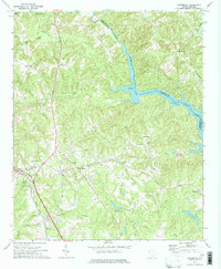 1971 Cokesbury1974 Print · USGSThe rural Upstate of the early 1970s is centered here around Cokesbury and its historic Old Cokesbury College campus. Researchers can trace family roots at Old Tabernacle Cem or locate community landmarks like North Hodges Sch and the Hodges Lookout Tower.2 unique versions available
 - 1971 Map of Waterloo, 1975 Print
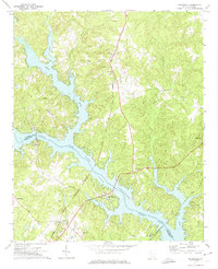 1971 Waterloo1975 Print · USGSThe Laurens and Greenwood County borderlands are defined by the rising waters of Lake Greenwood in the early seventies. Researchers can trace rural church history and rail transport through Waterloo, Cross Hill, and the Seaboard Coast Line corridor.
 - 1978 Map of Greenwood, 1979 Print
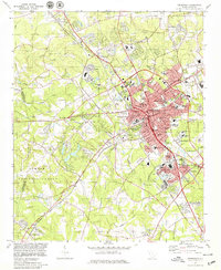 1978 Greenwood1979 Print · USGSGreenwood at the end of the 1970s shows a thriving regional hub where the SOUTHERN railroad meets a growing network of industrial and residential villages. Researchers can trace family sites at Promised Land, Lander College, and the Maxwell Childrens Home.
 - 1978 Map of Ninety-Six, 1979 Print
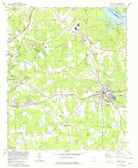 1978 Ninety-Six1979 Print · USGSThe town of Ninety Six and the surrounding backcountry are captured in the late 1970s, showing a landscape defined by rail and river. Genealogists can trace family landmarks and sites like the Old Star Fort (Site), Irvines Landing, and Siloam Ch.
 - 1979 Map of Abbeville, 1980 Print
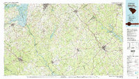 1979 Abbeville1980 Print · USGSThe South Carolina and Georgia borderlands are captured here during a period of significant hydroelectric development and regional growth. Researchers can trace the rail-and-river economy through the Seaboard Coast Line and landmarks like Hartwell Dam or the Silk Mills.2 unique versions available
End of results
Showing maps 1-9 of 9
Top cities near Greenwood
- Abbeville historical maps
- Honea Path historical maps
- Ninety Six historical maps
- Due West historical maps
- Cross Hill historical maps
- Donalds historical maps
See more
Top neighborhoods of Greenwood
- Smithfield historical maps
- South Greenwood historical maps
- Stalnaker Heights historical maps
- Wisewood historical maps
- Blakedale historical maps
- Glendale historical maps
See more
Frequently asked questions
- What are the different types of historical maps available for Greenwood?
- What is the oldest map of Greenwood?
- Where can I purchase historical maps of Greenwood for my home or office?
- Where can I download high-res historical maps of Greenwood?
- Are there historical topographic maps available for Greenwood?
- Is there historical aerial imagery available for Greenwood?
- Where are historical maps of Greenwood sourced from?