1900s (20th Century) Maps of Lexington, South Carolina
Explore 21 historic maps of Lexington from the 1900s (20th Century). These maps offer a rare glimpse into what life looked like during the 1900s — showing old roads, neighborhoods, homes, and landmarks that have changed or disappeared over time.
Whether you're researching your family's past, planning a metal detecting trip, or studying how Lexington's landscape evolved across the 1900s, these high-resolution maps are a powerful tool for exploring the history of this region.
- Focus on a specific era: All maps on this page are from the 1900s, giving you a focused view of this time period.
- See what’s changed: Compare century-old streets, trails, and buildings to today's modern landscape using overlays and satellite layers.
- Research with precision: Use these maps for genealogy, historical research, land use analysis, or educational projects.
- View, download, or print: Maps are fully viewable online in high resolution, and can be downloaded or printed for your own records.
Start exploring Lexington's history through authentic maps from the 1900s. This is your window into the past.
Lexington, SC maps
(21)- 1904 Map of Columbia
 1904 Columbia1904 Print · USGSRichland and Fairfield counties at the turn of the century are defined by their river-and-rail corridors and rural church communities. Genealogists can trace family footprints across Broad River ferries, the Southern R.R., and landmarks like The Old Brick Church or Winnsboro.2 unique versions available
 - 1941 Map of Spartanburg
 1941 Spartanburg1941 Print · USGSSouth Carolina’s Piedmont and Sandhills regions are shown here during the mid-century peak of the rail era. Researchers can trace the sprawling Fort Jackson Military Reservation and the industrial growth of hubs like Spartanburg and Rock Hill.
 - 1944 Map of Gilbert, 1946 Print
 1944 Gilbert1946 Print · USGSMid-century Lexington County is mapped here as a network of rail-side towns and rural mill seats. Researchers can trace family roots at St Matthews Ch, locate the Saxe-Gotha Millpond, or follow the Southern Railway through Gilbert.2 unique versions available
 - 1944 Map of Edmund, 1966 Print
 1944 Edmund1966 Print · USGSLexington County and the southern fringes of Columbia are shown in detail during the final years of World War II. Researchers can locate family landmarks like Saxe Gotha Sch, the Columbia Air Base, and Huckabaas Millpond.
 - 1946 Map of Irmo, 1968 Print
 1946 Irmo1968 Print · USGSMid-century Richland and Lexington Counties are caught in transition as the hydroelectric power of the Saluda River reshapes the land. Researchers can trace rural school locations like Rosenwald Sch and historical churches such as St Andrews Ch or Pilgrim Ch.
 - 1948 Map of Irmo
 1948 Irmo1948 Print · USGSThe Irmo area of South Carolina thrived as a railway and agricultural hub in the mid-forties, just as the Saluda River's transformation was complete. Genealogists and historians can trace institutional roots at the Harbison Institute or locate family plots at Upper Pine Grove Cem and Lower Pine Grove Cem.2 unique versions available
 - 1953 Map of Spartanburg, 1966 Print
 1953 Spartanburg1966 Print · USGSMid-century South Carolina comes into focus through this survey of the Piedmont and the Sand Hills at a time of significant reservoir expansion. Researchers can trace the legacy of industrial transit and resource extraction from the Haile Gold Mine to the rail hubs of the Seaboard Air Line.4 unique versions available
 - 1954 Map of Augusta
 1954 Augusta1954 Print · USGSThe Savannah River valley and South Carolina Midlands are captured here during a period of post-war growth. Researchers can trace the rail-and-river economy through the Southern RR corridor and locate historic settlements like Aiken, Orangeburg, and Sumter.
 - 1957 Map of Augusta, 1966 Print
 1957 Augusta1966 Print · USGSThe Savannah River and Santee basins are captured here during a period of massive military and industrial expansion in the late fifties. Genealogists can trace family footprints across Four Hole Swamp or near the Savannah River Plant.3 unique versions available
 - 1958 Map of Augusta
 1958 Augusta1958 Print · USGSThe borderlands between Georgia and South Carolina come alive in the 1950s, showing the early footprint of the Savannah River Plant. Genealogists and historians can trace rail-dependent towns and rural landmarks from Orangeburg to the Fort Jackson Military Reservation.
 - 1960 Map of Spartanburg
 1960 Spartanburg1960 Print · USGSThe South Carolina Piedmont and North Carolina borderlands come alive in this mid-century survey of the region between Spartanburg and Columbia. Researchers can trace the Seaboard Air Line railroad and explore landmarks like Anderson Quarry, Lake Murray, and Mount Croghan.2 unique versions available
 - 1961 Map of Augusta
 1961 Augusta1961 Print · USGSThe South Carolina lowcountry and CSRA appear here in the early sixties, during a period of massive military and industrial growth. Researchers can trace the development of the Savannah River Plant or locate legacy landmarks like Nelson Ferry and Magnolia Cemetery.2 unique versions available
 - 1962 Map of Augusta
 1962 Augusta1962 Print · USGSThe South Carolina and Georgia borderlands are seen here in the early sixties, showing the rise of the Savannah River Plant and the expansion of Fort Jackson. Researchers can trace old rail lines like the Southern Railway and find landmarks such as St. Pauls Church or the Santee Canal.
 - 1963 Map of Spartanburg
 1963 Spartanburg1963 Print · USGSMid-century South Carolina comes alive in this survey, showing the rail-linked corridor between the Upstate and the Midlands. Genealogists can trace family lands near old hubs like Union and Lancaster, or along the banks of the Broad River and Pee Dee River.
 - 1964 Map of Spartanburg
 1964 Spartanburg1964 Print · USGSMid-century South Carolina comes alive in this survey of the Piedmont and Upcountry, stretching from the Blue Ridge foothills to the Sandhills. Genealogists and historians can trace the rail-and-river economy through Monarch Mills, Glenn Springs, and the Southern Railway corridor.
 - 1971 Map of Irmo, 1973 Print
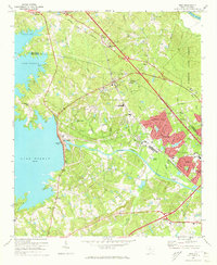 1971 Irmo1973 Print · USGSThe Irmo area was undergoing significant suburban growth in the early seventies as new neighborhoods expanded toward the shores of Lake Murray. Local researchers can trace the historic Columbia Newberry and Laurens rail line through Irmo and locate family landmarks like the Harbison Institute and Pilgrim Ch Cem.4 unique versions available
 - 1971 Map of Lake Murray East, 1973 Print
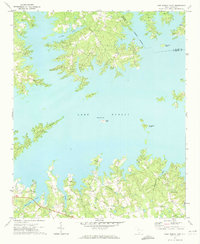 1971 Lake Murray East1973 Print · USGSLake Murray and the Lexington County shoreline are captured here in the early 1970s, showcasing a landscape of peninsulas and rural congregations. Genealogists can locate family landmarks like St Thomas Ch, Providence, and Counts Island.
 - 1972 Map of Lexington, 1974 Print
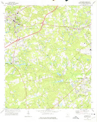 1972 Lexington1974 Print · USGSLexington and its surrounding communities are shown during a time of mid-century growth and industrial change. Genealogists and researchers can trace family-named water bodies like Shealy Pond and historic congregations including Nazareth Ch and Bethany Ch.3 unique versions available
 - 1983 Map of Aiken, 1984 Print
 1983 Aiken1984 Print · USGSThe Savannah River valley and South Carolina sandhills are shown in detail during the early eighties, as industry and education expanded. Researchers can trace the rail corridors of the Southern and Seaboard Coast Line through communities like Graniteville and Leesville.
 - 1986 Map of Barr Lake
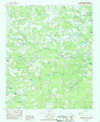 1986 Barr Lake1986 Print · USGSLexington and its surrounding rural crossroads are captured in the mid-1980s as a landscape of family-named ponds and winding creeks. Genealogists and local historians can trace legacy landmarks like Saxe-Gotha Millpond, Elsie, and Twelvemile Creek.
 - 1986 Map of Newberry
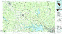 1986 Newberry1986 Print · USGSSouth Carolina's Piedmont region is shown here in the mid-1980s, revealing a landscape of historic crossroads and industrial mill villages. Researchers can trace family roots through landmarks like Lynch Woods Cem, New Hope Church, and the campus of Presbyterian College.2 unique versions available
End of results
Showing maps 1-21 of 21
Top cities near Lexington
- Columbia historical maps
- West Columbia historical maps
- Cayce historical maps
- Forest Acres historical maps
- Blythewood historical maps
- Springdale historical maps
See more
Top neighborhoods of Lexington
- Coventry Woods historical maps
- Lexington Woods historical maps
- Lakeland historical maps
- Heritage Hills historical maps
Frequently asked questions
- What are the different types of historical maps available for Lexington?
- What is the oldest map of Lexington?
- Where can I purchase historical maps of Lexington for my home or office?
- Where can I download high-res historical maps of Lexington?
- Are there historical topographic maps available for Lexington?
- Is there historical aerial imagery available for Lexington?
- Where are historical maps of Lexington sourced from?