Old Maps of West Columbia, South Carolina for Genealogy
Trace your family roots with 38 historic maps of West Columbia. These high-res maps reveal old neighborhoods, homesites, landmarks, and streets — helping you uncover where your ancestors lived and how the area evolved over time.
- Explore historic neighborhoods: Identify where your relatives may have lived in the 1800s or 1900s.
- Compare maps over time: Trace the changes in streets, buildings, and landmarks for multi-generational research.
- Perfect for genealogy & ancestry research: Used by family historians and researchers to map out lineage and migration.
These maps are an incredible resource for exploring your personal connection to West Columbia's past.
West Columbia, SC maps
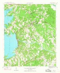
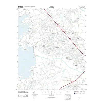
(38)- 1904 Map of Columbia
 1904 Columbia1904 Print · USGSRichland and Fairfield counties at the turn of the century are defined by their river-and-rail corridors and rural church communities. Genealogists can trace family footprints across Broad River ferries, the Southern R.R., and landmarks like The Old Brick Church or Winnsboro.2 unique versions available
 - 1941 Map of Spartanburg
 1941 Spartanburg1941 Print · USGSSouth Carolina’s Piedmont and Sandhills regions are shown here during the mid-century peak of the rail era. Researchers can trace the sprawling Fort Jackson Military Reservation and the industrial growth of hubs like Spartanburg and Rock Hill.
 - 1944 Map of Edmund, 1966 Print
 1944 Edmund1966 Print · USGSLexington County and the southern fringes of Columbia are shown in detail during the final years of World War II. Researchers can locate family landmarks like Saxe Gotha Sch, the Columbia Air Base, and Huckabaas Millpond.
 - 1946 Map of Irmo, 1968 Print
 1946 Irmo1968 Print · USGSMid-century Richland and Lexington Counties are caught in transition as the hydroelectric power of the Saluda River reshapes the land. Researchers can trace rural school locations like Rosenwald Sch and historical churches such as St Andrews Ch or Pilgrim Ch.
 - 1947 Map of Columbia North, 1965 Print
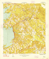
 1947 Columbia North1965 Print · USGSColumbia and its northern suburbs are captured in detail just after the war, showing the capital's rapid expansion into Eau Claire and Arden. Local historians can trace institutional history through the State Hospital, Allen Univ, and the State Penitentiary along the Broad River.
 - 1948 Map of Irmo
 1948 Irmo1948 Print · USGSThe Irmo area of South Carolina thrived as a railway and agricultural hub in the mid-forties, just as the Saluda River's transformation was complete. Genealogists and historians can trace institutional roots at the Harbison Institute or locate family plots at Upper Pine Grove Cem and Lower Pine Grove Cem.2 unique versions available
 - 1948 Map of Columbia North
 1948 Columbia North1948 Print · USGSColumbia and its northern suburbs are documented in the late 1940s as the city expanded across the Congaree and Broad River forks. Genealogists can trace family landmarks and historical sites including the Soldiers Home, Slatestone Graveyard Hill Cem, and Benedict College.2 unique versions available
 - 1953 Map of Spartanburg, 1966 Print
 1953 Spartanburg1966 Print · USGSMid-century South Carolina comes into focus through this survey of the Piedmont and the Sand Hills at a time of significant reservoir expansion. Researchers can trace the legacy of industrial transit and resource extraction from the Haile Gold Mine to the rail hubs of the Seaboard Air Line.4 unique versions available
 - 1954 Map of Augusta
 1954 Augusta1954 Print · USGSThe Savannah River valley and South Carolina Midlands are captured here during a period of post-war growth. Researchers can trace the rail-and-river economy through the Southern RR corridor and locate historic settlements like Aiken, Orangeburg, and Sumter.
 - 1957 Map of Augusta, 1966 Print
 1957 Augusta1966 Print · USGSThe Savannah River and Santee basins are captured here during a period of massive military and industrial expansion in the late fifties. Genealogists can trace family footprints across Four Hole Swamp or near the Savannah River Plant.3 unique versions available
 - 1958 Map of Augusta
 1958 Augusta1958 Print · USGSThe borderlands between Georgia and South Carolina come alive in the 1950s, showing the early footprint of the Savannah River Plant. Genealogists and historians can trace rail-dependent towns and rural landmarks from Orangeburg to the Fort Jackson Military Reservation.
 - 1960 Map of Spartanburg
 1960 Spartanburg1960 Print · USGSThe South Carolina Piedmont and North Carolina borderlands come alive in this mid-century survey of the region between Spartanburg and Columbia. Researchers can trace the Seaboard Air Line railroad and explore landmarks like Anderson Quarry, Lake Murray, and Mount Croghan.2 unique versions available
 - 1961 Map of Augusta
 1961 Augusta1961 Print · USGSThe South Carolina lowcountry and CSRA appear here in the early sixties, during a period of massive military and industrial growth. Researchers can trace the development of the Savannah River Plant or locate legacy landmarks like Nelson Ferry and Magnolia Cemetery.2 unique versions available
 - 1962 Map of Augusta
 1962 Augusta1962 Print · USGSThe South Carolina and Georgia borderlands are seen here in the early sixties, showing the rise of the Savannah River Plant and the expansion of Fort Jackson. Researchers can trace old rail lines like the Southern Railway and find landmarks such as St. Pauls Church or the Santee Canal.
 - 1963 Map of Spartanburg
 1963 Spartanburg1963 Print · USGSMid-century South Carolina comes alive in this survey, showing the rail-linked corridor between the Upstate and the Midlands. Genealogists can trace family lands near old hubs like Union and Lancaster, or along the banks of the Broad River and Pee Dee River.
 - 1964 Map of Spartanburg
 1964 Spartanburg1964 Print · USGSMid-century South Carolina comes alive in this survey of the Piedmont and Upcountry, stretching from the Blue Ridge foothills to the Sandhills. Genealogists and historians can trace the rail-and-river economy through Monarch Mills, Glenn Springs, and the Southern Railway corridor.
 - 1971 Map of Irmo, 1973 Print
 1971 Irmo1973 Print · USGSThe Irmo area was undergoing significant suburban growth in the early seventies as new neighborhoods expanded toward the shores of Lake Murray. Local researchers can trace the historic Columbia Newberry and Laurens rail line through Irmo and locate family landmarks like the Harbison Institute and Pilgrim Ch Cem.4 unique versions available
 - 1972 Map of Columbia North, 1973 Print
 1972 Columbia North1973 Print · USGSThe South Carolina capital and its river forks are captured here in the early seventies, just as suburban growth reached northward into Eau Claire. Researchers can trace the grounds of Benedict College, Allen Univ, and the historic Elmwood Cemetery.4 unique versions available
 - 1972 Map of Southwest Columbia, 1975 Print
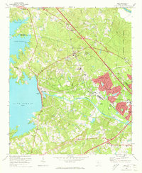
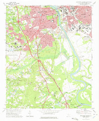 1972 Southwest Columbia1975 Print · USGSGreater Columbia in the early seventies shows a landscape of rapid suburban expansion balanced against the industrial Congaree riverfront. Researchers can trace the mid-century layout of the Columbia Metropolitan Airport, the Columbia Speedway, and local landmarks like Mt Pisgah Ch.2 unique versions available
 - 1983 Map of Aiken, 1984 Print
 1983 Aiken1984 Print · USGSThe Savannah River valley and South Carolina sandhills are shown in detail during the early eighties, as industry and education expanded. Researchers can trace the rail corridors of the Southern and Seaboard Coast Line through communities like Graniteville and Leesville.
 - 1986 Map of Newberry
 1986 Newberry1986 Print · USGSSouth Carolina's Piedmont region is shown here in the mid-1980s, revealing a landscape of historic crossroads and industrial mill villages. Researchers can trace family roots through landmarks like Lynch Woods Cem, New Hope Church, and the campus of Presbyterian College.2 unique versions available
 - 1994 Map of Southwest Columbia, 2000 Print
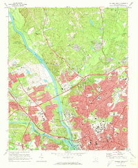
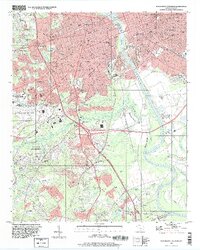 1994 Southwest Columbia2000 Print · USGSThe Congaree River corridor near the state capital was undergoing significant suburban and industrial expansion during the mid-nineties. Local historians can trace the development of Springdale and Pineridge alongside landmarks like the Styx State Fish Hatchery and Olympia Cem.
 - 1997 Map of Columbia North, 1999 Print
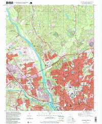 1997 Columbia North1999 Print · USGSThe state capital of Columbia stands at the river forks during the late nineties, showcasing a dense network of civic power and residential expansion. Researchers can trace institutional history at the State Capitol or locate ancestors in the historic Elmwood Cemetery and Palmetto Cem.
 - 2011 Map of Irmo, 2011 Print
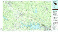
 2011 Irmo2011 Print · USGSCovers West Columbia, including Columbia, Lexington, and other nearby areas
 - 2011 Map of Columbia North, 2011 Print
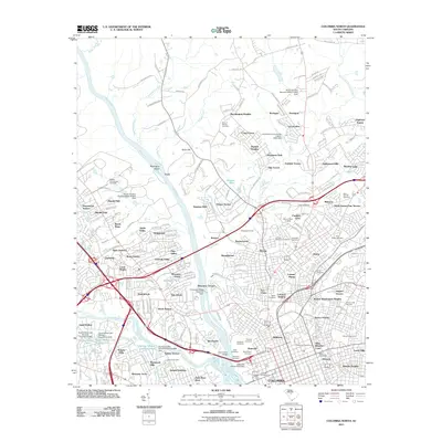 2011 Columbia North2011 Print · USGSCovers West Columbia, including Columbia, Evergreen Park, and other nearby areas
Showing maps 1-25 of 38
Top cities near West Columbia
- Columbia historical maps
- Lexington historical maps
- Cayce historical maps
- Forest Acres historical maps
- Blythewood historical maps
- Springdale historical maps
See more
Top neighborhoods of West Columbia
- Brookwood historical maps
- Triangle City historical maps
- Mill Village historical maps
- Park Place West historical maps
- Saluda Gardens historical maps
- Saluda Hills historical maps
See more
Frequently asked questions
- What are the different types of historical maps available for West Columbia?
- What is the oldest map of West Columbia?
- Where can I purchase historical maps of West Columbia for my home or office?
- Where can I download high-res historical maps of West Columbia?
- Are there historical topographic maps available for West Columbia?
- Is there historical aerial imagery available for West Columbia?
- Where are historical maps of West Columbia sourced from?