1900s (20th Century) Maps of Orangeburg County, South Carolina
Explore 74 historic maps of Orangeburg County from the 1900s (20th Century). These maps offer a rare glimpse into what life looked like during the 1900s — showing old roads, neighborhoods, homes, and landmarks that have changed or disappeared over time.
Whether you're researching your family's past, planning a metal detecting trip, or studying how Orangeburg County's landscape evolved across the 1900s, these high-resolution maps are a powerful tool for exploring the history of this region.
- Focus on a specific era: All maps on this page are from the 1900s, giving you a focused view of this time period.
- See what’s changed: Compare century-old streets, trails, and buildings to today's modern landscape using overlays and satellite layers.
- Research with precision: Use these maps for genealogy, historical research, land use analysis, or educational projects.
- View, download, or print: Maps are fully viewable online in high resolution, and can be downloaded or printed for your own records.
Start exploring Orangeburg County's history through authentic maps from the 1900s. This is your window into the past.
Orangeburg County, SC maps
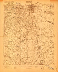
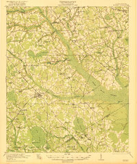
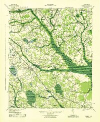
(74)- 1919 Map of Bamberg
 1919 Bamberg1919 Print · USGSThe South Carolina Lowcountry is captured here in the aftermath of the Great War, showing a landscape defined by rail junctions and river landings. Genealogists can trace family roots through numerous rural landmarks like Vorhees Institute, Spires Chapel, and Opossum College.
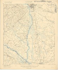
 - 1919 Map of Lodge, 1974 Print
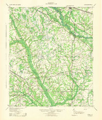
 1919 Lodge1974 Print · USGSCoastal plain life in the early twentieth century is mapped here through its river-reliant settlements and extensive swamp networks. Genealogists can trace family footprints across dozens of local landmarks like Lodge, Smoaks, and Zion Church.
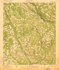
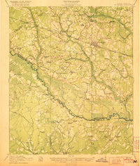
 - 1920 Map of Eutawville
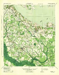
 1920 Eutawville1920 Print · USGSCoastal South Carolina comes to life in the years following the Great War, showing a landscape defined by the Santee River and Four Hole Swamp. Genealogists can trace family roots through numerous local landmarks like Black Creek Church, Unity School, and the settlement at Holly Hill.
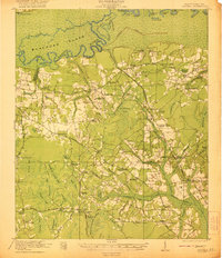
 - 1920 Map of Chicora
 1920 Chicora1920 Print · USGSBerkeley County was a landscape of river landings and bay-country settlements just after the turn of the century. Genealogists can locate family-named landmarks like Prioleau and numerous community anchors like St Luke Church, Eadytown, and the Francis Marion Tomb.
 - 1920 Map of Bowman
 1920 Bowman1920 Print · USGSIn the early twentieth century, this part of the South Carolina Lowcountry was a landscape of remote settlements and small-scale industry. Genealogists can trace family footprints through numerous community landmarks like Boghette Cem, Livingston Mill, and the Shady Grove Camp Ground.
 - 1920 Map of Lodge
 1920 Lodge1920 Print · USGSColleton and Bamberg counties at the dawn of the 1920s show a landscape of river-bottom farms and rural junctions. Genealogists can trace the location of early country institutions like Hunters Chapel, Tabernacle School, and the rail crossing at Hampton Branch Junction.
 - 1920 Map of Bamberg
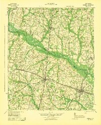
 1920 Bamberg1920 Print · USGSBamberg and Denmark thrived as essential South Carolina railroad junctions during the years following the Great War. Genealogists and local historians can trace rural schoolhouses and landings along the South Fork Edisto River, including the Voorhees Institute, Opossum College, and Old Union Church.2 unique versions available
 - 1920 Map of Orangeburg
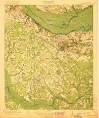
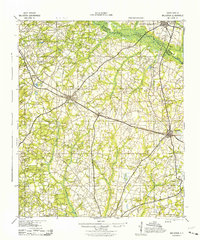
 1920 Orangeburg1920 Print · USGSOrangeburg and the Edisto River valley are captured here at the start of the 1920s, revealing a landscape of small agricultural communities and railroad sidings. Genealogists can locate family landmarks like Bryants Academy, Snake Swamp School, and Cattle Creek Church.
 - 1920 Map of St. George
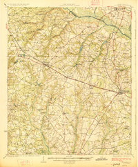
 1920 St. George1920 Print · USGSCoastal plain life in the 1920s centered on the Edisto River and the small railroad towns that bridged the area's vast swamps. Researchers can locate numerous vanished country landmarks, from St James Cemetery to the Cattle Creek School and Independence School.
 - 1921 Map of Orangeburg, 1919 Print
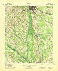
 1921 Orangeburg1919 Print · USGSOrangeburg and the Edisto River basin are captured here just after the Great War, during a period of established rail commerce and rural education. Genealogists can trace dozens of schools and churches like Bryants Academy, Sardis School, and Bethel Church.3 unique versions available
 - 1921 Map of Lodge
 1921 Lodge1921 Print · USGSThe Salkehatchie and Edisto river basins come alive in this early 1920s survey of the South Carolina Lowcountry. Researchers can trace rural genealogy and old rail lines through local landmarks like Hunters Chapel, Smoaks, and the Hampton and Branchville RR.3 unique versions available
 - 1921 Map of Chicora
 1921 Chicora1921 Print · USGSBerkeley County's riverfront and wetlands are captured in the early 1920s, showing the landscape before the Santee Cooper project transformed the region. Genealogists can locate family-named sites like the Francis Marion Tomb, Eadytown, and Rocks Creek School.4 unique versions available
 - 1921 Map of Bowman
 1921 Bowman1921 Print · USGSIn the early 1920s, the rural community of Bowman was a bustling intersection of country schools and swamp-fed drainage. Genealogists can trace family footprints through dozens of landmarks like Rochette Cemetery, the Campmeeting Grounds, and Livingston Mill.4 unique versions available
 - 1921 Map of St. George
 1921 St. George1921 Print · USGSThe Edisto River valley in the early 1920s was a landscape of small farming hamlets and vital rail connections. Genealogists can trace family roots through numerous sites like Indian Field Campgrounds, St James Cemetery, and the Heaton School.4 unique versions available
 - 1921 Map of Eutawville
 1921 Eutawville1921 Print · USGSCoastal South Carolina comes to life in this early twentieth-century survey of the Santee River lowlands and the growing railroad towns of the coastal plain. Genealogists can trace the location of community anchors like Gerizim Church, the Eutaw Springs Battle Monument, and Nelsons Ferry.3 unique versions available
 - 1923 Map of Williston
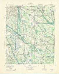
 1923 Williston1923 Print · USGSThe rural landscape of Barnwell County comes to life in the early twenties as it transitioned from rail dependence to a growing road network. Genealogists can locate family landmarks like Boylston Mill, Healing Springs, and more than a dozen local schools including Blessed Home School.
 - 1927 Map of Williston
 1927 Williston1927 Print · USGSBarnwell and Aiken Counties in the early twenties show a landscape centered on the SOUTHERN rail line and the South Fork Edisto River. Genealogists can locate rural landmarks such as Silver Spring Church, Ebenezer School, and historic sites like Woodward Mill.2 unique versions available
 - 1943 Map of Bowman
 1943 Bowman1943 Print · USGSThe rural Lowcountry of the 1940s is captured here in detail, showcasing the agrarian life of Orangeburg County. Genealogists can trace family footprints through numerous local landmarks like Bochette Cem, Dawkins Chapel, and Stephens Sch.
 - 1943 Map of Chicora
 1943 Chicora1943 Print · USGSThe Santee River lowlands are captured here in the early 1940s, just as modern water management began to reshape the region. Genealogists can locate family-named landmarks like the Francis Marion Tomb, Eadytown, and the Oakland Club.
 - 1943 Map of Lodge
 1943 Lodge1943 Print · USGSThe South Carolina Lowcountry is captured here in the early 1940s at the junction of four counties. Genealogists can trace family roots through numerous rural landmarks like H & B Junction, Hunters Chapel, and the Little Swamp Sch.
 - 1943 Map of Bamberg
 1943 Bamberg1943 Print · USGSMid-century South Carolina comes to life here, showing the intricate rail-and-river network of the Lowcountry. Researchers can locate the Vorhees Institute, trace family ties at Spires Chapel, and find old river access points like Hutto Landing.
 - 1943 Map of Orangeburg
 1943 Orangeburg1943 Print · USGSCoastal plain settlements and river forks define the South Carolina lowcountry during the early war years. Genealogists can trace family landmarks like Bochette Cem, Hunters Chapel Zion Ch, and unique sites like the Indian Field Camp Grounds.
 - 1943 Map of Williston
 1943 Williston1943 Print · USGSBarnwell County in the early 1940s was a landscape of rail-linked towns and scattered rural communities. Genealogists can trace family roots through numerous local landmarks, including the Blessed Home Sch, Woodward Mill, and the community of Healing Springs.2 unique versions available
 - 1943 Map of Orangeburg
 1943 Orangeburg1943 Print · USGSThe Orangeburg area in the early 1940s was a critical hub where the Southern and Atlantic Coast Line railroads intersected the Edisto forks. Genealogists can locate numerous rural landmarks like Bryants Academy, Mt Pisgah Ch, and the County Farm.
 - 1943 Map of Eutawville, 1944 Print
 1943 Eutawville1944 Print · USGSCoastal South Carolina during the mid-forties shows a landscape of historic battlefields and newly formed reservoirs. Genealogists and historians can trace family church and school sites like Gerizim Ch and Stutz Sch or locate the Eutaw Battle Monument.
Showing maps 1-25 of 74
Top cities of Orangeburg County
- Orangeburg historical maps
- Holly Hill historical maps
- Bowman historical maps
- Branchville historical maps
- Santee historical maps
- North historical maps
See more
Frequently asked questions
- What are the different types of historical maps available for Orangeburg County?
- What is the oldest map of Orangeburg County?
- Where can I purchase historical maps of Orangeburg County for my home or office?
- Where can I download high-res historical maps of Orangeburg County?
- Are there historical topographic maps available for Orangeburg County?
- Is there historical aerial imagery available for Orangeburg County?
- Where are historical maps of Orangeburg County sourced from?