1900s (20th Century) Maps of Beadle County, South Dakota
Explore 48 historic maps of Beadle County from the 1900s (20th Century). These maps offer a rare glimpse into what life looked like during the 1900s — showing old roads, neighborhoods, homes, and landmarks that have changed or disappeared over time.
Whether you're researching your family's past, planning a metal detecting trip, or studying how Beadle County's landscape evolved across the 1900s, these high-resolution maps are a powerful tool for exploring the history of this region.
- Focus on a specific era: All maps on this page are from the 1900s, giving you a focused view of this time period.
- See what’s changed: Compare century-old streets, trails, and buildings to today's modern landscape using overlays and satellite layers.
- Research with precision: Use these maps for genealogy, historical research, land use analysis, or educational projects.
- View, download, or print: Maps are fully viewable online in high resolution, and can be downloaded or printed for your own records.
Start exploring Beadle County's history through authentic maps from the 1900s. This is your window into the past.
Beadle County, SD maps
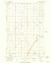
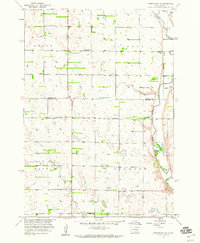
(48)- 1950 Map of Wessington
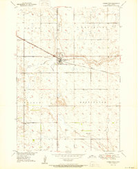 1950 Wessington1950 Print · USGSThe town of Wessington straddles the Hand and Beadle county line in the mid-twentieth century, centered on its vital rail connection. Genealogists can locate rural landmarks like Bothwell Sch, Rogers Sch, and the Wessington Cem.3 unique versions available
 - 1950 Map of Wessington NE
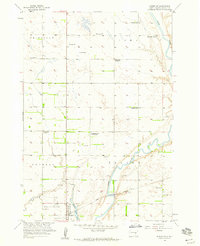
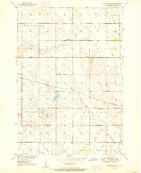 1950 Wessington NE1950 Print · USGSBeadle County was a hub of rural life and steam-era railroading at the mid-century. Researchers can trace the legacy of prairie education at Neeman Sch or locate the junction of the Chicago and North Western and the Milwaukee Road.3 unique versions available
 - 1951 Map of Wessington SE
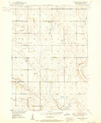 1951 Wessington SE1951 Print · USGSBeadle County farming townships are documented here in the early fifties, showing the peak of the rural school system. Genealogists can trace family land near Roosevelt Sch, the Town Hall in Vernon, or the many artesian Flowing Well sites.3 unique versions available
 - 1951 Map of Wessington SW
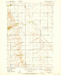 1951 Wessington SW1951 Print · USGSThe border of Hand and Beadle counties comes alive in the early 1950s, showing a prairie landscape shaped by township farming and rural education. Genealogists can trace family footprints near McNeil Sch, McGillvery Sch, and a lonely prairie Cem.3 unique versions available
 - 1953 Map of Huron, 1959 Print
 1953 Huron1959 Print · USGSCentral South Dakota comes alive in the mid-1950s as a thriving rail and agricultural corridor between the Missouri and James Rivers. Trace the legacy of family farms and prairie towns like Huron, Faulkton, and Wessington Springs along the historic Chicago and North Western rail lines.3 unique versions available
 - 1953 Map of Watertown, 1968 Print
 1953 Watertown1968 Print · USGSEastern South Dakota and the Minnesota borderlands are captured here during the mid-twentieth century as the region's agricultural and rail-service centers thrived. Genealogists and local historians can trace family-named sites across the Coteau des Prairies and find landmarks in Watertown, De Smet, and Brookings.3 unique versions available
 - 1954 Map of Huron, 1977 Print
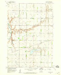
 1954 Huron1977 Print · USGSCentral South Dakota was a landscape of grain elevators and river bends during the mid-fifties. Genealogists and historians can trace the development of the James River valley through railroad towns like Redfield and the sprawling Crow Creek Indian Reservation.
 - 1956 Map of Lake Byron NW, 1957 Print
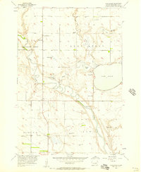
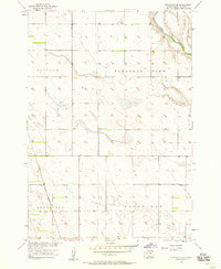
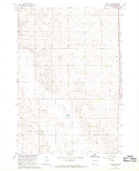
 1956 Lake Byron NW1957 Print · USGSThe glacial till of eastern South Dakota is captured here during the mid-fifties as the Missouri River Basin development program was underway. Researchers can locate several rural school sites like Bluebell Sch and Sunshine Sch, as well as the Irving Cem.
 - 1956 Map of Lake Byron, 1957 Print
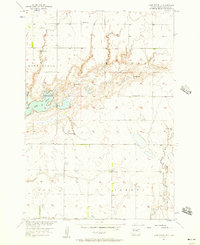
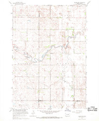
 1956 Lake Byron1957 Print · USGSBeadle County was defined by its water and agricultural colonies in the mid-1950s as the Missouri River Basin development progressed. Genealogists and historians can locate the Huron Colony settlement, trace the James River valley, and find local landmarks like Lake Byron Sch or the Atfield Cem.2 unique versions available
 - 1956 Map of Spink Colony, 1957 Print
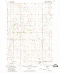
 1956 Spink Colony1957 Print · USGSThe James River valley at the Spink and Beadle county line appears in the mid-fifties as a landscape of rural townships and flowing wells. Genealogists can locate Hillestad Cem and trace the closure of country schools like Lincoln Sch (Abandoned).2 unique versions available
 - 1956 Map of Lake Byron SE, 1957 Print
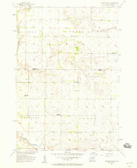
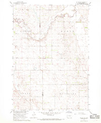
 1956 Lake Byron SE1957 Print · USGSBeadle County townships at the height of the mid-fifties show a landscape of productive prairie farms and rural school districts. Researchers can locate artesian Flowing Well sites and local landmarks like Bethel Ch, Hofer Sch, and the eastern reaches of Lake Byron.
 - 1956 Map of Hitchcock SE, 1958 Print
 1956 Hitchcock SE1958 Print · USGSBeadle County settlements and rural school districts are captured here during the mid-1950s. Genealogists can trace family footprints near Broadland Cem or locate the Marshall Sch and Bethel Ch along the prairie sections.
 - 1957 Map of Forestburg NE, 1958 Print
 1957 Forestburg NE1958 Print · USGSThe James River valley in the late fifties reveals a dense network of rural school districts and township landmarks. Researchers can locate the Pearl Ch, Bonny Cem, and several school sites including the Flagel Sch and Maurer Sch.
 - 1957 Map of Cavour, 1958 Print
 1957 Cavour1958 Print · USGSBeadle County was a landscape of small prairie schoolhouses and steady rail traffic during the late fifties. Genealogists can locate family landmarks such as Richland Center Sch, Bloodgood Sch, and the depot at Cavour along the Chicago and North Western line.2 unique versions available
 - 1957 Map of Huron, 1958 Print
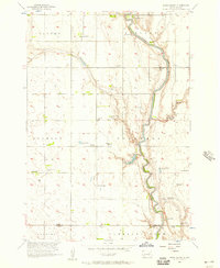
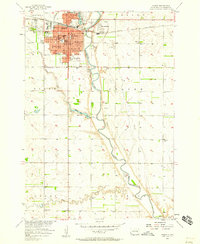 1957 Huron1958 Print · USGSHuron and the James River valley are captured in the late fifties as the city expanded around its rail and river roots. Genealogists and historians can trace neighborhood developments like Morningside or locate landmarks such as Huron College and Riverside Cemetery.2 unique versions available
 - 1958 Map of Watertown
 1958 Watertown1958 Print · USGSThe eastern South Dakota prairie and the Minnesota borderlands are captured here in the late fifties, showcasing a landscape of terminal moraine lakes and burgeoning rail hubs. Genealogists and historians can trace the early paths of the Chicago and North Western railroad or locate family roots in Watertown, Clark, or the Sisseton Indian Reservation.2 unique versions available
 - 1958 Map of Forestburg NW, 1959 Print
 1958 Forestburg NW1959 Print · USGSSanborn County and Beadle County farm country is mapped here in the late fifties as the James River valley supported a robust network of rural schools. Genealogists can trace family land proximity to Bethlehem Ch, Christensen Sch, or McDonald Sch.2 unique versions available
 - 1958 Map of Huron NW, 1959 Print
 1958 Huron NW1959 Print · USGSBeadle County rural life in the late fifties is defined by the winding James River and a scattering of Hutterite and pioneer-era legacy sites. Researchers can trace the consolidation of local education through several one-room schoolhouses, including Edison Sch and Whittier Sch, alongside the communal Riverside Colony.2 unique versions available
 - 1958 Map of Huron NE, 1959 Print
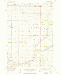
 1958 Huron NE1959 Print · USGSBeadle County was a landscape of prairie townships and rail-side settlements in the late fifties. Researchers can trace the Great Northern rail line through Sheffield and Cavour, or locate family sites near Ackerman Sch and St Patrick Cem.
 - 1967 Map of Hitchcock SW, 1968 Print
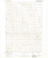 1967 Hitchcock SW1968 Print · USGSBeadle County farmland and township life are captured here in the late sixties during a period of Missouri River Basin development. Genealogists and local historians can locate early burial sites like Altoona Cem or trace the path of the Chicago and North Western rail line near Bonilla.
 - 1967 Map of Tulare NW, 1968 Print
 1967 Tulare NW1968 Print · USGSSpink and Hand counties are captured in the mid-1960s, showing a prairie landscape defined by meandering creek beds and rural townships. Researchers can trace local history through landmarks like St Johns Ch, Buffalo Cem, and a notable Flowing Well.
 - 1967 Map of Tulare SE, 1968 Print
 1967 Tulare SE1968 Print · USGSBeadle County was a quiet patchwork of prairie townships and rail-side hamlets during the late sixties. Genealogists and local historians can trace the corridor of the Chicago Milwaukee St Paul and Pacific through Bonilla and locate family landmarks near Cain Creek.
 - 1967 Map of Tulare SW, 1968 Print
 1967 Tulare SW1968 Print · USGSBeadle and Hand counties appear in the late sixties as a landscape of rural townships and prairie streams. Genealogists and local historians can locate the Tipton Community Ch, early Townhall sites, and family lands along Turtle Creek.
 - 1967 Map of Hitchcock, 1969 Print
 1967 Hitchcock1969 Print · USGSThe rural prairie of Beadle and Spink counties comes into focus during the late 1960s, centered on the railroad town of Hitchcock. Researchers can trace the CHICAGO AND NORTH WESTERN line and locate rural landmarks like Tulare Cem and Flowing Well.
 - 1967 Map of Tulare, 1970 Print
 1967 Tulare1970 Print · USGSThe Spink County prairie near Tulare is captured in the late sixties, showing a landscape defined by the Milwaukee Road railroad. Researchers can locate the Garfield Cem, the remote siding at Spottswood, and the many agricultural wells that sustained these townships.
Showing maps 1-25 of 48
Top cities of Beadle County
- Huron historical maps
- Wolsey historical maps
- Wessington historical maps
- Cavour historical maps
- Yale historical maps
- Hitchcock historical maps
See more
Frequently asked questions
- What are the different types of historical maps available for Beadle County?
- What is the oldest map of Beadle County?
- Where can I purchase historical maps of Beadle County for my home or office?
- Where can I download high-res historical maps of Beadle County?
- Are there historical topographic maps available for Beadle County?
- Is there historical aerial imagery available for Beadle County?
- Where are historical maps of Beadle County sourced from?