1970s Maps of Charles Mix County, South Dakota
Explore 28 historic maps of Charles Mix County from the 1970s. These maps offer a rare glimpse into what life looked like during the 1970s — showing old roads, neighborhoods, homes, and landmarks that have changed or disappeared over time.
Whether you're researching your family's past, planning a metal detecting trip, or studying how Charles Mix County's landscape evolved across the 1970s, these high-resolution maps are a powerful tool for exploring the history of this region.
- Focus on a specific era: All maps on this page are from the 1970s, giving you a focused view of this time period.
- See what’s changed: Compare century-old streets, trails, and buildings to today's modern landscape using overlays and satellite layers.
- Research with precision: Use these maps for genealogy, historical research, land use analysis, or educational projects.
- View, download, or print: Maps are fully viewable online in high resolution, and can be downloaded or printed for your own records.
Start exploring Charles Mix County's history through authentic maps from the 1970s. This is your window into the past.
Charles Mix County, SD maps
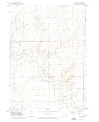
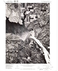
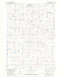
(28)- 1971 Map of Lucas NW, 1974 Print
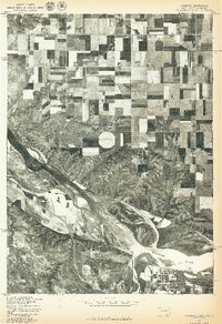
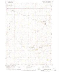
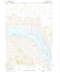 1971 Lucas NW1974 Print · USGSThe Missouri River breaks and the waters of Lake Francis Case define this South Dakota landscape in the early seventies. Genealogists and historians can locate Platte Colony and trace the original path of Rush Creek toward the Platte Winner Bridge.
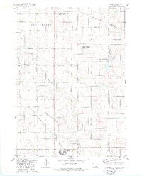
 - 1971 Map of Academy, 1974 Print
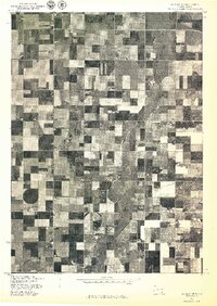
 1971 Academy1974 Print · USGSThe South Dakota prairie meets the Missouri River in the early seventies, capturing the rural character of Charles Mix County. Genealogists and local historians can trace family roots through sites like Platte Colony, Academy, and the La Roche Cem.
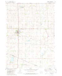
 - 1971 Map of Dixon NE, 1974 Print
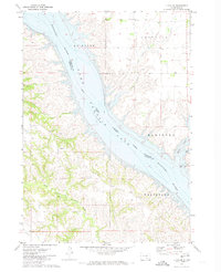
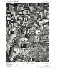
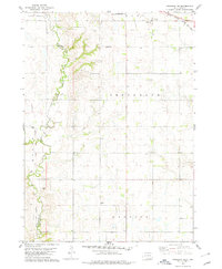
 1971 Dixon NE1974 Print · USGSThe Missouri River breaks of Gregory and Lyman counties are captured here in the early seventies, detailing the newly formed Lake Francis Case. Researchers can trace the Rosebud Indian Reservation Boundary and locate landmarks like Berry Spring and Landing Creek.
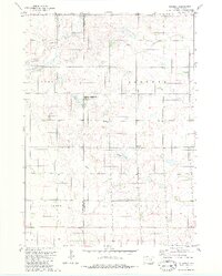
 - 1971 Map of Lucas SE, 1974 Print
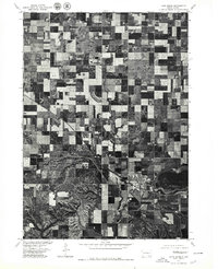
 1971 Lucas SE1974 Print · USGSThe Missouri River breaks into the reservoir of Lake Francis Case during the early seventies, defining the border of the Rosebud Indian Reservation. Local history researchers can locate Trinity Ch, a hilltop Cem, and drainage points like Whetstone Creek.
 - 1972 Map of Niobrara NW, 1974 Print
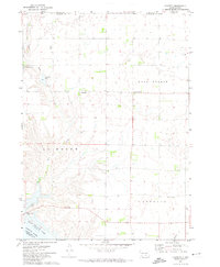
 1972 Niobrara NW1974 Print · USGSCharles Mix County in the early 1970s reveals a rural landscape defined by the Old Indian Treaty Boundary and the Yankton Indian Reservation. Genealogists and historians can trace community centers like Holy Name Ch, School No 73, and local Flowing Wells.
 - 1972 Map of Dante, 1974 Print
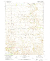
 1972 Dante1974 Print · USGSDante and the surrounding prairies of the Yankton Indian Reservation are captured here in the early 1970s. Local researchers can trace the Old Indian Treaty Boundary and locate family sites near United Cem and the Dante rail line.
 - 1977 Map of Oak Hollow
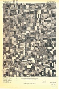 1977 Oak Hollow1977 Print · USGSHutchinson County farmland is captured in sharp aerial detail during the late seventies, showing the precise layout of local agriculture. Genealogists and historians can locate specific farmsteads and water features like Tripp Lake and the drainage of Oak Hollow.
 - 1977 Map of Wagner
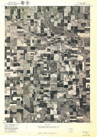 1977 Wagner1977 Print · USGSWagner and the surrounding farmlands of Charles Mix County are seen from the air in the late seventies. Family historians and researchers can trace the precise layout of Wagner and the winding path of Choteau Creek across the prairie.
 - 1977 Map of Wagner SW
 1977 Wagner SW1977 Print · USGSSouthern South Dakota agriculture and the Missouri River bluffs are captured in this late-seventies aerial survey. Trace the intersection of structured field patterns with the natural erosional drainages of the river valley near the Bureau of Indian Affairs lands.
 - 1977 Map of Niobrara
 1977 Niobrara1977 Print · USGSThe Nebraska-South Dakota borderlands come into focus in the late seventies, showing the dramatic confluence of the Niobrara River and Missouri River. Researchers can trace the layout of Niobrara and the varied agricultural patterns near Perkins.
 - 1977 Map of Wagner NE
 1977 Wagner NE1977 Print · USGSCharles Mix County agriculture is captured in detail during the late seventies, showing the intricate grid of rural land management. Trace the winding course of Choteau Creek and the development of local farmsteads across this agricultural landscape.
 - 1977 Map of Lake Andes NW, 1979 Print
 1977 Lake Andes NW1979 Print · USGSThe prairie landscape of Charles Mix County is captured in the late seventies, showing the transition from grid-patterned fields to the river bluffs. Genealogists and land researchers can trace the area around Geddes and the extensive shoreline of Lake Francis Case.
 - 1977 Map of Lake Andes, 1979 Print
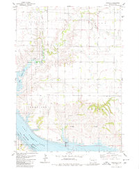
 1977 Lake Andes1979 Print · USGSThe town and waters of Lake Andes are captured in this late 1970s orthophotograph, showing the South Dakota landscape in striking detail. Researchers can trace the exact 1977 street layout of Lake Andes and the surrounding agricultural field patterns.
 - 1977 Map of Fort Randall Dam, 1979 Print
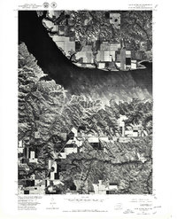
 1977 Fort Randall Dam1979 Print · USGSPickstown and the Missouri River bluffs are seen in high detail in the late seventies. Researchers can trace the layout of Pickstown, the massive footprint of the Fort Randall Dam, and the historic grounds of Fort Randall.
 - 1977 Map of Lake Andes SW, 1979 Print
 1977 Lake Andes SW1979 Print · USGSThe Missouri River bluffs and the rising waters of Lake Francis Case are captured in this late-1970s aerial survey. Trace the historic grounds of Fort Randall and the path of US Highway 18 as they intersect this South Dakota landscape.
 - 1978 Map of Oak Hollow, 1979 Print
 1978 Oak Hollow1979 Print · USGSHutchinson and Douglas counties meet along the Yankton Indian Reservation line in the late seventies. Family historians can locate rural landmarks like Oak Hollow Cem, Zion Cem, and the local Townhall near Tripp Lake.
 - 1978 Map of Avon, 1979 Print
 1978 Avon1979 Print · USGSSettled along the railroad in the late seventies, this region of Bon Homme County shows a prairie landscape of grain and water. Trace local genealogy and land use near Avon through landmarks like Giedd Sch, the Cem, and the Choteau Creek wetlands.
 - 1978 Map of Greenwood Colony, 1979 Print
 1978 Greenwood Colony1979 Print · USGSThe Douglas and Charles Mix county line in the late 1970s shows a landscape of reservation boundaries and rural prairie settlements. Researchers can trace the layout of Greenwood Colony and find local landmarks such as St Pauls Ch and New Salem Cem.
 - 1978 Map of Niobrara NE, 1979 Print
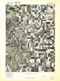
 1978 Niobrara NE1979 Print · USGSIn the late seventies, this portion of Bon Homme and Charles Mix counties remained a landscape of prairie schools and country parishes. Genealogists can trace early homestead footprints via the Old Indian Treaty Boundary and sites like Trumbo Sch and Trinity Cem.
 - 1979 Map of Castalia, 1980 Print
 1979 Castalia1980 Print · USGSCharles Mix County's prairie and river landscape are captured here in the late 1970s, as the Missouri River transition defines the local terrain. Genealogists and researchers can locate Friesland Cem, the settlement of Castalia, and several Flowing Wells tucked into the creek breaks.
 - 1979 Map of Bovee, 1980 Print
 1979 Bovee1980 Print · USGSCharles Mix County is captured here in the late 1970s as a landscape of prairie townships and rail-connected settlements. Genealogists and historians can locate Edgerton and Bloomington or trace the Chicago Milwaukee St Paul and Pacific line near Bovee.
 - 1979 Map of Geddes SE, 1980 Print
 1979 Geddes SE1980 Print · USGSThe rural plains of Charles Mix and Douglas counties are captured here in the late seventies, showing the intersection of township life and the Yankton Indian Reservation Boundary. Genealogists can locate family landmarks like St Paul Cem, Cohee Cem, and the Townhall.
 - 1979 Map of Geddes, 1980 Print
 1979 Geddes1980 Print · USGSGeddes and the surrounding townships of Charles Mix County are documented here during the late seventies, showing a landscape defined by prairie rail lines and waterfowl conservation. You can trace the path of the Chicago Milwaukee St Paul and Pacific railroad or locate the Morningside Cem and Pease Creek.
 - 1979 Map of Armour, 1980 Print
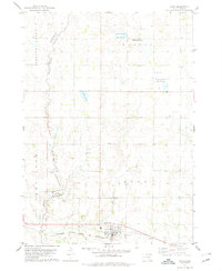
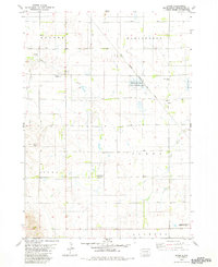
 1979 Armour1980 Print · USGSDouglas County farming and conservation efforts take center stage in this late-seventies survey of the Armour region. Local researchers can trace the Old Railroad Grade and locate burials at Pleasant Ridge Cem or the Yankton Indian Reservation Boundary.
 - 1979 Map of Joubert, 1980 Print
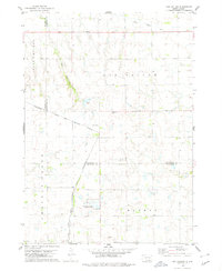
 1979 Joubert1980 Print · USGSThe rural prairie of Douglas and Aurora counties is captured here in the late seventies, showing a landscape shaped by agriculture and water management. Researchers can locate the Clark-Joubert Sch, the Townhall, and conserved lands in the National Waterfowl Production Area.
Showing maps 1-25 of 28
Top cities of Charles Mix County
Frequently asked questions
- What are the different types of historical maps available for Charles Mix County?
- What is the oldest map of Charles Mix County?
- Where can I purchase historical maps of Charles Mix County for my home or office?
- Where can I download high-res historical maps of Charles Mix County?
- Are there historical topographic maps available for Charles Mix County?
- Is there historical aerial imagery available for Charles Mix County?
- Where are historical maps of Charles Mix County sourced from?