2020s Maps of Charles Mix County, South Dakota
Explore 34 historic maps of Charles Mix County from the 2020s. These maps offer a rare glimpse into what life looked like during the 2020s — showing old roads, neighborhoods, homes, and landmarks that have changed or disappeared over time.
Whether you're researching your family's past, planning a metal detecting trip, or studying how Charles Mix County's landscape evolved across the 2020s, these high-resolution maps are a powerful tool for exploring the history of this region.
- Focus on a specific era: All maps on this page are from the 2020s, giving you a focused view of this time period.
- See what’s changed: Compare century-old streets, trails, and buildings to today's modern landscape using overlays and satellite layers.
- Research with precision: Use these maps for genealogy, historical research, land use analysis, or educational projects.
- View, download, or print: Maps are fully viewable online in high resolution, and can be downloaded or printed for your own records.
Start exploring Charles Mix County's history through authentic maps from the 2020s. This is your window into the past.
Charles Mix County, SD maps
(34)- 2021 Map of Niobrara NE, 2021 Print
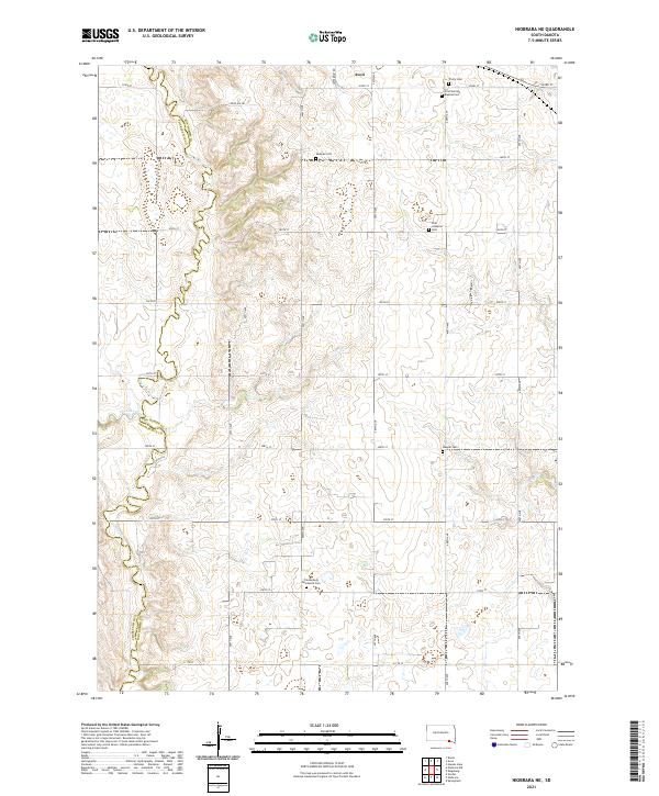 2021 Niobrara NE2021 Print · USGSBon Homme County at the start of the 2020s remains a landscape defined by its rural heritage and the meandering Choteau Cr border. Genealogists can trace family connections through numerous local burial sites like Weslyan Cem, Wagner Cem, and Trinity Cem.
 - 2021 Map of Marty, 2021 Print
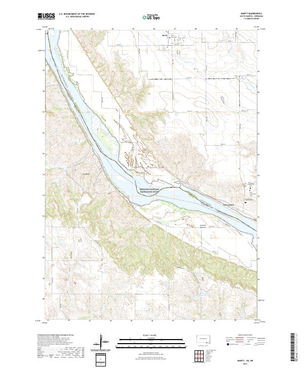 2021 Marty2021 Print · USGSThe Missouri River borderlands of South Dakota and Nebraska are captured here in the early twenty-first century. Genealogists can trace local history through numerous sites like Saint Pauls Cem and Holy Fellowship Cem near the riverfront at Greenwood.
 - 2021 Map of Niobrara NW, 2021 Print
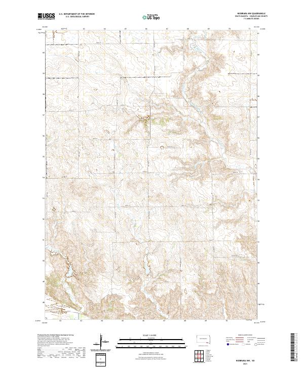 2021 Niobrara NW2021 Print · USGSCharles Mix County at the start of the 2020s shows a landscape of conservation and rural transit. Researchers can trace land boundaries near the Charles Mix County Waterfowl Production Area and follow drainage along Bull Cr and Chateau Creek.
 - 2021 Map of Monowi, 2021 Print
 2021 Monowi2021 Print · USGSMonowi and the surrounding prairie highlands are documented here at the turn of the decade. Genealogists can locate Beulah Cem and Alford Cem, while those studying the river systems can trace the Niobrara River and Ponca Creek.
 - 2021 Map of Verdel, 2021 Print
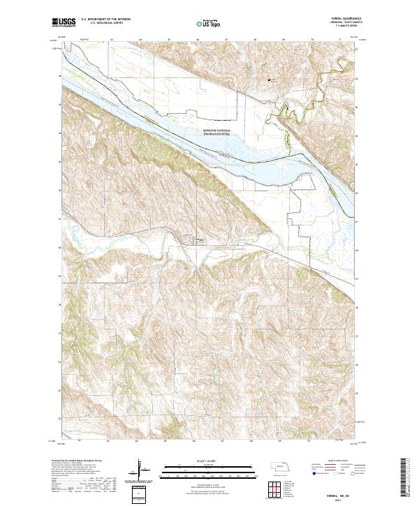 2021 Verdel2021 Print · USGSThe Missouri River floodplain on the Nebraska-South Dakota border is captured here during the 2020s. Genealogists and local historians can trace the streets of Verdel, locate Cedar Hill Cemetery, or follow the winding course of Ponca Creek.
 - 2021 Map of Lake George, 2021 Print
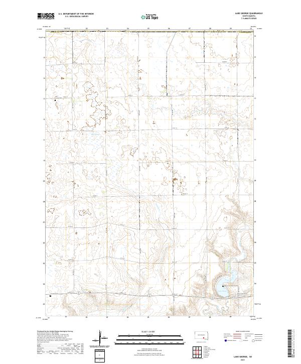 2021 Lake George2021 Print · USGSCharles Mix County in the early twenty-first century remains a landscape of rolling prairie and vital water bodies. Researchers can trace family history at the Lake George Cem or explore the drainage patterns of Castalia Cr and Platte Cr.
 - 2021 Map of Wagner NE, 2021 Print
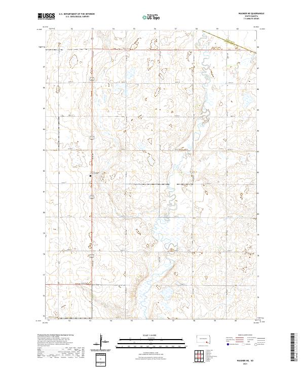 2021 Wagner NE2021 Print · USGSCharles Mix County agricultural lands and the meandering path of Choteau Creek are documented in this contemporary survey. Researchers can locate the East Lake Andes Lutheran Cem and trace rural section lines like 286th St and 392nd Ave.
 - 2021 Map of Dante, 2021 Print
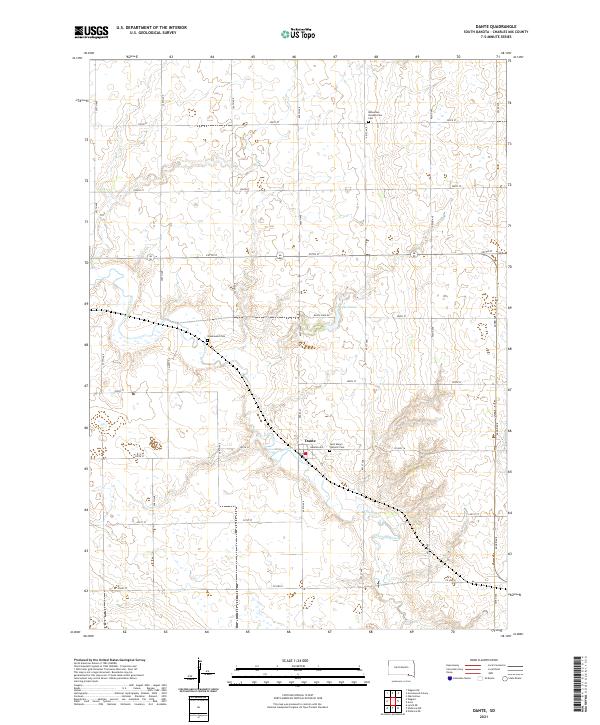 2021 Dante2021 Print · USGSDante and the surrounding Charles Mix County prairie are captured here in the early twenty-first century. Genealogists and local historians can locate family burial sites at Saint Mary's Catholic Cem, Bohemian Presbyterian Cem, and Greenwood Cem.
 - 2021 Map of Lynch NE, 2021 Print
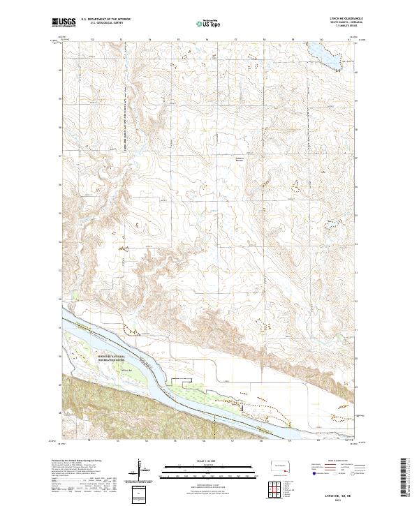 2021 Lynch NE2021 Print · USGSThe Missouri River borderlands come alive in this recent survey, showcasing the meeting point of South Dakota and Nebraska. Researchers can trace the river's path through Tobacco Bottom or explore the wetlands of the Charles Mix County Waterfowl Production Area.
 - 2021 Map of Joubert, 2021 Print
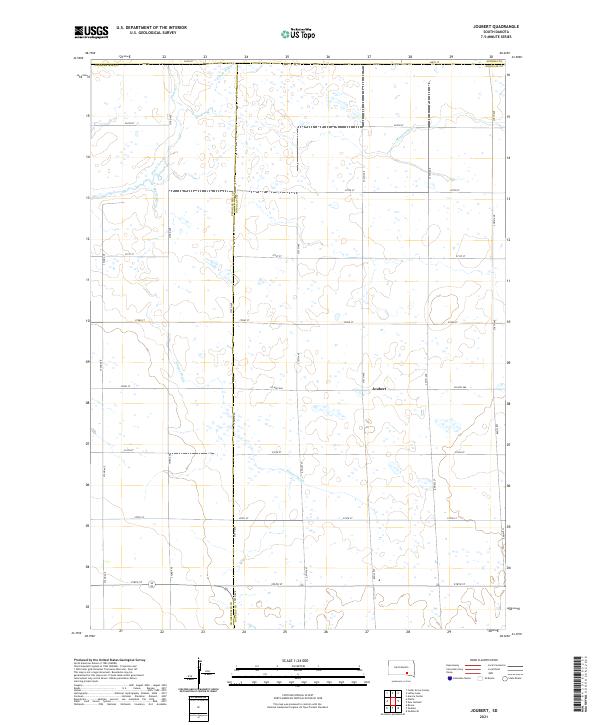 2021 Joubert2021 Print · USGSDouglas County farming life is captured here in the 2020s, centered on the historic crossroads of Joubert. Researchers can trace the sophisticated water management of the prairie through named features like Sluiter Drain and the E Fork Platte Cr.
 - 2021 Map of Wagner, 2021 Print
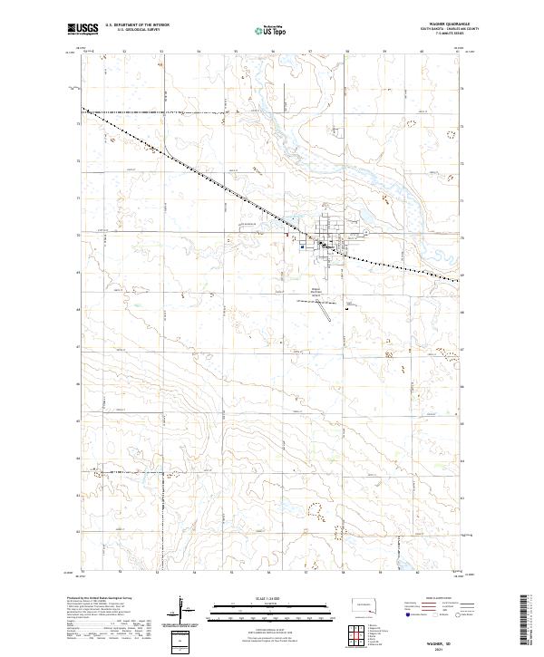 2021 Wagner2021 Print · USGSThe community of Wagner in Charles Mix County is shown in this contemporary 2020s survey of the South Dakota plains. Researchers can trace the local landscape from the banks of Choteau Creek to the town grid near Saint Johns Cem and the Wagner Municipal Airport.
 - 2021 Map of Wagner SW, 2021 Print
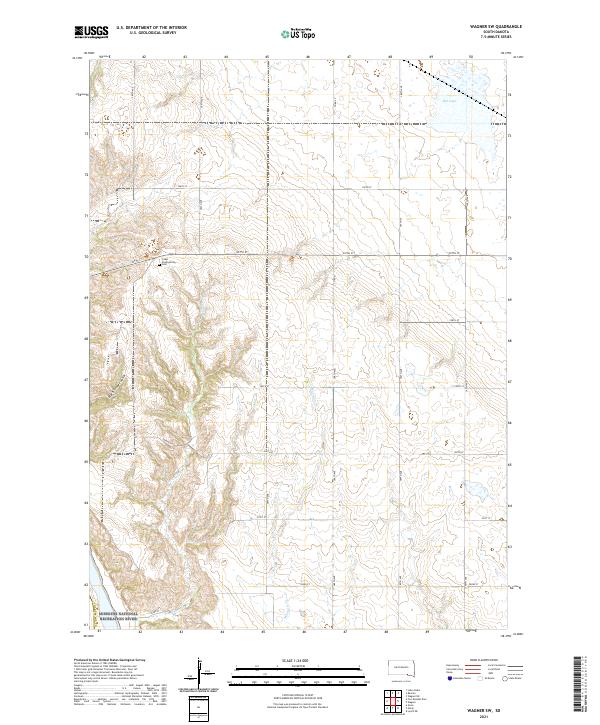 2021 Wagner SW2021 Print · USGSCharles Mix County at the start of the 2020s shows a landscape where the prairie meets the protected waters of the Missouri River. Genealogists and local historians can trace family roots at the Cedar Presbyterian Cem or follow the path of Sevenmile Cr toward the river valley.
 - 2021 Map of Platte, 2021 Print
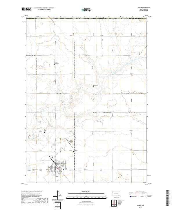 2021 Platte2021 Print · USGSSouth Dakota's prairie landscape in Charles Mix County is defined here by the established town grid of Platte and its network of section-line roads. Genealogists can trace family history at the Old Platte Cem, Rock Hill Cem, or Friedhem Lutheran Cem.
 - 2021 Map of Dixon NE, 2021 Print
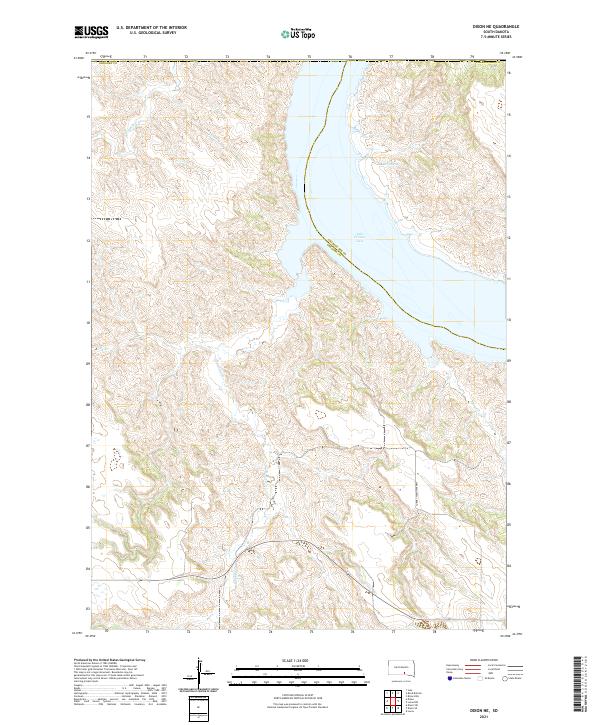 2021 Dixon NE2021 Print · USGSThe Missouri River breaks of Gregory and Charles Mix counties are captured here in the early twenty-first century. Researchers can trace drainage patterns along Landing Cr and Rush Cr as they feed into the expansive Lake Francis Case.
 - 2021 Map of Greenwood Colony, 2021 Print
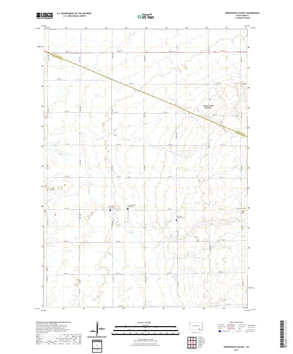 2021 Greenwood Colony2021 Print · USGSDouglas and Charles Mix counties are shown here as they appeared in the early 21st century, defined by vast agricultural grids. Genealogists can trace family burial sites at Zion Baptist Church Cem, New Salem Cem, and Saint Pauls Lutheran Cem.
 - 2021 Map of Academy, 2021 Print
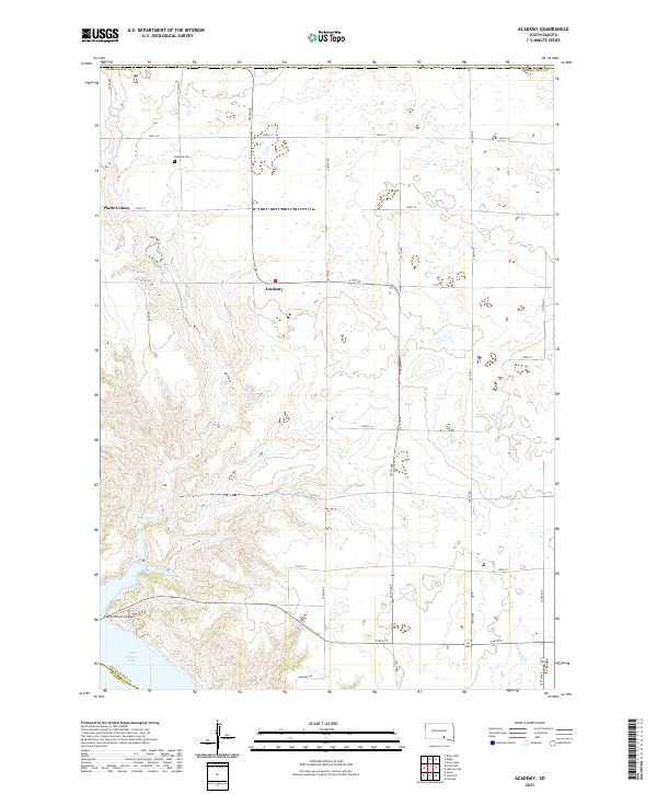 2021 Academy2021 Print · USGSThe Missouri River bluffs of Charles Mix County are captured here in 2021, showing the modern expanse of Lake Francis Case. Trace local roots near the LaRoche Cem or explore the rural settlements of Academy and Platte Colony.
 - 2021 Map of Ravinia, 2021 Print
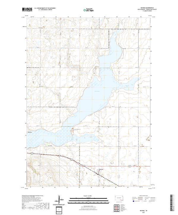 2021 Ravinia2021 Print · USGSRavinia and the banks of Lake Andes appear here in the early 2020s, showing the modern layout of this Charles Mix County landscape. Researchers can trace local landmarks like Dezera, the waters of Johnson Bay, and the protected pathways along the Owens Bay Wildlife Trl.
 - 2021 Map of Armour, 2021 Print
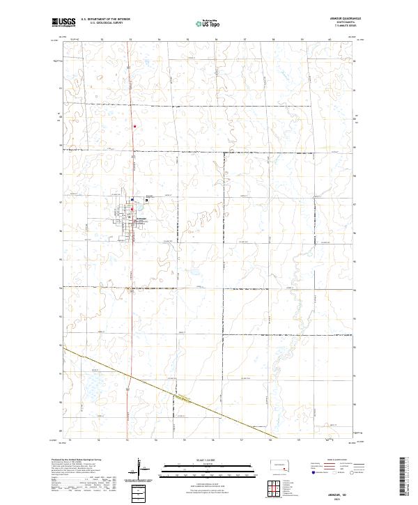 2021 Armour2021 Print · USGSArmour and the surrounding prairie of Douglas County are captured here in the early twenty-first century. Researchers can trace local lineage at Pleasant Ridge Cem or study the civic layout around the Douglas County Courthouse.
 - 2021 Map of Bovee, 2021 Print
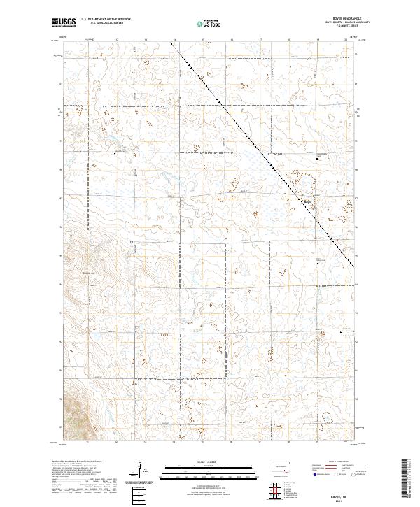 2021 Bovee2021 Print · USGSCharles Mix County at the start of the 2020s remains a landscape of section-line roads and prairie drainages centered on the community of Bovee. Researchers can locate several remote burial grounds like Jasper Cem and Bloomington Cem or trace the path of Edgerton Cr.
 - 2021 Map of Armour SW, 2021 Print
 2021 Armour SW2021 Print · USGSAgriculture and legacy define this Douglas County landscape in the early twenty-first century. Researchers can locate the German Reform Cem and trace the drainage of Andes Cr as it crosses the Douglas Co Charles Mix Co line.
 - 2021 Map of Lucas SE, 2021 Print
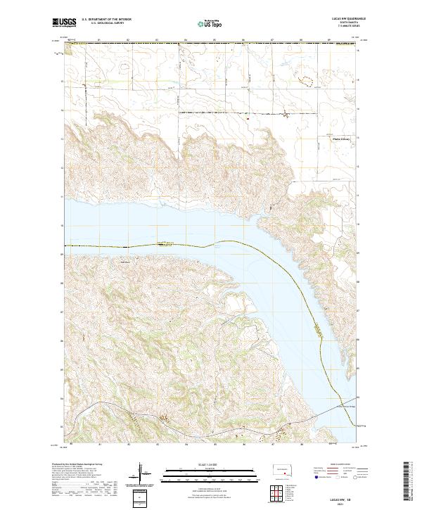
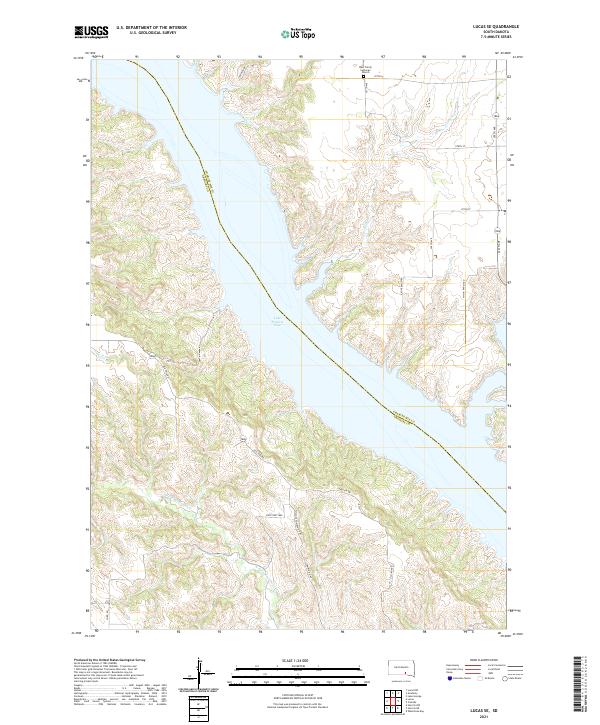 2021 Lucas SE2021 Print · USGSThe Missouri River breaks of Gregory County are captured here in the early twenty-first century as they meet the expansive Lake Francis Case. Researchers can locate rural landmarks like the West Trinity Lutheran Church or trace the transition from Old 1806 Rd to modern township highways.
 - 2021 Map of Lucas NW, 2021 Print
 2021 Lucas NW2021 Print · USGSThe Missouri River breaks of South Dakota are captured here in the early twenty-first century as they meet the expansive waters of Lake Francis Case. Researchers can trace the rural landscape near Platte Colony and the crossing at Platte-Winner Bridge.
 - 2021 Map of Niobrara, 2021 Print
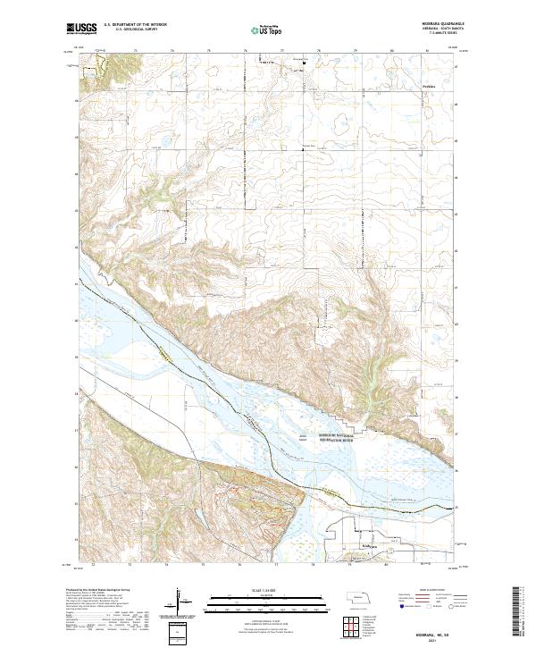 2021 Niobrara2021 Print · USGSNiobrara and the Missouri River corridor are captured here at the start of the 2020s, showing the complex river island geography of the South Dakota border. Genealogists and historians can trace local heritage through Pioneer Cem, Norwegian Cem, and the George Drouillard Trl.
 - 2021 Map of Avon, 2021 Print
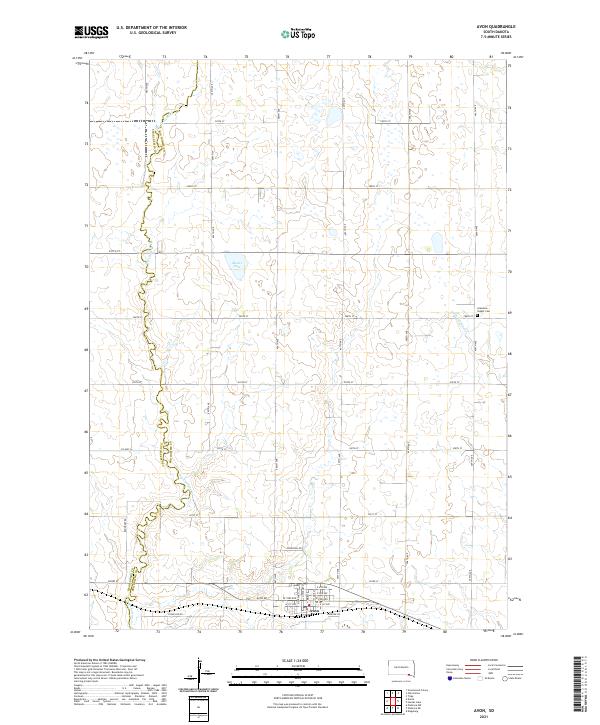 2021 Avon2021 Print · USGSThe rural landscape around Avon is captured here in the early twenty-first century as it spans the Bon Homme and Charles Mix county line. Genealogists and local researchers can trace the vicinity of Gramkow - Vesper Cem and the drainage of Dry Choteau Cr.
 - 2021 Map of Lake Andes NW, 2021 Print
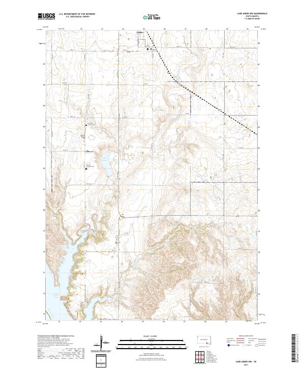 2021 Lake Andes NW2021 Print · USGSCharles Mix County is documented here in its contemporary state, showing the prairie uplands above the Missouri River bluffs. Genealogists can locate several key burial sites like Saint Anns Catholic Cem and Jackson Township Cem near the town of Geddes.
Showing maps 1-25 of 34
Top cities of Charles Mix County
Frequently asked questions
- What are the different types of historical maps available for Charles Mix County?
- What is the oldest map of Charles Mix County?
- Where can I purchase historical maps of Charles Mix County for my home or office?
- Where can I download high-res historical maps of Charles Mix County?
- Are there historical topographic maps available for Charles Mix County?
- Is there historical aerial imagery available for Charles Mix County?
- Where are historical maps of Charles Mix County sourced from?