1970s Maps of Little Eagle, South Dakota
Explore 5 historic maps of Little Eagle from the 1970s. These maps offer a rare glimpse into what life looked like during the 1970s — showing old roads, neighborhoods, homes, and landmarks that have changed or disappeared over time.
Whether you're researching your family's past, planning a metal detecting trip, or studying how Little Eagle's landscape evolved across the 1970s, these high-resolution maps are a powerful tool for exploring the history of this region.
- Focus on a specific era: All maps on this page are from the 1970s, giving you a focused view of this time period.
- See what’s changed: Compare century-old streets, trails, and buildings to today's modern landscape using overlays and satellite layers.
- Research with precision: Use these maps for genealogy, historical research, land use analysis, or educational projects.
- View, download, or print: Maps are fully viewable online in high resolution, and can be downloaded or printed for your own records.
Start exploring Little Eagle's history through authentic maps from the 1970s. This is your window into the past.
Little Eagle, SD maps
(5)- 1971 Map of McLaughlin SW, 1974 Print
 1971 McLaughlin SW1974 Print · USGSCorson County's wide-open prairie and township lines are captured here in the early 1970s. Genealogists and rail historians can trace the path of the Chicago Milwaukee St Paul and Pacific through the Lincoln and Cadillac districts.
 - 1975 Map of Glencross, 1978 Print
 1975 Glencross1978 Print · USGSDewey County, South Dakota, is captured here in the mid-1970s at the intersection of two major tribal lands. Researchers can trace the rail corridor of the Chicago Milwaukee St Paul and Pacific through Glencross and locate the Sacred Heart Cem.
 - 1975 Map of Trail City, 1978 Print
 1975 Trail City1978 Print · USGSTrail City in the mid-seventies occupies a unique position on the boundary between the Standing Rock and Cheyenne River Indian Reservations. Researchers can trace the path of the Chicago Milwaukee St Paul and Pacific railroad through the townsite and locate the Trail City Cem and Trail City Lake.
 - 1975 Map of Glencross NE, 1978 Print
 1975 Glencross NE1978 Print · USGSThe northern plains of South Dakota are captured in the mid-seventies, showing the intersection of tribal and county lands. Researchers can trace the path of the Chicago Milwaukee St Paul and Pacific rail line past Trail City RR Lake and the winding Handboy Creek.
 - 1978 Map of Timber Lake, 1979 Print
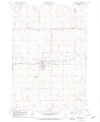 1978 Timber Lake1979 Print · USGSTimber Lake and the surrounding plains of the Standing Rock Indian Reservation are captured here in the late seventies. Researchers can trace the Chicago Milwaukee St Paul and Pacific rail corridor or locate family sites at Holy Cross Cem and Timber Lake.2 unique versions available
End of results
Showing maps 1-5 of 5
Top cities near Little Eagle
- McLaughlin historical maps
- McLaughlin historical maps
- Timber Lake historical maps
- Wakpala historical maps
Frequently asked questions
- What are the different types of historical maps available for Little Eagle?
- What is the oldest map of Little Eagle?
- Where can I purchase historical maps of Little Eagle for my home or office?
- Where can I download high-res historical maps of Little Eagle?
- Are there historical topographic maps available for Little Eagle?
- Is there historical aerial imagery available for Little Eagle?
- Where are historical maps of Little Eagle sourced from?