1950s Maps of Custer County, South Dakota
Explore 49 historic maps of Custer County from the 1950s. These maps offer a rare glimpse into what life looked like during the 1950s — showing old roads, neighborhoods, homes, and landmarks that have changed or disappeared over time.
Whether you're researching your family's past, planning a metal detecting trip, or studying how Custer County's landscape evolved across the 1950s, these high-resolution maps are a powerful tool for exploring the history of this region.
- Focus on a specific era: All maps on this page are from the 1950s, giving you a focused view of this time period.
- See what’s changed: Compare century-old streets, trails, and buildings to today's modern landscape using overlays and satellite layers.
- Research with precision: Use these maps for genealogy, historical research, land use analysis, or educational projects.
- View, download, or print: Maps are fully viewable online in high resolution, and can be downloaded or printed for your own records.
Start exploring Custer County's history through authentic maps from the 1950s. This is your window into the past.
Custer County, SD maps
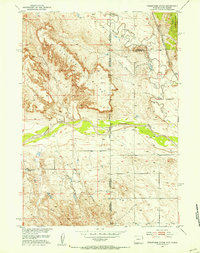
(49)- 1950 Map of Hot Springs, 1952 Print
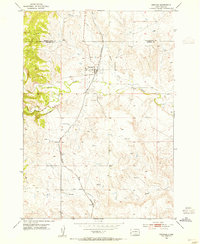
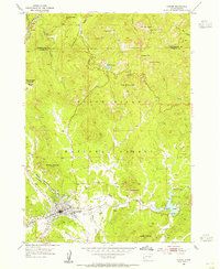
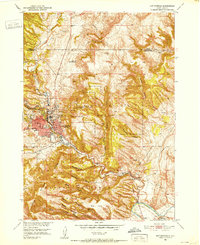 1950 Hot Springs1952 Print · USGSHot Springs and the southern Black Hills are captured here in the early postwar era, showing a community defined by its therapeutic waters and veteran services. Researchers can locate the Battle Mountain National Sanitarium, the State Soldiers Home, and local landmarks like Larive Lake or the Aaberg Sch.6 unique versions available
 - 1950 Map of Buffalo Gap, 1952 Print
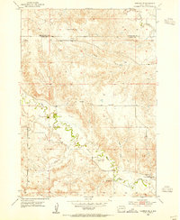
 1950 Buffalo Gap1952 Print · USGSBuffalo Gap and the surrounding Custer County landscape are captured here in the early postwar era as the railroad remained central to local life. Researchers can locate the Friedrick Sch, the winding Cheyenne River, and the Buffalo Gap Cemetery.3 unique versions available
 - 1950 Map of Burdock, 1952 Print
 1950 Burdock1952 Print · USGSSouth Dakota's river-and-rail frontier is captured here in the early fifties, showing the ranching and irrigation patterns of Fall River County. Genealogists and researchers can locate old sites like Burdock and Marietta, the Burdock Sch, and the Doran Ranch.2 unique versions available
 - 1950 Map of Edgemont NE, 1952 Print
 1950 Edgemont NE1952 Print · USGSThe southern Black Hills are captured here during the early fifties, a landscape defined by ranching and forest management. Researchers can locate remote schoolhouses like Robinson School and family homesteads including the Johnson Ranch and Hay Ranch.3 unique versions available
 - 1950 Map of Minnekahta, 1952 Print
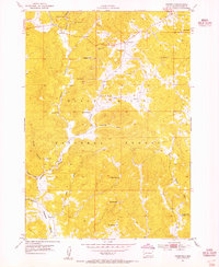
 1950 Minnekahta1952 Print · USGSFall River County ranching and rail infrastructure are captured here in the early fifties at a time when remote outposts still thrived. Researchers can find family landmarks like Johnson Ranch, the tracks of the Chicago Burlington and Quincy, and the now-deauthorized Fossil Cycad National Monument.3 unique versions available
 - 1951 Map of Fairburn SE
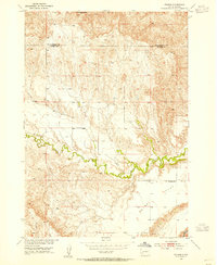
 1951 Fairburn SE1951 Print · USGSThe Cheyenne River breaks across the South Dakota prairie in the early 1950s, marking the border between Custer and Shannon Counties. Genealogists and historians can locate rural landmarks like Harrison Flat Sch, Greives Sch, and the Pine Ridge Indian Reservation Boundary.2 unique versions available
 - 1951 Map of Red Shirt, 1952 Print
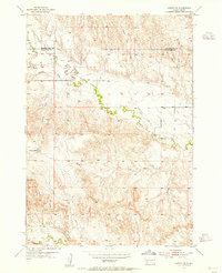
 1951 Red Shirt1952 Print · USGSThe Cheyenne River valley and the Pine Ridge Indian Reservation are captured here in the early fifties. Genealogists and historians can trace the settlement at Red Shirt and locate early rural landmarks like Steele Sch and French Creek Sch.3 unique versions available
 - 1951 Map of Dewey, 1953 Print
 1951 Dewey1953 Print · USGSCrossing the state line during the early fifties, this map captures the railroad-dependent life of the Wyoming-South Dakota borderlands. Genealogists and historians can trace the rail corridor between Dakoming and Dewey or locate the Lucky Strike Bentonite Mine.4 unique versions available
 - 1951 Map of Twentyone Divide, 1953 Print
 1951 Twentyone Divide1953 Print · USGSThe high ridges of the Wyoming and South Dakota border are captured here in the early 1950s. Trace the path of the Chicago Burlington and Quincy railroad or locate the isolated Cheyenne River School and the remote Artesian Well.2 unique versions available
 - 1951 Map of Fanny Peak, 1953 Print
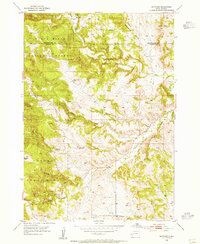
 1951 Fanny Peak1953 Print · USGSThe Wyoming and South Dakota borderlands come into focus in the early 1950s, highlighting the rugged terrain where the Black Hills meet the high plains. Researchers can trace the layout of the L A K Ranch, locate the Sweet School, and identify high-altitude points like Fanny Peak.4 unique versions available
 - 1951 Map of Red Shirt NE, 1953 Print
 1951 Red Shirt NE1953 Print · USGSThe northern reaches of the Pine Ridge Indian Reservation and the winding Cheyenne River are captured here in the early fifties. Local history researchers can trace the intricate network of draws and tables, including Blindman Table and Plenty Star Table.3 unique versions available
 - 1951 Map of Red Shirt SW, 1953 Print
 1951 Red Shirt SW1953 Print · USGSThe Pine Ridge Indian Reservation landscape is documented here in the early fifties, showing the intricate erosion of the high plains. Researchers can trace the Reservation Boundary along the Cheyenne River and locate Squaw Humper Table.2 unique versions available
 - 1951 Map of Smithwick NE, 1953 Print
 1951 Smithwick NE1953 Print · USGSThe Black Hills foothills meet the High Plains in the early fifties, where the Cheyenne River flows past Harrison Flat. Researchers can trace the Pine Ridge Indian Reservation Boundary and locate landmarks like Smithwick and the Squaw-Humper Table.
 - 1951 Map of Smithwick NW, 1953 Print
 1951 Smithwick NW1953 Print · USGSThe Cheyenne River breaks through the South Dakota highlands in the early fifties, revealing a landscape of high flats and deeply cut drainages. Researchers can trace rural school locations like W G Flat Sch and the course of Lame Johnny Creek through Harrison Flat.3 unique versions available
 - 1951 Map of Minnekahta NE, 1953 Print
 1951 Minnekahta NE1953 Print · USGSFall River County at the dawn of the fifties shows a landscape shaped by the southern Black Hills and the rail lines that served them. You can trace the rural school system at Miller Sch and follow the Burlington and Chicago railroad through Erskine.2 unique versions available
 - 1951 Map of Clifton, 1953 Print
 1951 Clifton1953 Print · USGSThe Wyoming and South Dakota borderlands come into focus in the early 1950s as a high-altitude ranching and rail corridor. Researchers can trace the Chicago Burlington and Quincy line past the Clifton School and family sites like Blaine Ranch.4 unique versions available
 - 1953 Map of Hermosa, 1955 Print
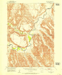
 1953 Hermosa1955 Print · USGSHermosa and the surrounding plains of Custer County are captured in the early fifties, centered on the CHICAGO AND NORTH WESTERN rail line. Genealogists and historians can locate the local Cem, the town Reservoir, and numerous Windmills scattered across L 7 Draw.3 unique versions available
 - 1953 Map of Hermosa SE, 1955 Print
 1953 Hermosa SE1955 Print · USGSCuster and Pennington counties appear here in the early fifties, showing a rural landscape defined by rugged drainage systems. Genealogists and researchers can locate the sites of local schools including Carey Sch and Lower Battle Creek Sch.3 unique versions available
 - 1953 Map of Folsom, 1955 Print
 1953 Folsom1955 Print · USGSPennington and Custer counties appear here in the early fifties, when remote ranching outposts and high prairie flats defined the landscape. Genealogists and local researchers can locate the McMann Sch and trace the winding course of Spring Creek past Folsom.2 unique versions available
 - 1953 Map of Caputa SW, 1973 Print
 1953 Caputa SW1973 Print · USGSCuster and Pennington Counties appear in the early fifties as a landscape of remote ranches and deep drainage draws. Researchers can trace land boundaries near Lauzon Ranch or follow the paths of Spring Creek, Indian Trail Draw, and Battle Creek.2 unique versions available
 - 1954 Map of Iron Mountain, 1955 Print
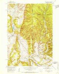
 1954 Iron Mountain1955 Print · USGSThe Black Hills in the mid-fifties are captured here during a period of established mining and growing tourism. Researchers can trace the layout of the Spokane Mine settlement or locate institutional landmarks like the Black Hills Playhouse and State Park Sch.5 unique versions available
 - 1954 Map of Fourmile, 1955 Print
 1954 Fourmile1955 Print · USGSThe Black Hills during the mid-fifties reveal a landscape shaped by active mining and rural education. Genealogists and historians can locate remote schoolhouses like Sevenmile Sch and trace numerous mineral sites including the Tin Mountain Mine and Tiptop Mine.4 unique versions available
 - 1954 Map of Custer, 1955 Print
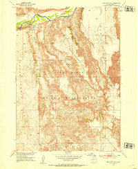
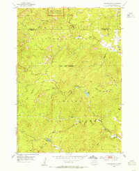
 1954 Custer1955 Print · USGSMid-century Custer and the Black Hills are captured here during a period of burgeoning tourism and active mining. Researchers can trace the development of Custer, the site of the Crazy Horse Carving, and numerous prospects like the Clara Belle Mine.5 unique versions available
 - 1954 Map of Hayward, 1955 Print
 1954 Hayward1955 Print · USGSThe Black Hills of South Dakota are captured here in the mid-fifties, showing the transition between national forest and state park lands. Genealogists and historians can trace the remote locations of Spokane, Rushmore Cave, and the small Central Sch.6 unique versions available
 - 1954 Map of Berne, 1955 Print
 1954 Berne1955 Print · USGSThe Black Hills in the mid-fifties were a hub of rail activity and mountain industry, centered on the Chicago Burlington and Quincy line. Genealogists and historians can locate the Penobscot Mine, the Park Sch, and early work at the Crazy Horse Carvings.4 unique versions available
Showing maps 1-25 of 49
Top cities of Custer County
- Custer historical maps
- Hermosa historical maps
- Buffalo Gap historical maps
- Pringle historical maps
- Fairburn historical maps
Frequently asked questions
- What are the different types of historical maps available for Custer County?
- What is the oldest map of Custer County?
- Where can I purchase historical maps of Custer County for my home or office?
- Where can I download high-res historical maps of Custer County?
- Are there historical topographic maps available for Custer County?
- Is there historical aerial imagery available for Custer County?
- Where are historical maps of Custer County sourced from?