Old Maps of McNenny, South Dakota for Genealogy
Trace your family roots with 13 historic maps of McNenny. These high-res maps reveal old neighborhoods, homesites, landmarks, and streets — helping you uncover where your ancestors lived and how the area evolved over time.
- Explore historic neighborhoods: Identify where your relatives may have lived in the 1800s or 1900s.
- Compare maps over time: Trace the changes in streets, buildings, and landmarks for multi-generational research.
- Perfect for genealogy & ancestry research: Used by family historians and researchers to map out lineage and migration.
These maps are an incredible resource for exploring your personal connection to McNenny's past.
McNenny, SD maps
(13)- 1901 Map of Aladdin, 1954 Print
 1901 Aladdin1954 Print · USGSCrook County ranching and rail life at the turn of the century is preserved here, from the mountain slopes to the river valleys. Genealogists can trace early homesteads and shipping points like Aladdin, Beulah, and the VVV Ranch.
 - 1903 Map of Aladdin
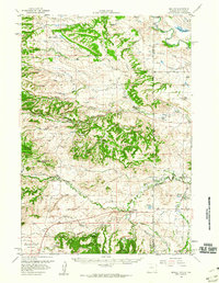
 1903 Aladdin1903 Print · USGSThe northern Black Hills region at the turn of the century reveals a landscape defined by the arrival of the Wyoming and Missouri River R.R. and expansive cattle ranching. Researchers can trace the early footprints of settlements like Aladdin and Beulah, alongside established landmarks like the VVV Ranch and Schoolmarm Butte.3 unique versions available
 - 1954 Map of Gillette, 1975 Print
 1954 Gillette1975 Print · USGSGillette and the northeast Wyoming ranching country are captured here in the mid-1950s as coal and bentonite mining shaped the local economy. Genealogists can trace family landmarks like the Bethlehem Church, Wellman School, and early settlements along the Chicago Burlington and Quincy RR.
 - 1955 Map of Gillette, 1976 Print
 1955 Gillette1976 Print · USGSNortheastern Wyoming in the mid-twentieth century is captured here as the energy and ranching landscape began to shift. Genealogists and historians can trace the foundations of local communities through sites like Wyodak, the Pleasantdale Community Building, and landmarks like Devils Tower National Monument.
 - 1958 Map of Gillette
 1958 Gillette1958 Print · USGSNortheastern Wyoming and the Black Hills are captured here in the late fifties, showcasing a landscape of high-plains ranching and emerging energy production. Researchers can trace the rail-side growth of Gillette and find historic rural landmarks like the Wyodak Coal Mine, Bethlehem Church, and Devils Tower National Monument.2 unique versions available
 - 1958 Map of Beulah, 1960 Print
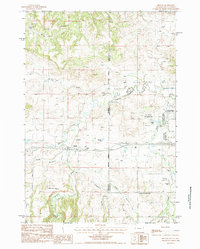
 1958 Beulah1960 Print · USGSThe borderlands of Wyoming and South Dakota come into focus in the late fifties, showcasing the ranching communities of the Black Hills foothills. Genealogists and historians can trace family landholdings like the Fisher Ranch and Hall Ranch or find old school sites like Beaver Creek Sch.3 unique versions available
 - 1962 Map of Gillette
 1962 Gillette1962 Print · USGSHigh plains ranching and coal mining dominate the Powder River Basin in the early sixties. Genealogists can trace rural communities through landmarks like the Bethlehem Church, Lake School, and settlements such as Moorcroft and Sundance.
 - 1979 Map of Devils Tower
 1979 Devils Tower1979 Print · USGSThe High Plains meet the Black Hills in the late 1970s, where the landmark Devils Tower rises above the Belle Fourche River. Trace the Chicago and North Western rail line and locate old outposts like Aladdin and Hulett.2 unique versions available
 - 1984 Map of Beulah
 1984 Beulah1984 Print · USGSThe Wyoming-South Dakota borderlands come alive in this mid-eighties survey of the high plains and Black Hills. Genealogists and local historians can trace the area's development through landmarks like the Beulah townsite, the Cem, and the Mc Nenny National Fish Hatchery.2 unique versions available
 - 2012 Map of Beulah, 2012 Print
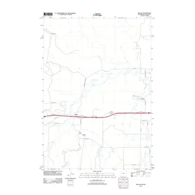 2012 Beulah2012 Print · USGSCovers McNenny, including Beulah, Lawrence County, and other nearby areas
 - 2015 Map of Beulah, 2015 Print
 2015 Beulah2015 Print · USGSCovers McNenny, including Beulah, Lawrence County, and other nearby areas
 - 2017 Map of Beulah, 2017 Print
 2017 Beulah2017 Print · USGSCovers McNenny, including Beulah, Lawrence County, and other nearby areas
 - 2021 Map of Beulah, 2021 Print
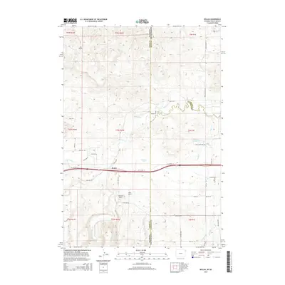
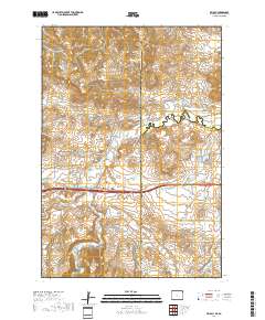
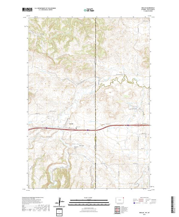 2021 Beulah2021 Print · USGSThe Wyoming and South Dakota borderlands come into focus in this recent survey of the Black Hills foothills. Genealogists and local historians can trace family locations near the Beulah Cem or follow the historic route of Old US Hwy 14 past Montana Lake.
End of results
Showing maps 1-13 of 13
Top cities near McNenny
- Spearfish historical maps
- Belle Fourche historical maps
- Lead historical maps
- North Spearfish historical maps
- Mountain Plains historical maps
- Beulah historical maps
Frequently asked questions
- What are the different types of historical maps available for McNenny?
- What is the oldest map of McNenny?
- Where can I purchase historical maps of McNenny for my home or office?
- Where can I download high-res historical maps of McNenny?
- Are there historical topographic maps available for McNenny?
- Is there historical aerial imagery available for McNenny?
- Where are historical maps of McNenny sourced from?