1960s Maps of Mellette County, South Dakota
Explore 5 historic maps of Mellette County from the 1960s. These maps offer a rare glimpse into what life looked like during the 1960s — showing old roads, neighborhoods, homes, and landmarks that have changed or disappeared over time.
Whether you're researching your family's past, planning a metal detecting trip, or studying how Mellette County's landscape evolved across the 1960s, these high-resolution maps are a powerful tool for exploring the history of this region.
- Focus on a specific era: All maps on this page are from the 1960s, giving you a focused view of this time period.
- See what’s changed: Compare century-old streets, trails, and buildings to today's modern landscape using overlays and satellite layers.
- Research with precision: Use these maps for genealogy, historical research, land use analysis, or educational projects.
- View, download, or print: Maps are fully viewable online in high resolution, and can be downloaded or printed for your own records.
Start exploring Mellette County's history through authentic maps from the 1960s. This is your window into the past.
Mellette County, SD maps
(5)- 1969 Map of Norris, 1971 Print
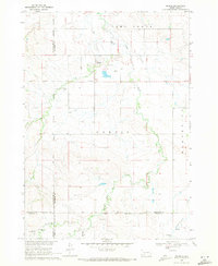 1969 Norris1971 Print · USGSMellette County and the Rosebud Indian Reservation come into focus during the late sixties as the community of Norris anchors this prairie landscape. Genealogists and local historians can trace family ties at Poor Thunder Cem, St Stephens Ch, and Red Leaf Cem along the Black Pipe Creek valley.
 - 1969 Map of Soldier Creek NE, 1971 Print
 1969 Soldier Creek NE1971 Print · USGSThe South Dakota prairie meets the winding Little White River in the late sixties along the Rosebud Indian Reservation. Genealogists and researchers can trace local family landmarks like Ring Thunder Sacred Heart Cem and St John Cem across the northern plains.
 - 1969 Map of Parmelee NE, 1971 Print
 1969 Parmelee NE1971 Print · USGSThe northern reaches of the Rosebud Reservation are captured here in the late sixties, showing a landscape defined by prairie drainage and ranching life. Genealogists and historians can trace local landmarks such as St Johns Ch, the Cem, and the small settlement of Gray.
 - 1969 Map of Mission NW, 1971 Print
 1969 Mission NW1971 Print · USGSThe rural prairie landscape of Mellette County was surveyed in the late 1960s as it appeared before many modern shifts. Genealogists and researchers can trace community landmarks like St James Chapel, Body of Christ Cem, and the Neville Sch near the Horse Creek drainage.
 - 1969 Map of Soldier Creek NW, 1971 Print
 1969 Soldier Creek NW1971 Print · USGSThe Rosebud Indian Reservation landscape in the late sixties reveals a network of rural schools and family-centered landmarks across Mellette and Todd Counties. Researchers can locate the Holy Family Cem, Ring Thunder Sch, and the settlement at Graves.
End of results
Showing maps 1-5 of 5
Top cities of Mellette County
Frequently asked questions
- What are the different types of historical maps available for Mellette County?
- What is the oldest map of Mellette County?
- Where can I purchase historical maps of Mellette County for my home or office?
- Where can I download high-res historical maps of Mellette County?
- Are there historical topographic maps available for Mellette County?
- Is there historical aerial imagery available for Mellette County?
- Where are historical maps of Mellette County sourced from?