1980s Maps of Mellette County, South Dakota
Explore 16 historic maps of Mellette County from the 1980s. These maps offer a rare glimpse into what life looked like during the 1980s — showing old roads, neighborhoods, homes, and landmarks that have changed or disappeared over time.
Whether you're researching your family's past, planning a metal detecting trip, or studying how Mellette County's landscape evolved across the 1980s, these high-resolution maps are a powerful tool for exploring the history of this region.
- Focus on a specific era: All maps on this page are from the 1980s, giving you a focused view of this time period.
- See what’s changed: Compare century-old streets, trails, and buildings to today's modern landscape using overlays and satellite layers.
- Research with precision: Use these maps for genealogy, historical research, land use analysis, or educational projects.
- View, download, or print: Maps are fully viewable online in high resolution, and can be downloaded or printed for your own records.
Start exploring Mellette County's history through authentic maps from the 1980s. This is your window into the past.
Mellette County, SD maps
(16)- 1980 Map of Kadoka
 1980 Kadoka1980 Print · USGSWestern South Dakota's open plains and Badlands are captured here in the early eighties, showcasing a region defined by its railroads and reservations. Researchers can trace the routes of the Chicago and North Western or locate local landmarks like Kadoka Lake and Wanblee.
 - 1981 Map of Cedar Butte
 1981 Cedar Butte1981 Print · USGSThe South Dakota prairie at the start of the eighties is captured here, detailing the rural landscape of Mellette and Jackson counties. Local researchers can trace family landmarks and community sites like Stands For Them Cem, Running Bird Sch, and St Thomas Ch.
 - 1982 Map of Mission NE
 1982 Mission NE1982 Print · USGSMellette and Todd Counties at the start of the 1980s reveal a landscape of vast ranchlands and reservation geography. Local history researchers can pinpoint family holdings like Gifford Ranch and Lauritsen Ranch along the banks of White Thunder Creek.
 - 1982 Map of Murdo 3 NW
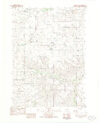 1982 Murdo 3 NW1982 Print · USGSMellette County ranching life is preserved here in the early eighties, showing a landscape defined by cattle operations and wide drainage basins. Genealogists can locate family holdings like the Lyle Chamberlain Ranch, Shouldis Ranch, and Nielson Ranch.2 unique versions available
 - 1982 Map of Two Nation Creek
 1982 Two Nation Creek1982 Print · USGSThe high plains of Mellette and Tripp Counties are captured here in the early eighties as a landscape of isolated homesteads and prairie creeks. Researchers can locate the Pahapesto Sch, trace the winding Two Nation Creek, and find the remote Landing Strip and Gravel Pit sites.
 - 1982 Map of White River SE
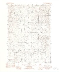
 1982 White River SE1982 Print · USGSSouth Dakota ranching country is meticulously detailed in the early eighties, showing the dispersed family operations across Mellette County. Researchers can trace landholdings like Frank Krogman Ranch and Iverson Ranch or locate St Marys Garden Cem.
 - 1982 Map of Wood North
 1982 Wood North1982 Print · USGSMellette County during the early eighties remains a landscape defined by its natural waterways and tribal boundaries. Genealogists and researchers can trace the winding courses of White Thunder Creek and Butte Creek through the Rosebud and Cody areas.
 - 1982 Map of Badnation SE
 1982 Badnation SE1982 Print · USGSMellette County, South Dakota, is captured in the early eighties as a landscape of open prairie and winding creek beds. Genealogists and local historians can trace the borders of the Rosebud Indian Reservation and locate landmarks like the Butte and Oak Creek.
 - 1982 Map of White River East
 1982 White River East1982 Print · USGSMellette County ranching country is captured here in the early eighties, centered on the community of White River. Local historians and genealogists can trace family landholdings such as Hutchinson Ranch, Didier Ranch, and Ellis Ranch along the Little White River.
 - 1982 Map of White River West
 1982 White River West1982 Print · USGSMellette County ranching and water management are front and center in this early 1980s landscape near the White River confluence. Trace family lands such as the Risseuw Ranch alongside infrastructure like the Small Power Plant and Saint Ignatius Cem.
 - 1982 Map of Carter
 1982 Carter1982 Print · USGSTripp County and the surrounding tribal lands are captured here in the early eighties as rail service gave way to rural roads. Genealogists and local historians can trace the boundary of the Rosebud Indian Res and locate sites like Carter or the Schlakker Landing Strip.
 - 1982 Map of Mosher
 1982 Mosher1982 Print · USGSMellette and Todd Counties were still defined by remote prairie drainages and quiet outposts in the early 1980s. Genealogists and historians can trace the Old R.R. Grade through the Rosebud Indian Reservation and locate the Advent Cem near Mosher.
 - 1982 Map of Wood South
 1982 Wood South1982 Print · USGSThe northern edge of the Rosebud Reservation comes into focus during the early 1980s, centered on the community of Wood. Researchers can trace local landmarks and burial sites like the Grandstand Rodeo Arena, Evergreen Cem, and Rattlesnake Butte.
 - 1982 Map of Mission, 1983 Print
 1982 Mission1983 Print · USGSThe Rosebud Reservation in the early eighties shows a landscape of plains communities and aviation outposts. Genealogists and researchers can trace local centers like Mission, Rosebud, and St Francis, or locate family landmarks near Antelope Lake and the Keya Paha River.
 - 1983 Map of Martin
 1983 Martin1983 Print · USGSBennett County and the neighboring tribal lands appear here in the early eighties as a network of High Plains settlements and conservation areas. Researchers can trace tribal boundaries and local genealogy through sites like Pine Ridge Indian Reservation, Long Valley, and Arnold Ranch.
 - 1985 Map of White River, 1986 Print
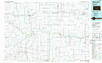 1985 White River1986 Print · USGSSouth-central South Dakota comes into focus during the mid-eighties as a critical junction of rail and river life. Researchers can trace the Chicago and North Western line through high-plains towns like Murdo and Presho or locate rural landmarks such as Stony Butte and Fate Dam.2 unique versions available
End of results
Showing maps 1-16 of 16
Top cities of Mellette County
Frequently asked questions
- What are the different types of historical maps available for Mellette County?
- What is the oldest map of Mellette County?
- Where can I purchase historical maps of Mellette County for my home or office?
- Where can I download high-res historical maps of Mellette County?
- Are there historical topographic maps available for Mellette County?
- Is there historical aerial imagery available for Mellette County?
- Where are historical maps of Mellette County sourced from?