Old Maps of Mellette County, South Dakota for Academic Research
Study the evolution of Mellette County with 165 high-resolution historic maps. Whether you're teaching, researching, or modeling changes in land use, these maps provide essential visual documentation of urban, environmental, and geographic change.
- Analyze long-term change: Track patterns in development, transportation, and natural features.
- Ideal for environmental or urban studies: Support academic projects with primary historical map data.
- Use in the classroom or lab: Educators and researchers rely on these maps to bring historical context to life.
These maps are a powerful tool for teaching, research, and visualizing how Mellette County has changed over the decades.
Mellette County, SD maps
(165)- 1951 Map of Stamford SW, 1952 Print
 1951 Stamford SW1952 Print · USGSSouth Dakota's river breaks and high plateaus are captured here in the early fifties, showing the rural landscape south of the Milwaukee Road. Genealogists and local historians can locate Valley Sch (Abandoned), Six School, and the winding course of the White River.3 unique versions available
 - 1951 Map of Murdo SE, 1953 Print
 1951 Murdo SE1953 Print · USGSThe White River breaks through the South Dakota plains in the early fifties, marking the border between Jones and Mellette counties. Local researchers can trace the drainages of Bull Creek and Johnny Creek or locate the site of South Liberty Sch.2 unique versions available
 - 1951 Map of Badnation, 1953 Print
 1951 Badnation1953 Print · USGSThe White River breaks of South Dakota are shown here in the early 1950s, revealing a landscape of remote settlements and mission churches. Researchers can locate the Bad Nation Indian Sch and rural congregations like St George Ch and St Catharine Ch.2 unique versions available
 - 1951 Map of Stamford SE, 1953 Print
 1951 Stamford SE1953 Print · USGSMellette County ranching country is documented here in the early fifties, where the winding White River separates high plateaus. Researchers can locate family landmarks like the Bear Heels Ranch and rural centers such as St James Ch and the Big White River Sch.3 unique versions available
 - 1951 Map of Cedar Butte NW, 1953 Print
 1951 Cedar Butte NW1953 Print · USGSNative American ranching and early community life in Mellette County come into focus during the early fifties. Genealogists and historians can trace family locations at Walker Ranch and the Church Creek Ch Cem near the Black Pipe Creek crossing.2 unique versions available
 - 1951 Map of Cedar Butte NE, 1953 Print
 1951 Cedar Butte NE1953 Print · USGSMellette County ranching life is preserved in high detail in the early fifties, showing a landscape of named family spreads and isolated schoolhouses. Genealogists can trace the locations of the Brauns on Ranch, Dixon Ranch, and the centrally located Prospect Sch.
 - 1951 Map of White River NE, 1953 Print
 1951 White River NE1953 Print · USGSThe river breaks of South Dakota are captured in detail during the early fifties, showing the frontier-style settlement patterns of Mellette and Jones counties. Genealogists and local historians can trace rural schoolhouse locations like Strait Sch and Paleck Sch near the White River.3 unique versions available
 - 1951 Map of Okaton SW, 1953 Print
 1951 Okaton SW1953 Print · USGSThe river valley at the Jones and Mellette county line comes alive in this mid-century survey of the South Dakota ranchlands. Genealogists and local historians can locate specific family holdings such as the Conrad Ranch and Sandy Ranch, or trace the grounds of the South Grandview Sch.3 unique versions available
 - 1951 Map of Westover, 1953 Print
 1951 Westover1953 Print · USGSThe river breaks of south-central South Dakota are captured here in the early fifties, showing a landscape defined by the winding White River. Genealogists and local historians can locate rural landmarks like Riverview School, St Philip Ch, and the settlement of Westover.3 unique versions available
 - 1951 Map of Badnation NW, 1953 Print
 1951 Badnation NW1953 Print · USGSThe White River corridor in South Dakota was being carefully mapped in the early fifties for Missouri River Basin development. Genealogists and researchers can trace local land divisions in Zickrick, Riverside, and the rugged draws of Badnation.2 unique versions available
 - 1951 Map of Murdo 3 NW, 1953 Print
 1951 Murdo 3 NW1953 Print · USGSMellette County ranching country is captured here in the early fifties during the Missouri River Basin development era. Researchers can trace rural life through landmarks like the UP Ranch and Round-up Sch, or the terrain of Cottonwood Valley.3 unique versions available
 - 1951 Map of Murdo 3 NE, 1953 Print
 1951 Murdo 3 NE1953 Print · USGSThe White River hills of Mellette and Jones counties are captured here in the early fifties, showing a remote landscape of deep draws and high ridges. Researchers can trace the rural school district around Valley View Sch and the broad reaches of the Cottonwood Valley.3 unique versions available
 - 1951 Map of Okaton SE, 1953 Print
 1951 Okaton SE1953 Print · USGSJones and Mellette counties appear here in the early fifties, just as the Missouri River Basin development program was underway. Researchers can locate the winding White River corridor and trace historical rural sites like the Osborn Sch and Barnette Cem.3 unique versions available
 - 1951 Map of Presho 4 NW, 1953 Print
 1951 Presho 4 NW1953 Print · USGSThe White River breaks of South Dakota are captured in the early fifties during a period of Missouri River Basin development. Genealogists and local historians can trace isolated homesteads such as Krutson Ranch and Iverson Ranch or the location of the Pleasant Hill Sch.4 unique versions available
 - 1955 Map of Martin, 1968 Print
 1955 Martin1968 Print · USGSTribal lands and rail corridors define the South Dakota plains in the mid-fifties, from the sand hills to the badlands. Genealogists and historians can trace the early layout of Pine Ridge Indian Reservation settlements and find small rail towns like Stamford and Witten.2 unique versions available
 - 1958 Map of Martin
 1958 Martin1958 Print · USGSSouth Dakota's southern plains are documented here in the late fifties, showing the expansive Pine Ridge and Rosebud Indian Reservations. Genealogists and historians can locate early settlements along the Chicago Milwaukee St Paul and Pacific line or find family roots near Martin and the Indian Cemetery.
 - 1969 Map of Norris, 1971 Print
 1969 Norris1971 Print · USGSMellette County and the Rosebud Indian Reservation come into focus during the late sixties as the community of Norris anchors this prairie landscape. Genealogists and local historians can trace family ties at Poor Thunder Cem, St Stephens Ch, and Red Leaf Cem along the Black Pipe Creek valley.
 - 1969 Map of Soldier Creek NE, 1971 Print
 1969 Soldier Creek NE1971 Print · USGSThe South Dakota prairie meets the winding Little White River in the late sixties along the Rosebud Indian Reservation. Genealogists and researchers can trace local family landmarks like Ring Thunder Sacred Heart Cem and St John Cem across the northern plains.
 - 1969 Map of Parmelee NE, 1971 Print
 1969 Parmelee NE1971 Print · USGSThe northern reaches of the Rosebud Reservation are captured here in the late sixties, showing a landscape defined by prairie drainage and ranching life. Genealogists and historians can trace local landmarks such as St Johns Ch, the Cem, and the small settlement of Gray.
 - 1969 Map of Mission NW, 1971 Print
 1969 Mission NW1971 Print · USGSThe rural prairie landscape of Mellette County was surveyed in the late 1960s as it appeared before many modern shifts. Genealogists and researchers can trace community landmarks like St James Chapel, Body of Christ Cem, and the Neville Sch near the Horse Creek drainage.
 - 1969 Map of Soldier Creek NW, 1971 Print
 1969 Soldier Creek NW1971 Print · USGSThe Rosebud Indian Reservation landscape in the late sixties reveals a network of rural schools and family-centered landmarks across Mellette and Todd Counties. Researchers can locate the Holy Family Cem, Ring Thunder Sch, and the settlement at Graves.
 - 1980 Map of Kadoka
 1980 Kadoka1980 Print · USGSWestern South Dakota's open plains and Badlands are captured here in the early eighties, showcasing a region defined by its railroads and reservations. Researchers can trace the routes of the Chicago and North Western or locate local landmarks like Kadoka Lake and Wanblee.
 - 1981 Map of Cedar Butte
 1981 Cedar Butte1981 Print · USGSThe South Dakota prairie at the start of the eighties is captured here, detailing the rural landscape of Mellette and Jackson counties. Local researchers can trace family landmarks and community sites like Stands For Them Cem, Running Bird Sch, and St Thomas Ch.
 - 1982 Map of Mission NE
 1982 Mission NE1982 Print · USGSMellette and Todd Counties at the start of the 1980s reveal a landscape of vast ranchlands and reservation geography. Local history researchers can pinpoint family holdings like Gifford Ranch and Lauritsen Ranch along the banks of White Thunder Creek.
 - 1982 Map of Murdo 3 NW
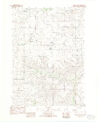 1982 Murdo 3 NW1982 Print · USGSMellette County ranching life is preserved here in the early eighties, showing a landscape defined by cattle operations and wide drainage basins. Genealogists can locate family holdings like the Lyle Chamberlain Ranch, Shouldis Ranch, and Nielson Ranch.2 unique versions available
Showing maps 1-25 of 165
Top cities of Mellette County
Frequently asked questions
- What are the different types of historical maps available for Mellette County?
- What is the oldest map of Mellette County?
- Where can I purchase historical maps of Mellette County for my home or office?
- Where can I download high-res historical maps of Mellette County?
- Are there historical topographic maps available for Mellette County?
- Is there historical aerial imagery available for Mellette County?
- Where are historical maps of Mellette County sourced from?