2020s Maps of Wounded Knee District, South Dakota
Explore 16 historic maps of Wounded Knee District from the 2020s. These maps offer a rare glimpse into what life looked like during the 2020s — showing old roads, neighborhoods, homes, and landmarks that have changed or disappeared over time.
Whether you're researching your family's past, planning a metal detecting trip, or studying how Wounded Knee District's landscape evolved across the 2020s, these high-resolution maps are a powerful tool for exploring the history of this region.
- Focus on a specific era: All maps on this page are from the 2020s, giving you a focused view of this time period.
- See what’s changed: Compare century-old streets, trails, and buildings to today's modern landscape using overlays and satellite layers.
- Research with precision: Use these maps for genealogy, historical research, land use analysis, or educational projects.
- View, download, or print: Maps are fully viewable online in high resolution, and can be downloaded or printed for your own records.
Start exploring Wounded Knee District's history through authentic maps from the 2020s. This is your window into the past.
Wounded Knee District, SD maps
(16)- 2021 Map of Manderson, 2021 Print
 2021 Manderson2021 Print · USGSManderson and the Pine Ridge Reservation are captured here in the early twenty-first century as the landscape follows the winding Wounded Knee Cr. Trace local heritage at Saint Agnes Catholic Cem or follow the path of Big Foot Trl across the high plains.
 - 2021 Map of Stirk Table, 2021 Print
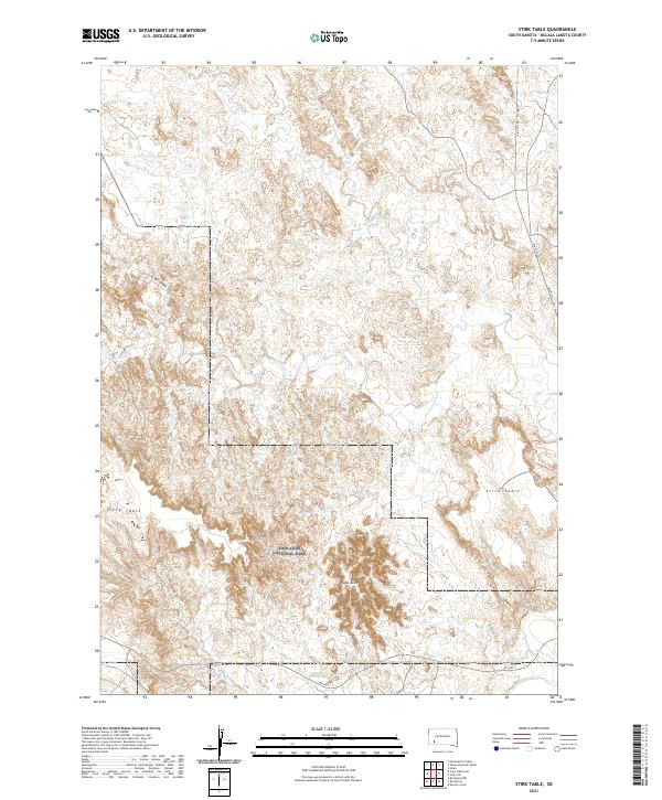 2021 Stirk Table2021 Print · USGSOglala Lakota land in the early twenty-first century is defined by its high plateaus and river valleys. Genealogists and historians can trace the paths of Big Foot Trl Bia Hwy 27 and BIA Hwy 2 across Stirk Table and toward the White River.
 - 2021 Map of Wounded Knee, 2021 Print
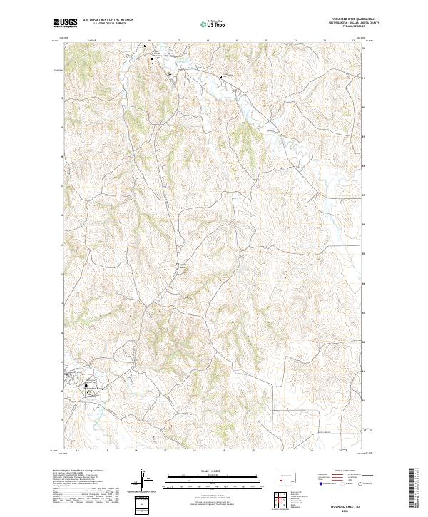 2021 Wounded Knee2021 Print · USGSThe Pine Ridge Indian Reservation is documented here in the early twenty-first century, centered on the historic site of Wounded Knee. Researchers can trace local genealogy and landmarks through sites like the Wounded Knee Monument, Saint Julia Cem, and the Big Foot Trl.
 - 2021 Map of Red Shirt NE, 2021 Print
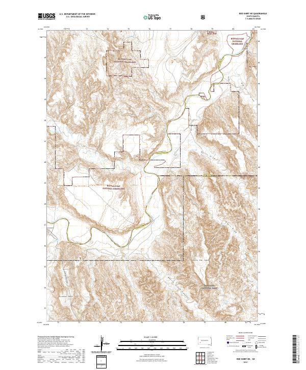 2021 Red Shirt NE2021 Print · USGSThe high tablelands of Custer and Pennington Counties are documented here as they appeared in 2021. Researchers can trace the winding Cheyenne River and locate remote landmarks like Plenty Star Table, Blindman Table, and Battle Creek Canyon.
 - 2021 Map of Pine Ridge NE, 2021 Print
 2021 Pine Ridge NE2021 Print · USGSOglala Lakota County's terrain is documented here in the early 2020s, showcasing the intricate drainage systems of the northern plains. Trace the paths of Little Grass Creek, Pepper Creek, and the route of White Horse Creek Rd.
 - 2021 Map of Cuny Table East, 2021 Print
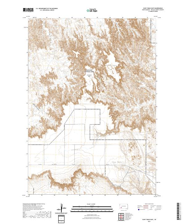 2021 Cuny Table East2021 Print · USGSWithin the Oglala Lakota region, this modern survey captures the high plateau and canyon country of the Badlands. Researchers can trace the layout of Badlands National Park and landforms like Stronghold Table, Cuny Table, and Battle Creek Canyon.
 - 2021 Map of Evergreen SW, 2021 Print
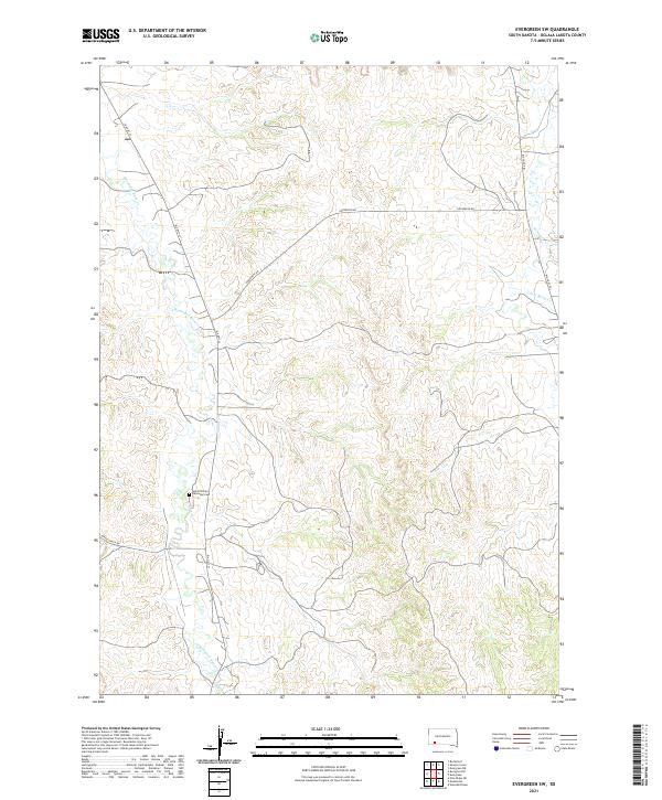 2021 Evergreen SW2021 Print · USGSThe high plains of Oglala Lakota County are mapped in the early twenty-first century, showing the enduring paths of tribal road networks and prairie waterways. Trace local history along Wounded Knee Cr or locate Saint Phillip's Episcopal Cem and the Big Foot Trl.
 - 2021 Map of Rockyford SW, 2021 Print
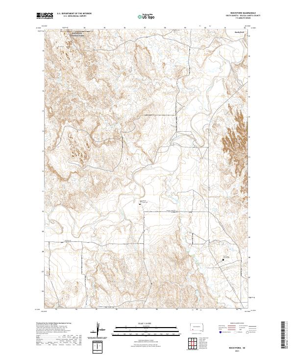
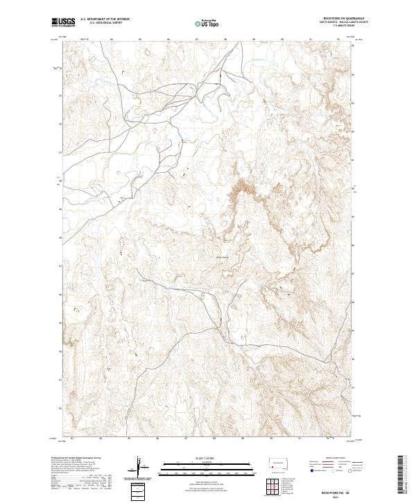 2021 Rockyford SW2021 Print · USGSOglala Lakota County is defined by its deep river valleys and canyon networks in this modern survey. Researchers can trace the path of the White River and follow Grass Creek Rd through the topography of Wolf Canyon.
 - 2021 Map of Rockyford SE, 2021 Print
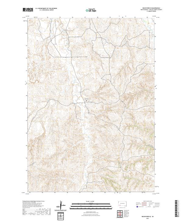 2021 Rockyford SE2021 Print · USGSThe Oglala Lakota landscape is documented here in the early twenty-first century, showing the enduring importance of river valleys and rural routes. Researchers can locate Saint Mary's Church Cem and follow the drainages of Grass Cr and Wounded Knee Cr.
 - 2021 Map of Rockyford NW, 2021 Print
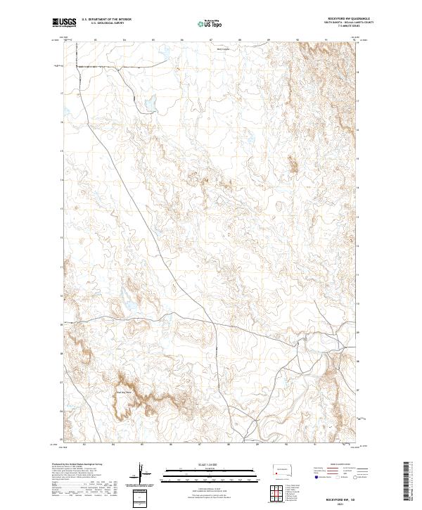 2021 Rockyford NW2021 Print · USGSThe Oglala Lakota landscape is documented here in the early twenty-first century as it spans the high plateaus and river drainages. You can trace the winding course of the White River and locate distinctive landmarks like Red Dog Table and Wolf Canyon.
 - 2021 Map of Rockyford, 2021 Print
 2021 Rockyford2021 Print · USGSThe Oglala Lakota landscape in the early 2020s shows a community centered around the White River and Rockyford. Genealogists and historians can locate specific sites like Saint Mark's Episcopal Cem and Saint Peter Church Cem.
 - 2021 Map of Sharps Corner, 2021 Print
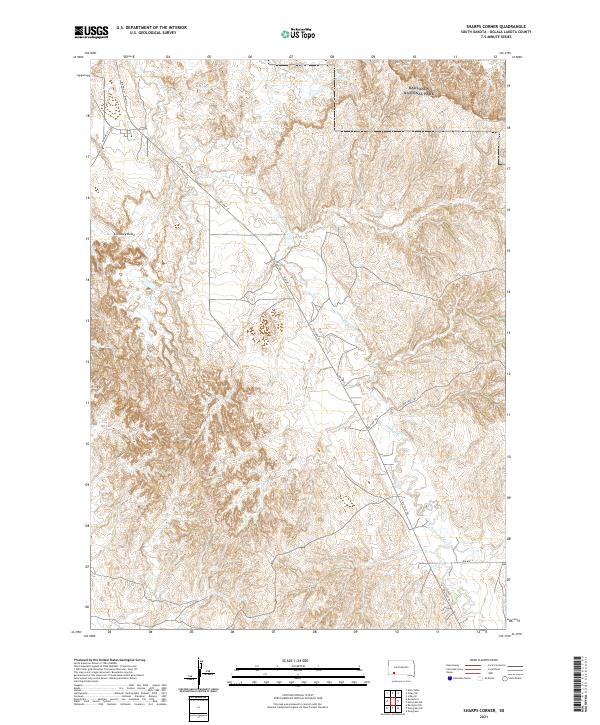 2021 Sharps Corner2021 Print · USGSOglala Lakota County is mapped here in 2021, showing the rugged transition from the high plains into the southern edges of Badlands National Park. Researchers can trace the path of Porcupine Cr and locate prominent local landmarks such as Chimney Butte.
 - 2021 Map of Red Shirt, 2021 Print
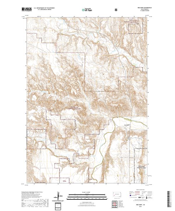 2021 Red Shirt2021 Print · USGSThe Oglala Lakota County border and the Cheyenne River define this South Dakota landscape in 2021. Genealogists and local historians can trace the community around Red Shirt, the Seventh-day Adventist Church Cem, and the high plateau of Red Shirt Table.
 - 2021 Map of Hutmacher Table, 2021 Print
 2021 Hutmacher Table2021 Print · USGSPennington County, South Dakota, is captured here in the early twenty-first century, showcasing a landscape of high tables and deep draws. Researchers can trace the natural topography of Hutmacher Table or follow the paths of Big Corral Draw and Quinn Draw.
 - 2021 Map of Cuny Table West, 2021 Print
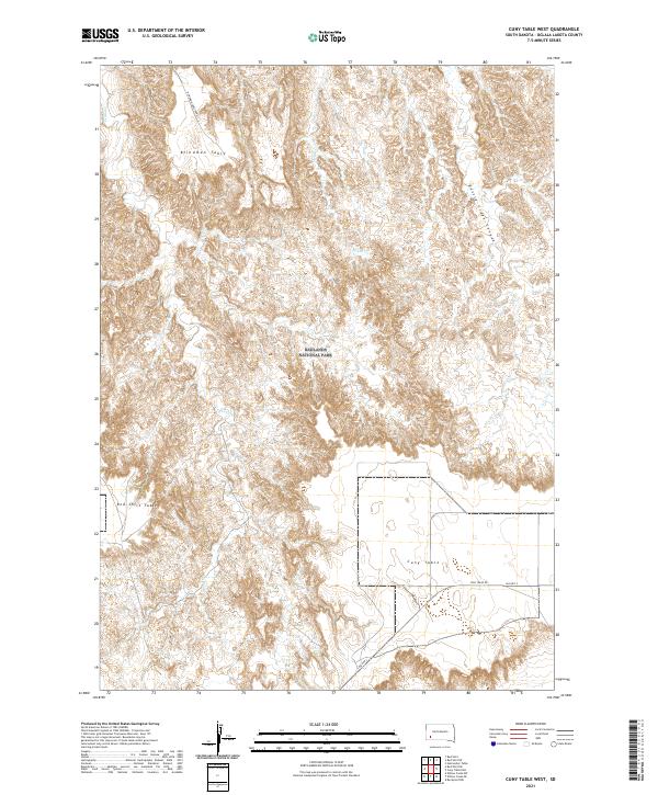 2021 Cuny Table West2021 Print · USGSThe high mesas and eroded canyons of Oglala Lakota County are captured here in the modern era. Researchers can trace remote access routes like Blindman Table Road across Blindman Table and down into the depths of Battle Creek Canyon.
 - 2021 Map of Sheep Mountain Table, 2021 Print
 2021 Sheep Mountain Table2021 Print · USGSPennington County reveals its dramatic geology and open range at the edge of the Badlands in the early twenty-first century. Researchers can trace historic routes like Big Foot Trl across the heights of Sheep Mtn Table and Hart Table.
End of results
Showing maps 1-16 of 16
Top neighborhoods of Wounded Knee District
Frequently asked questions
- What are the different types of historical maps available for Wounded Knee District?
- What is the oldest map of Wounded Knee District?
- Where can I purchase historical maps of Wounded Knee District for my home or office?
- Where can I download high-res historical maps of Wounded Knee District?
- Are there historical topographic maps available for Wounded Knee District?
- Is there historical aerial imagery available for Wounded Knee District?
- Where are historical maps of Wounded Knee District sourced from?