1950s Maps of Todd County, South Dakota
Explore 10 historic maps of Todd County from the 1950s. These maps offer a rare glimpse into what life looked like during the 1950s — showing old roads, neighborhoods, homes, and landmarks that have changed or disappeared over time.
Whether you're researching your family's past, planning a metal detecting trip, or studying how Todd County's landscape evolved across the 1950s, these high-resolution maps are a powerful tool for exploring the history of this region.
- Focus on a specific era: All maps on this page are from the 1950s, giving you a focused view of this time period.
- See what’s changed: Compare century-old streets, trails, and buildings to today's modern landscape using overlays and satellite layers.
- Research with precision: Use these maps for genealogy, historical research, land use analysis, or educational projects.
- View, download, or print: Maps are fully viewable online in high resolution, and can be downloaded or printed for your own records.
Start exploring Todd County's history through authentic maps from the 1950s. This is your window into the past.
Todd County, SD maps
(10)- 1950 Map of Norden
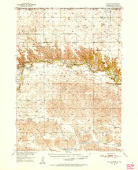
 1950 Norden1950 Print · USGSThe Niobrara River valley in the early fifties shows a rugged landscape of family-run cattle operations and scattered rural school districts. Genealogists can locate family holdings like Worth Ranch or McMara Ranch and burial sites at Sparks Cem.2 unique versions available
 - 1950 Map of Sparks, 1952 Print
 1950 Sparks1952 Print · USGSThe Niobrara River canyon cuts through Cherry County during the mid-twentieth century, revealing a landscape of remote ranches and conservation lands. Researchers can trace the Chicago and North Western rail line and locate rural landmarks like Smith Falls, Bryant Ranch, and several numbered schoolhouses.3 unique versions available
 - 1950 Map of Kilgore, 1952 Print
 1950 Kilgore1952 Print · USGSSettled along the tracks of the Chicago and North Western, this northern Nebraska landscape is shown at the mid-century point. Genealogists can trace rural family life through scattered schools like School No 10 and prominent sites like Dittmer Ranch.2 unique versions available
 - 1950 Map of Valentine, 1952 Print
 1950 Valentine1952 Print · USGSThe ranching and rail country of Cherry County comes alive in this 1950s record of Valentine and its surrounding prairie. Researchers can locate early one-room schoolhouses like Ward School, family landmarks like Heth Ranch, and the path of the Chicago and North Western railroad.2 unique versions available
 - 1950 Map of Cody, 1952 Print
 1950 Cody1952 Print · USGSCherry County ranching and rail life are at the forefront here in the early fifties as the railroad connects isolated outposts. Researchers can trace historic family lands like the Goodwin Ranch or locate vanished rural schoolhouses such as Crackerbox Sch and School No 60.2 unique versions available
 - 1952 Map of Norden
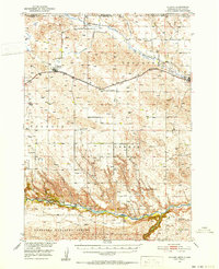
 1952 Norden1952 Print · USGSKeya Paha and Brown counties meet along the winding Niobrara River in the early fifties, capturing a period of transition for Nebraska's ranching country. Genealogists can trace family footprints at Norden, Sparks Cem, and numerous schoolhouses from Rockford Sch to School No 74.
 - 1955 Map of Martin, 1968 Print
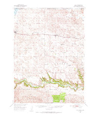
 1955 Martin1968 Print · USGSTribal lands and rail corridors define the South Dakota plains in the mid-fifties, from the sand hills to the badlands. Genealogists and historians can trace the early layout of Pine Ridge Indian Reservation settlements and find small rail towns like Stamford and Witten.2 unique versions available
 - 1957 Map of Valentine, 1960 Print
 1957 Valentine1960 Print · USGSNorthern Nebraska's ranching country and the vast Sand Hills are detailed here in the late fifties. Genealogists and historians can locate numerous family-named landmarks like the Dahlgren Ranch and trace the path of the Chicago and North Western railroad through Valentine.3 unique versions available
 - 1958 Map of Martin
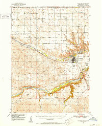
 1958 Martin1958 Print · USGSSouth Dakota's southern plains are documented here in the late fifties, showing the expansive Pine Ridge and Rosebud Indian Reservations. Genealogists and historians can locate early settlements along the Chicago Milwaukee St Paul and Pacific line or find family roots near Martin and the Indian Cemetery.
 - 1959 Map of Valentine
 1959 Valentine1959 Print · USGSThe northern Nebraska Sand Hills are captured here in the late fifties, showcasing a vast ranching landscape shaped by the Niobrara and Loup rivers. Genealogists and historians can trace rail-town development along the Chicago and North Western and locate remote outposts like Brownlee or Kennedy.
End of results
Showing maps 1-10 of 10
Top cities of Todd County
Frequently asked questions
- What are the different types of historical maps available for Todd County?
- What is the oldest map of Todd County?
- Where can I purchase historical maps of Todd County for my home or office?
- Where can I download high-res historical maps of Todd County?
- Are there historical topographic maps available for Todd County?
- Is there historical aerial imagery available for Todd County?
- Where are historical maps of Todd County sourced from?