1980s Maps of Walworth County, South Dakota
Explore 4 historic maps of Walworth County from the 1980s. These maps offer a rare glimpse into what life looked like during the 1980s — showing old roads, neighborhoods, homes, and landmarks that have changed or disappeared over time.
Whether you're researching your family's past, planning a metal detecting trip, or studying how Walworth County's landscape evolved across the 1980s, these high-resolution maps are a powerful tool for exploring the history of this region.
- Focus on a specific era: All maps on this page are from the 1980s, giving you a focused view of this time period.
- See what’s changed: Compare century-old streets, trails, and buildings to today's modern landscape using overlays and satellite layers.
- Research with precision: Use these maps for genealogy, historical research, land use analysis, or educational projects.
- View, download, or print: Maps are fully viewable online in high resolution, and can be downloaded or printed for your own records.
Start exploring Walworth County's history through authentic maps from the 1980s. This is your window into the past.
Walworth County, SD maps
(4)- 1985 Map of Gettysburg
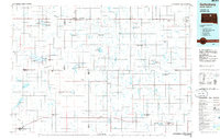 1985 Gettysburg1985 Print · USGSIn the mid-1980s, the plains of north-central South Dakota were shaped by the Burlington Northern railroad and dozens of protected wetlands. Researchers can trace the layout of rail towns like Bowdle, Hoven, and Faulkton alongside family landmarks like Southside Cem.3 unique versions available
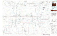
 - 1985 Map of Mobridge
 1985 Mobridge1985 Print · USGSCrossing the Missouri River in the mid-1980s, this landscape reveals the intersection of the Standing Rock Indian Reservation and the rising waters of Lake Oahe. Researchers can locate significant historical markers such as Sitting Bulls Grave, St Elizabeth Mission Home, and the Leavenworth Monument.2 unique versions available
 - 1985 Map of Eureka, 1986 Print
 1985 Eureka1986 Print · USGSThe northern plains of the mid-eighties come alive in this survey of the border country between South Dakota and North Dakota. Researchers can trace the rail-side growth of Eureka and Hosmer or locate local landmarks like the Plainview Colony and Lake Hiddenwood State Park.3 unique versions available
 - 1985 Map of La Plant, 1986 Print
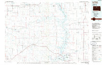 1985 La Plant1986 Print · USGSThe Cheyenne River and Standing Rock Indian Reservations meet here in the mid-eighties as Lake Oahe reshapes the Missouri River valley. Genealogists and local historians can trace the Old RR Gr and locate community landmarks like La Plant, Whitehorse, and Rabenberg Cemetery.2 unique versions available
End of results
Showing maps 1-4 of 4
Top cities of Walworth County
- Mobridge historical maps
- Selby historical maps
- Java historical maps
- Glenham historical maps
- Akaska historical maps
- Lowry historical maps
Frequently asked questions
- What are the different types of historical maps available for Walworth County?
- What is the oldest map of Walworth County?
- Where can I purchase historical maps of Walworth County for my home or office?
- Where can I download high-res historical maps of Walworth County?
- Are there historical topographic maps available for Walworth County?
- Is there historical aerial imagery available for Walworth County?
- Where are historical maps of Walworth County sourced from?