Old Maps of Walworth County, South Dakota for Metal Detecting
Plan your next treasure hunt with 133 historic maps of Walworth County. Find old homesites, ghost towns, trails, and gathering spots that may be lost to time — perfect for identifying promising metal detecting locations.
- Locate forgotten sites: Uncover places like long-lost settlements, abandoned rail lines, or gathering spots.
- Plan better hunts: Use map overlays combined with LiDAR or satellite views to narrow in on historically rich areas.
- Made for detectorists: Thousands of hobbyists use these maps to discover relics, coins, and hidden history.
Use these historic maps to boost your research and find new opportunities beneath the surface of Walworth County.
Walworth County, SD maps
(133)- 1953 Map of McIntosh, 1965 Print
 1953 McIntosh1965 Print · USGSThe north-central Dakota prairie is captured here during the mid-fifties, showing the vast Standing Rock Indian Reservation and the newly formed Oah E Reservoir. Genealogists and historians can trace the Chicago Milwaukee St Paul and Pacific rail line through stops like McIntosh, Walker, and Eagle Butte.3 unique versions available
 - 1954 Map of Aberdeen, 1964 Print
 1954 Aberdeen1964 Print · USGSNortheastern South Dakota in the mid-fifties remains a world of rail-dependent prairie towns and sweeping waterfowl refuges. Genealogists can trace family roots through settlements like Eureka and Ipswich or locate rural landmarks near Richmond Lake.2 unique versions available
 - 1956 Map of Aberdeen
 1956 Aberdeen1956 Print · USGSUpper South Dakota during the mid-fifties remains a landscape of rail-connected farming towns and expansive glacial lake basins. Genealogists and historians can trace the paths of the Minneapolis and St Louis railroad through Gettysburg or locate vanished stops near Elm Lake and Richmond Lake.
 - 1958 Map of McIntosh
 1958 McIntosh1958 Print · USGSThe north-central Dakotas appear here in the mid-1950s as massive engineering projects and rail lines shaped the plains. Researchers can trace tribal lands within the Standing Rock Indian Reservation and locate local landmarks like the Keller Mine or the Virginia Siding.
 - 1967 Map of Glenham, 1968 Print
 1967 Glenham1968 Print · USGSWalworth County in the late sixties reveals a landscape transformed by the Missouri River's damming and the steady pulse of the rail line. Genealogists and researchers can trace the rural Habenberg Sch, the rail siding at Ridgeland, and the shoreline of the Oahe Reservoir.
 - 1967 Map of Selby SW, 1969 Print
 1967 Selby SW1969 Print · USGSWalworth County and Campbell County are captured here in the late sixties as a landscape of rail-served prairie settlements and isolated schoolhouses. Researchers can trace the path of the Chicago Milwaukee St Paul and Pacific through Sitka or locate the Lund Sch and Lindbergh Sch.
 - 1967 Map of Selby, 1969 Print
 1967 Selby1969 Print · USGSWalworth and Campbell Counties show their agricultural and rail roots in the late sixties. Genealogists and local historians can trace the foundations of the community through sites like Bethany Cemetery, Monroe School, and the Selby rail corridor.
 - 1967 Map of Mobridge, 1969 Print
 1967 Mobridge1969 Print · USGSMobridge and the Missouri River corridor are captured here during the late sixties as the reservoir transformed the regional landscape. Researchers can locate Sitting Bulls Grave, trace the Chicago Milwaukee St Paul and Pacific rail line, and find local landmarks like Greenwood Cem or Beadle Sch.2 unique versions available
 - 1968 Map of Moreau NE, 1970 Print
 1968 Moreau NE1970 Print · USGSThe Missouri River breaks of Walworth and Dewey counties appear in the late sixties as the waters of Lake Oahe reshape the valley. Genealogists and researchers can trace the boundaries of the Standing Rock and Cheyenne River reservations or locate the settlement at Ridgeland.
 - 1968 Map of Akaska NW, 1971 Print
 1968 Akaska NW1971 Print · USGSWalworth County prairies are shown at the end of the 1960s, documenting a remote landscape of section-line roads and rural boundaries. Researchers can locate the Pershing Sch and a local Gravel Pit among the hills and draws.
 - 1968 Map of Akaska SW, 1971 Print
 1968 Akaska SW1971 Print · USGSWalworth County, South Dakota, was transitioning in the late 1960s as the Missouri River valley adjusted to the presence of Lake Oahe. Researchers can trace the path of the Old Railroad Grade and locate family history at Old Zion Cem near Swan Creek.
 - 1968 Map of Akaska, 1971 Print
 1968 Akaska1971 Print · USGSAkaska and the rolling plains of Walworth County are documented here in the late sixties, showing a landscape defined by prairie agriculture. You can trace the path of the Old Railroad Grade and locate family landmarks like the Akaska Cem and Rieger Creek.
 - 1968 Map of Moreau SE, 1971 Print
 1968 Moreau SE1971 Print · USGSThe Missouri River breaks and the Cheyenne River Indian Reservation are captured here in the late sixties, just as the landscape was being reshaped by the Oahe reservoir. Researchers can trace the flooded valleys of the Moreau River and locate the Swan Creek Recreation Area and Flowing Well.
 - 1968 Map of Akaska NE, 1971 Print
 1968 Akaska NE1971 Print · USGSWalworth County settlement and rural infrastructure are captured here in the late sixties as the area around Selby continued to develop. Researchers can locate family sites and local landmarks like Selby Union Cem, Bangor Cem, and the Rabenberg Airport.
 - 1969 Map of Four Bear Creek, 1972 Print
 1969 Four Bear Creek1972 Print · USGSThe Missouri River breaks into a series of wide bays along the Dewey and Potter county lines during the late sixties. Researchers can trace the flooded reaches of Four Bear Creek and Buck Creek or locate the Indian Reservation Boundary as it stood at this mid-century moment.
 - 1970 Map of Steamboat Creek, 1972 Print
 1970 Steamboat Creek1972 Print · USGSPotter and Walworth Counties at the dawn of the seventies show a landscape reshaped by the rising Missouri River. Genealogists can locate family landmarks like the Appomattox Sch and trace early reservoir shorelines at Dodge Bay and Latin Bay.
 - 1970 Map of Lake Hurley NE, 1972 Print
 1970 Lake Hurley NE1972 Print · USGSPotter and Walworth Counties come into focus during the early seventies, showing a prairie landscape of townships and creeks. Genealogists can locate family landmarks like Hanson Cem or trace the rural life around Fayette Sch and Little Cheyenne Creek.
 - 1974 Map of Lowry, 1978 Print
 1974 Lowry1978 Print · USGSWalworth County, South Dakota, is captured here in the 1970s as a quiet prairie landscape shaped by early transportation and local agriculture. Researchers can trace the Old Railroad Grade past the settlement of Lowry and locate family history at the Lowry Cem.
 - 1974 Map of Hoven, 1978 Print
 1974 Hoven1978 Print · USGSThe town of Hoven and its surrounding townships are captured in the 1970s as a quiet plains community on the Walworth and Potter county line. Genealogists and researchers can trace the Old RR Grade, locate the town Cem, and find local landmarks like Simons Dam.
 - 1974 Map of Hoven Muni. Airport, 1978 Print
 1974 Hoven Muni. Airport1978 Print · USGSWalworth County during the mid-1970s reveals a prairie landscape defined by managed wetlands and rural industry. Researchers can trace the Old Railroad Grade south of Swan Lake or locate family history at the Theodore Cem.
 - 1974 Map of Spring Lake, 1978 Print
 1974 Spring Lake1978 Print · USGSWalworth County in the mid-1970s is a landscape of expansive wetlands and critical rail lines. Genealogists and researchers can trace the rail corridor through Alamo or locate local landmarks like the Cem and the Spring Lake State Public Shooting Area.
 - 1974 Map of Lowry NW, 1978 Print
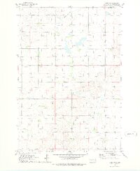 1974 Lowry NW1978 Print · USGSThe northern plains of Walworth County come into focus in the mid-1970s, showcasing a rural landscape defined by grain and rail. Genealogists and historians can locate the Java Sch, the village Java, and the path of the Old Railroad Grade.
 - 1974 Map of Flight Lake, 1978 Print
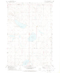 1974 Flight Lake1978 Print · USGSPotter and Walworth counties are shown in the mid-1970s as a landscape of prairie schools and glacial waters. Researchers can trace the Old Railroad Grade and locate local landmarks like Prairie Grove Cem and Arena Sch.
 - 1974 Map of Bowdle, 1978 Print
 1974 Bowdle1978 Print · USGSThe prairie town of Bowdle is captured in the mid-1970s, showing a landscape defined by the railroad and local township life. Genealogists can locate several historic burial sites, including Neu Glueckstal Cem and Redeemer Cem, alongside the Chicago Milwaukee St Paul and Pacific rail line.
 - 1978 Map of Seneca NW
 1978 Seneca NW1978 Print · USGSPotter and Edmunds counties are shown in the mid-1970s, reflecting a landscape of quiet prairie townships and waterfowl conservation. Genealogists and historians can trace an Old Railroad Grade or locate burials at the rural Spring Cem near Alkali Lake.
Showing maps 1-25 of 133
Top cities of Walworth County
- Mobridge historical maps
- Selby historical maps
- Java historical maps
- Glenham historical maps
- Akaska historical maps
- Lowry historical maps
Frequently asked questions
- What are the different types of historical maps available for Walworth County?
- What is the oldest map of Walworth County?
- Where can I purchase historical maps of Walworth County for my home or office?
- Where can I download high-res historical maps of Walworth County?
- Are there historical topographic maps available for Walworth County?
- Is there historical aerial imagery available for Walworth County?
- Where are historical maps of Walworth County sourced from?