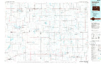
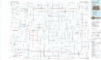
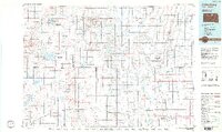
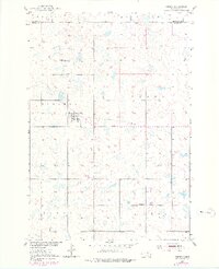
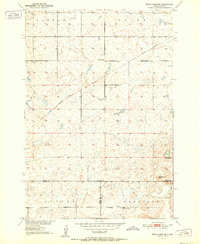
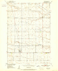
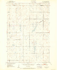
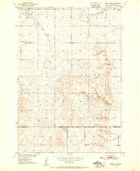
1985 Map of Gettysburg
USGS Topo · Published 1985About this map
The agricultural heartland of the Missouri Plateau in north-central South Dakota is defined here by the Burlington Northern railroad lines that link a chain of small grain-elevator towns. At the intersection of these rail corridors and county roads lie established communities such as Ipswich, Bowdle, and Gettysburg, the latter serving as a vital hub for the surrounding plains. The landscape is characterized by a dense network of conservation areas, including numerous National Waterfowl Production Areas and State Game Production Areas that punctuate the prairie near Swan Lake and Dry Lake. Small prairie settlements like Tolstoy, Onaka, and Lebanon illustrate the typical township settlement pattern of the mid-1980s. Local history is anchored by landmarks such as Southside Cem near Ipswich and several municipal airports, reflecting the region's reliance on both rail and air for connectivity across the vast open spaces of Potter, Edmunds, and Faulk counties.
Find a feature on this map
41 named features on this map. Tap any name to fly to it.
Don’t see what you’re looking for? This feature index may not catch every label — zoom into the map to look around manually.
Map Details
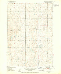
Editions of this 1985 Gettysburg Map
3 editions found
Other maps of this area

1899 · Ellendale
USGS Topo · 1:125,000

1899 · Northville
USGS Topo · 1:125,000

1899 · Redfield
USGS Topo · 1:125,000
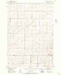
1950 · Rezac Lake NE
USGS Topo · 1:24,000
1950 · Onaka
USGS Topo · 1:24,000
1951 · Rezac Lake NE
USGS Topo · 1:24,000
1951 · Orient
USGS Topo · 1:24,000
1951 · Clark Lake
USGS Topo · 1:24,000
1951 · Orient NW
USGS Topo · 1:24,000
1951 · Rezac Lake NW
USGS Topo · 1:24,000