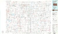
1985 Map of Gettysburg
USGS Topo · Published 1990About this map
Glacial prairie landscapes and a network of small agricultural hubs define this mid-1980s look at north-central South Dakota. The Burlington Northern railroad serves as the primary industrial spine, connecting elevators and grain depots in towns like Ipswich, Roscoe, and Bowdle. In the western reaches, Gettysburg stands as a prominent local center, while smaller communities such as Lebanon, Seneca, and Tolstoy anchor the surrounding townships. The region is notable for its extensive conservation lands, with numerous State Game Production Areas and National Waterfowl Production Areas punctuating the grid-patterned fields. Natural features like Swan Lake and Green Lake break the expansive horizons, providing critical habitats within the prairie pothole region. This survey captures a moment of established rural infrastructure, from the Hoven Municipal Airport to the section-line roads that organize the land between Faulkton and the Missouri River breaks beyond the western map edge.
Find a feature on this map
69 named features on this map. Tap any name to fly to it.
Don’t see what you’re looking for? This feature index may not catch every label — zoom into the map to look around manually.
Map Details
Editions of this 1985 Gettysburg Map
3 editions found
Other maps of this area

1899 · Ellendale
USGS Topo · 1:125,000

1899 · Northville
USGS Topo · 1:125,000

1899 · Redfield
USGS Topo · 1:125,000

1950 · Rezac Lake NE
USGS Topo · 1:24,000

1950 · Onaka
USGS Topo · 1:24,000

1951 · Rezac Lake NE
USGS Topo · 1:24,000

1951 · Orient
USGS Topo · 1:24,000

1951 · Clark Lake
USGS Topo · 1:24,000

1951 · Orient NW
USGS Topo · 1:24,000

1951 · Rezac Lake NW
USGS Topo · 1:24,000