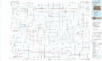
1985 Map of Gettysburg
USGS Topo · Published 1985About this map
Gettysburg and the surrounding high plains of north-central South Dakota are defined by a network of small agricultural hubs and protected wetlands in the mid-1980s. The landscape is crisscrossed by the Burlington Northern railroad, which historically linked grain elevators in towns like Bowdle, Roscoe, and Ipswich. This survey reveals a high concentration of conservation areas, including numerous National Waterfowl Production Areas and State Game Production Areas that punctuate the prairie between Lebanon and Onaka.
Find a feature on this map
39 named features on this map. Tap any name to fly to it.
Don’t see what you’re looking for? This feature index may not catch every label — zoom into the map to look around manually.
Map Details
Editions of this 1985 Gettysburg Map
3 editions found
Other maps of this area

1899 · Ellendale
USGS Topo · 1:125,000

1899 · Northville
USGS Topo · 1:125,000

1899 · Redfield
USGS Topo · 1:125,000

1950 · Rezac Lake NE
USGS Topo · 1:24,000

1950 · Onaka
USGS Topo · 1:24,000

1951 · Rezac Lake NE
USGS Topo · 1:24,000

1951 · Orient
USGS Topo · 1:24,000

1951 · Clark Lake
USGS Topo · 1:24,000

1951 · Orient NW
USGS Topo · 1:24,000

1951 · Rezac Lake NW
USGS Topo · 1:24,000