Old Maps of Bedford County, Tennessee for Hiking & Exploration
Hike through history with 147 historic maps of Bedford County. Explore old trails, ghost towns, and forgotten backroads — perfect for outdoor adventurers and local explorers.
- Rediscover forgotten places: Map out old mining camps, roads, and footpaths that no longer exist on modern maps.
- Layer with modern tools: Combine with LiDAR or satellite views to plan hikes through historical terrain.
- Made for exploration: Popular among hikers, overlanders, and local history lovers.
Use these maps to find adventure and explore the hidden past of Bedford County.
Bedford County, TN maps
(147)- 1913 Map of Hollow Springs
 1913 Hollow Springs1913 Print · USGSThe Tennessee highland plateau meets the Central Basin in the years before the Great War, showing a landscape of family-run stores and district schools. Genealogists can trace ancestral homes near Hollow Springs, Patmos Chapel, and the McMahan School district.4 unique versions available
 - 1936 Map of Ovoca
 1936 Ovoca1936 Print · USGSCoffee County's rural landscape is captured here in the mid-1930s as the Tennessee Valley Authority mapped the region's complex river systems. Genealogists can locate family landmarks such as the Ovoca Orphans Home, the Holland Hill Cem, and numerous Duck River crossings like Richardson Ford.
 - 1936 Map of Webbs Jungle
 1936 Webbs Jungle1936 Print · USGSRutherford and Bedford Counties are captured in the mid-1930s, showing a rural landscape defined by the Tennessee Basin Divide. Genealogists and local historians can trace family locations near Webbs Jungle, the Beechwood Ch, and along Wartrace Creek.
 - 1936 Map of Booneville
 1936 Booneville1936 Print · USGSThe rural borderlands of Moore, Lincoln, and Bedford counties are captured here in the mid-1930s during a period of steady local development. Researchers can pinpoint early community hubs like Screamersville, Charity Sch, and the river crossing at Booneville.
 - 1936 Map of Chapel Hill
 1936 Chapel Hill1936 Print · USGSMiddle Tennessee’s rural landscape is captured here in the mid-1930s as the regional electrical grid was expanding. Researchers can locate vanished landmarks like the Holtland PO, trace family roots at LESTER CEM, or find the old Edwards Grove Ch.
 - 1936 Map of Farmington
 1936 Farmington1936 Print · USGSMarshall County rural life in the mid-1930s is defined by the winding Duck River and a network of family-run farms. Researchers can trace ancestral locations near Wilhoite Mills, Rock Creek Ch, and family burial sites like Thomas Cem.
 - 1936 Map of Shelbyville
 1936 Shelbyville1936 Print · USGSBedford County during the mid-1930s shows a landscape of river-based industry and tightly knit rural settlements along the Duck River. Genealogists and local historians can trace early community life at Shelbyville Mills, Mullins Chapel, and Holly Grove Sch.
 - 1936 Map of Rover
 1936 Rover1936 Print · USGSMiddle Tennessee farmland at the Rutherford and Bedford county line is meticulously captured in the mid-thirties. Family historians can trace dozens of burial sites and community centers like Rover, Kingdom Ch, and the Vernon Corner Sch.
 - 1936 Map of Belfast
 1936 Belfast1936 Print · USGSMarshall County rural life and the local rail economy are captured here just before the late 1930s. Genealogists and historians can trace family locations through Bethel Cem, Cedar Grove Sch, and churches like Head Springs Ch.
 - 1936 Map of Deason
 1936 Deason1936 Print · USGSNorthern Bedford County at the peak of the New Deal era reveals a landscape of rural academies and family-named landmarks. Trace ancestral connections at Possumtrot Ch, Harts Chapel, and the historic grounds of Coops Academy.
 - 1936 Map of Cumberland Springs
 1936 Cumberland Springs1936 Print · USGSMoore County and Lynchburg are captured in the mid-1930s as a land of narrow hollows and high ridges. Researchers can trace the early layout of Lynchburg and find community centers like Raysville Sch, Smith Chapel, and Cumberland Springs.
 - 1936 Map of Belleville
 1936 Belleville1936 Print · USGSLincoln County and the surrounding borderlands are captured here in the mid-1930s, showing a rural landscape organized around deep hollows and creek branches. Researchers can locate numerous local landmarks including Oak Hill Ch, Patton Cem, and the settlement of Belleville.
 - 1936 Map of Beech Grove
 1936 Beech Grove1936 Print · USGSCoffee County rural life in the mid-1930s is detailed here along the winding Garrison Fork and Duck River. Researchers can trace family ties at the Barnes Store, Union Ch, and numerous burial grounds like the Arnold Cem.
 - 1936 Map of Noah
 1936 Noah1936 Print · USGSCoffee County and the Bedford border are captured here in the mid-1930s as rural life centered on the forks and ridges. Genealogists can locate family burial grounds like Alley Cem and Riley Creek Cem or local school sites such as Model Sch and Beech Grove Sch.
 - 1936 Map of Wartrace
 1936 Wartrace1936 Print · USGSMid-1930s Bedford County comes to life as a network of rail and river, centered on the bustling depots at Bell Buckle and Wartrace. Genealogists and historians can trace family ties at Webb Sch, Hollywood Cem, and rural outposts like Bugscuffle.
 - 1936 Map of Unionville
 1936 Unionville1936 Print · USGSBedford County's agricultural heartland is documented here in the mid-1930s, where river mills and country schoolhouses define the social geography. Researchers can locate family landmarks like Blackburns Mill, the curiosly named Three Cornered Garden, and the riverside Britton Ford.
 - 1936 Map of Bedford
 1936 Bedford1936 Print · USGSBedford and the surrounding Tennessee countryside are captured in the mid-1930s just as the Tennessee Valley Authority began its regional surveys. Researchers can locate many vanished family landmarks and community hubs, including Pisgah Cem, New Bethel Ch, and Powell Creek Sch.
 - 1936 Map of Normandy
 1936 Normandy1936 Print · USGSBedford and Moore counties come to life in the 1930s as the rail-and-river economy centers on the town of Normandy. Genealogists and historians can trace family locations at Bugscuffle, locate Jenkins Sch, or find industrial landmarks like Cortners Mill.
 - 1936 Map of Fosterville
 1936 Fosterville1936 Print · USGSThe Rutherford and Bedford county line comes into focus in the mid-1930s as the Tennessee Valley Authority mapped the region's watersheds. Researchers can locate family landmarks such as Woodfin Cem or trace the early paths of U S Highway No 241 and the N C & St L railroad.
 - 1941 Map of Ovoca, 1943 Print
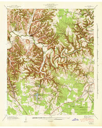 1941 Ovoca1943 Print · USGSCoffee County in the early 1940s reflects a rural landscape undergoing rapid change as the military expanded its footprint. Genealogists can locate family-named crossings like Richardson Ford and local landmarks such as the Ovoca Orphans Home or Hickerson Station.2 unique versions available
 - 1941 Map of Cumberland Springs, 1943 Print
 1941 Cumberland Springs1943 Print · USGSMoore County and the Highland Rim are captured in the early 1940s, just as the nearby military expansion began to transform the local landscape. Genealogists can trace family footprints through community sites like Lynchburg, Bakertown, and Hickory Hill Sch.5 unique versions available
 - 1943 Map of Mc Minnville, 1944 Print
 1943 Mc Minnville1944 Print · USGSMid-Tennessee is captured here during the mobilization of the early 1940s, showing the vast Camp Forrest Military Reservation and thriving rail towns. Trace the N C & ST L line through Mcminnville or locate smaller rural hubs like Morrison and Hickerson Station.
 - 1944 Map of Shelbyville
 1944 Shelbyville1944 Print · USGSMid-century Middle Tennessee is captured here during the wartime mobilization of the 1940s. Genealogists and researchers can trace family lands near Bugscuffle, Shelbyville Mills, and the expansive Camp Forrest Military Res.
 - 1947 Map of Farmington, 1948 Print
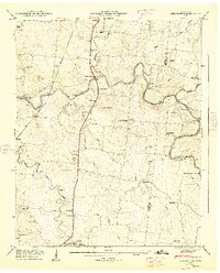 1947 Farmington1948 Print · USGSThe Duck River and the Louisville and Nashville RR shape this Marshall County landscape in the late 1940s. Genealogists can locate family names at Wilhoite Cem or trace the river at White Ford and Wilhoite Mills.4 unique versions available
 - 1947 Map of Bedford, 1948 Print
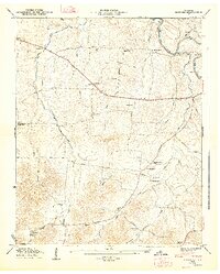 1947 Bedford1948 Print · USGSThe rural landscape of Middle Tennessee is captured here in the late 1940s, highlighting a network of small farming settlements and river crossings. Researchers can trace family history through sites like Temple Ford, Richmond Ch, and the numerous community burial grounds like Gaunt Cem.6 unique versions available
Showing maps 1-25 of 147
Top cities of Bedford County
- Shelbyville historical maps
- Wartrace historical maps
- Bell Buckle historical maps
- Normandy historical maps
Frequently asked questions
- What are the different types of historical maps available for Bedford County?
- What is the oldest map of Bedford County?
- Where can I purchase historical maps of Bedford County for my home or office?
- Where can I download high-res historical maps of Bedford County?
- Are there historical topographic maps available for Bedford County?
- Is there historical aerial imagery available for Bedford County?
- Where are historical maps of Bedford County sourced from?