1940s Maps of Bradley County, Tennessee
Explore 19 historic maps of Bradley County from the 1940s. These maps offer a rare glimpse into what life looked like during the 1940s — showing old roads, neighborhoods, homes, and landmarks that have changed or disappeared over time.
Whether you're researching your family's past, planning a metal detecting trip, or studying how Bradley County's landscape evolved across the 1940s, these high-resolution maps are a powerful tool for exploring the history of this region.
- Focus on a specific era: All maps on this page are from the 1940s, giving you a focused view of this time period.
- See what’s changed: Compare century-old streets, trails, and buildings to today's modern landscape using overlays and satellite layers.
- Research with precision: Use these maps for genealogy, historical research, land use analysis, or educational projects.
- View, download, or print: Maps are fully viewable online in high resolution, and can be downloaded or printed for your own records.
Start exploring Bradley County's history through authentic maps from the 1940s. This is your window into the past.
Bradley County, TN maps
(19)- 1940 Map of Benton
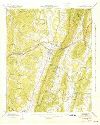
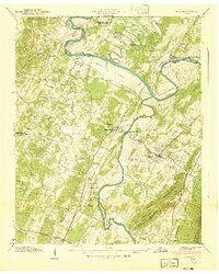 1940 Benton1940 Print · USGSPolk County life in the early 1940s centers on the fertile river bottoms and the rail lines connecting these valley communities. Researchers can trace family roots through numerous local landmarks, from Chestuee Mills to rural sites like New Harmony Ch and Baker Chapel Cem.3 unique versions available
 - 1940 Map of Ooltewah, 1954 Print
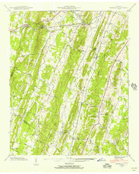
 1940 Ooltewah1954 Print · USGSSoutheast Tennessee is captured here just before the mid-century as a landscape of ridge-and-valley farming and emerging education. Genealogists can trace family names at Sylar Cem and Pollard Cem or locate the early campus of Southern Junior College.
 - 1940 Map of Mc Donald, 1956 Print
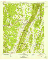
 1940 Mc Donald1956 Print · USGSThe rural ridges of Bradley and Hamilton County are captured here just before the war, when rail sidings and country schools anchored local life. Genealogists can locate family landmarks like Tucker Cem and Triplett Cem or trace the old Lee Highway corridor.
 - 1941 Map of Mc Donald
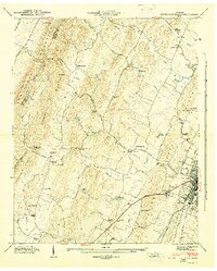
 1941 Mc Donald1941 Print · USGSIn the early 1940s, this Bradley County landscape was a network of ridgeline farms and rail-dependent hamlets. Researchers can trace the Southern Railway through McDonald or locate old community centers like Lebanon School and Bethel Ch.
 - 1941 Map of Ooltewah
 1941 Ooltewah1941 Print · USGSThe valleys and ridges of Hamilton and Bradley counties are shown here just before the mid-century industrial boom. Genealogists can locate family names and sites like Bell Mill, Mineral Park Chapel, and the campus of Southern Junior College.
 - 1942 Map of Snow Hill, 1954 Print
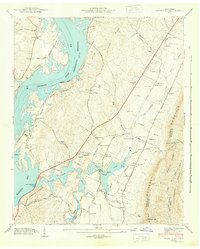
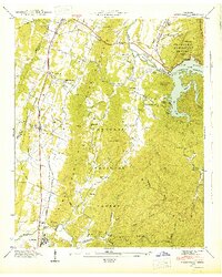
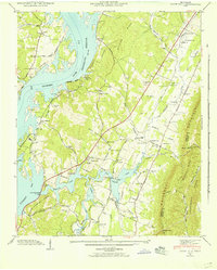 1942 Snow Hill1954 Print · USGSHamilton County communities adapt to a changing riverfront in the early 1940s as the Chickamauga Reservoir fills the valley. Researchers can trace dozens of family landmarks like Scoggins Mill, Anderson Cem, and Savannah Ch.
 - 1942 Map of Birchwood, 1960 Print
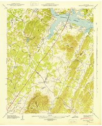
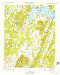 1942 Birchwood1960 Print · USGSSoutheast Tennessee rural life is captured here during the early 1940s as the river landscape was being reshaped. Researchers can trace family roots through landmarks like Mc Clanahan Cem, St Elmo Sch, and the community at Georgetown.
 - 1942 Map of Charleston, 1960 Print
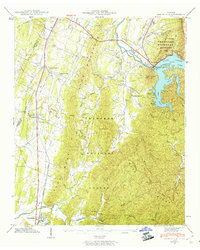
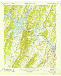
 1942 Charleston1960 Print · USGSThe riverfront communities of Charleston and Calhoun are captured at a pivotal moment in the 1940s as the Hiwassee River meets the backwaters of the new reservoir. Researchers can trace the Southern railroad line and locate family-named sites like Godsey Cem and Blevins Chapel.2 unique versions available
 - 1942 Map of Parksville, 1960 Print
 1942 Parksville1960 Print · USGSPolk County at the start of the 1940s shows the impact of hydropower and rail on the Appalachian landscape. Genealogists and historians can trace family locations through Oldfort and Conasauga, or locate rural landmarks like Horns Creek School and Antioch Church.2 unique versions available
 - 1943 Map of Dalton
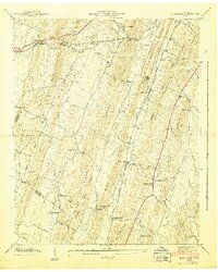
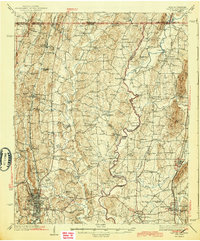 1943 Dalton1943 Print · USGSWhitfield and Murray counties come alive in the 1940s, showing the early industrial growth of the carpet capital and the surrounding farming settlements. Researchers can locate family landmarks like Praters Mill, Gregorys Mill, and the many rural sites such as Shiloh Ch or Oak Grove Sch.2 unique versions available
 - 1943 Map of Snow Hill
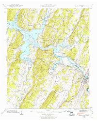
 1943 Snow Hill1943 Print · USGSSnow Hill and the eastern banks of the Tennessee River are shown here in the early 1940s as the new reservoir transformed the landscape. Researchers can trace family history through dozens of landmarks, including Scoggins Mill, Snow Hill, and the Penny Cem.2 unique versions available
 - 1943 Map of Birchwood
 1943 Birchwood1943 Print · USGSSoutheast Tennessee is captured here during the mid-forties as the landscape adjusted to the new shoreline of the Chickamauga Reservoir. Genealogists and local historians can trace family locations near Georgetown, Birchwood, and the Johnson Cem.
 - 1943 Map of Charleston, 1946 Print
 1943 Charleston1946 Print · USGSThe Tennessee riverfront and reservoir shoreline come alive in this mid-1940s survey of the Bradley and McMinn county lines. Genealogists can trace family roots at Maddux Cem, Mt Harmony Sch, and the riverside communities of Charleston and Calhoun.2 unique versions available
 - 1943 Map of East Cleveland, 1946 Print
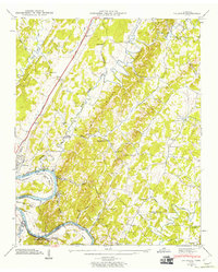
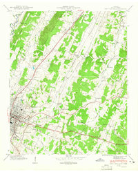 1943 East Cleveland1946 Print · USGSBradley County life in the early 1940s is detailed here as Cleveland expands along the Southern railroad. Researchers can trace family roots at Ramsey Cem or follow old school districts like Chatata Valley School and Valley Head School.2 unique versions available
 - 1943 Map of South Cleveland, 1946 Print
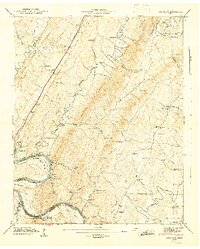
 1943 South Cleveland1946 Print · USGSThe foothills of Bradley County come alive in this mid-1940s survey of the ridge-and-valley landscape around the Cleveland city limits. Genealogists and historians can trace the foundations of local society at the Pentecostal Orphanage, find the Lead Mine, or locate family burial grounds like Seaborn Cem.4 unique versions available
 - 1943 Map of Parksville, 1946 Print
 1943 Parksville1946 Print · USGSPolk County enters the mid-1940s as a landscape of forested ridges and harnessed river power. Local historians can trace the early footprint of Lake Ocoee and locate rural landmarks like Horns Creek Sch and the Hillard-Ladd Cem.
 - 1943 Map of Calhoun, 1960 Print
 1943 Calhoun1960 Print · USGSThe Hiwassee River valley at the onset of the 1940s reveals a rural landscape of ridges and river bends at the borders of McMinn and Bradley counties. Genealogists and historians can trace family locations near Whites Mill, Gentry Store, and the Womack Cem.2 unique versions available
 - 1944 Map of Calhoun, 1946 Print
 1944 Calhoun1946 Print · USGSThe Hiwassee River corridor in the 1940s reveals a landscape of river bends and rural crossroads. Local historians can trace the foundations of the community at Whites Mill, the small rail siding at Sanford, and early schools like Claxton Sch.2 unique versions available
 - 1946 Map of Felker, 1947 Print
 1946 Felker1947 Print · USGSSoutheast Tennessee rural life is captured here in the mid-1940s, showing a landscape of ridge-top schools and creek-side churches. Genealogists can locate family landmarks like Kinser Tabernacle, Liberty Cem, and the small settlement of Pumpkin Center.2 unique versions available
End of results
Showing maps 1-19 of 19
Top cities of Bradley County
Frequently asked questions
- What are the different types of historical maps available for Bradley County?
- What is the oldest map of Bradley County?
- Where can I purchase historical maps of Bradley County for my home or office?
- Where can I download high-res historical maps of Bradley County?
- Are there historical topographic maps available for Bradley County?
- Is there historical aerial imagery available for Bradley County?
- Where are historical maps of Bradley County sourced from?