Old Maps of Bradley County, Tennessee for Hiking & Exploration
Hike through history with 137 historic maps of Bradley County. Explore old trails, ghost towns, and forgotten backroads — perfect for outdoor adventurers and local explorers.
- Rediscover forgotten places: Map out old mining camps, roads, and footpaths that no longer exist on modern maps.
- Layer with modern tools: Combine with LiDAR or satellite views to plan hikes through historical terrain.
- Made for exploration: Popular among hikers, overlanders, and local history lovers.
Use these maps to find adventure and explore the hidden past of Bradley County.
Bradley County, TN maps
(137)- 1886 Map of Dalton
 1886 Dalton1886 Print · USGSNorthwest Georgia in the 1880s is a landscape of mountain gaps and vital river ferries. Trace family roots and vanished infrastructure from Dalton to Spring Place, including named landmarks like Shackelfords Ferry and Fort Mountain.
 - 1886 Map of Cleveland
 1886 Cleveland1886 Print · USGSSoutheast Tennessee in the mid-1880s was a landscape defined by the iron rails and winding rivers that fueled the region's growth. You can trace early river crossings like Savannah Ford and Kincannons Ferry or locate old community centers like Chestua Mills.
 - 1888 Map of Chattanooga
 1888 Chattanooga1888 Print · USGSSoutheast Tennessee in the late nineteenth century was a landscape of river ferries and mountain mining. Trace family roots and vanished landmarks near Chattanooga, from the Aetna Mines to historic river crossings like Harrison Ferry.
 - 1892 Map of Cleveland
 1892 Cleveland1892 Print · USGSSoutheast Tennessee is captured in the late nineteenth century as a landscape of river ferries and emerging rail junctions. Genealogists and historians can locate early settlements like Charleston and Riceville or trace the original river crossings at Kincannons Ferry and Helderbrand Ford.
 - 1892 Map of Dalton
 1892 Dalton1892 Print · USGSNorthwest Georgia in the late nineteenth century was defined by its river crossings and the emerging rail lines through Dalton. Researchers can trace the Federal Road and locate family landmarks like Newtown Ferry or Talking Rock Mills.
 - 1893 Map of Chattanooga
 1893 Chattanooga1893 Print · USGSSoutheast Tennessee is shown here in the 1890s, when river ferries and coal mines defined the landscape around the booming hub of Chattanooga. Genealogists and researchers can trace family lands near Eldridge Landing, the Mc Nabb Mines, or old settlements like Ooltewah.9 unique versions available
 - 1895 Map of Cleveland
 1895 Cleveland1895 Print · USGSSoutheast Tennessee thrived along the Hiwassee River and its rail corridors during the 1890s. Genealogists and historians can trace defunct river crossings like Bunker Hill Ferry and milling sites including Chestuee Mills and Longs Mills.
 - 1897 Map of Dalton
 1897 Dalton1897 Print · USGSNorthwest Georgia in the late nineteenth century was a rugged landscape of river crossings and mountain gaps. Genealogists can trace early homesteads and commerce at Praters Mill, Spring Place, and historic river crossings like Montgomery Ferry.4 unique versions available
 - 1901 Map of Cleveland
 1901 Cleveland1901 Print · USGSSoutheast Tennessee was a thriving hub of river and rail commerce at the dawn of the twentieth century. Genealogists can trace family homesteads near vanished landmarks like Marble Switch, Bunker Hill Ferry, or the early settlements of Riceville and Benton.4 unique versions available
 - 1935 Map of East Cleveland
 1935 East Cleveland1935 Print · USGSBradley County was a landscape of ridges and rail lines in the mid-1930s as the Tennessee Valley Authority began its regional work. Genealogists and local historians can trace family roots through numerous country landmarks like Hauns Mill, Julian Chapel, and the CCC Camp No 3466.
 - 1935 Map of Mc Donald
 1935 Mc Donald1935 Print · USGSDuring the mid-1930s, the rural Bradley County landscape was a network of ridge-top schools and valley rail stops. Researchers can trace family sites like Goats Chapel, the industry of Grumgoof Mill, and old settlements at Black Fox or Marble Switch.
 - 1935 Map of Calhoun
 1935 Calhoun1935 Print · USGSEastern Tennessee in the mid-thirties was a region of small farming settlements and growing power networks. Researchers can trace early family landmarks like Squire Liner Hollow, the community at Sanford, and historic congregations at South Liberty Ch or Britton Ch.
 - 1935 Map of Benton
 1935 Benton1935 Print · USGSThe river valleys of Polk County come alive in the mid-1930s as the Tennessee Valley Authority maps the transition from ferry crossings to modern power grids. Genealogists can trace family footprints at Chestuee Mills, Benton Station, and rural landmarks like Wiregrass Chapel.
 - 1935 Map of Tiger Creek
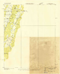 1935 Tiger Creek1935 Print · USGSThe Tennessee and Georgia borderlands meet along the ridges of Whitfield and Catoosa counties in the mid-1930s. Genealogists and historians can trace family land along Tiger Creek and locate the Southern railroad crossing at White Cut.
 - 1935 Map of Felker
 1935 Felker1935 Print · USGSEastern Bradley County was a network of rural creek valleys and community crossroads in the mid-1930s. Family historians can trace local landmarks like Taylors Sch, Kinsers Tabernacle, and the Union Grove Ch cemetery.
 - 1935 Map of Snow Hill
 1935 Snow Hill1935 Print · USGSHamilton County in the mid-1930s was a landscape of ridge-and-valley farms and small riverfront communities. Genealogists and local historians can trace family locations through numerous sites like Norman Cem, Maddox Sch, and Scoggins Mill.
 - 1935 Map of Charleston
 1935 Charleston1935 Print · USGSSoutheast Tennessee is captured here in the mid-1930s as the river-and-rail economy centered on the Hiwassee flourished. Genealogists and researchers can locate family landmarks like Bethel Ch, trace the old route of the Raht Ferry, or find rural schoolhouses such as Mouse Creek Sch.
 - 1935 Map of Parksville
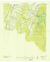 1935 Parksville1935 Print · USGSPolk County in the mid-1930s was a landscape in transition as the Tennessee Valley Authority reshaped the Ocoee River. Genealogists and local historians can trace family locations near Horns Creek Sch, Beech Springs Ch, and the early settlement at Oldfort.
 - 1935 Map of Ooltewah
 1935 Ooltewah1935 Print · USGSHamilton County's ridge-and-valley landscape is documented here in the mid-1930s as rural life centered on the rail lines and mountain gaps. Genealogists and historians can trace family roots at Ooltewah Cem, locate the early campus of Southern Junior College, or find the old Rogers Mill.
 - 1935 Map of Birchwood
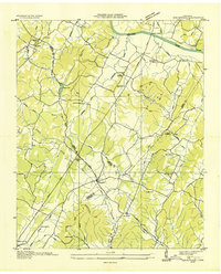 1935 Birchwood1935 Print · USGSSoutheastern Tennessee rural life is documented here during the mid-1930s as the regional power grid began to expand across the ridges. Genealogists can trace early homesteads near Georgetown, Birchwood, and country landmarks like St Elmo Sch or New Union Ch.
 - 1935 Map of South Cleveland
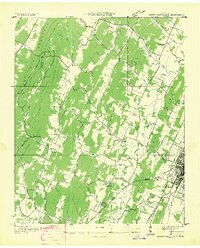 1935 South Cleveland1935 Print · USGSSoutheast Tennessee in the mid-1930s is defined here by its ridge-and-valley landscape and rural crossroads. Genealogists and historians can locate family landmarks like Trues Chapel Cem, the Pentecostal Orphans Home, and Norman Chapel Sch.
 - 1938 Map of Chatsworth
 1938 Chatsworth1938 Print · USGSMurray and Whitfield counties in the late 1930s show a landscape of river-crossing culture and early aviation infrastructure. Researchers can locate family landmarks like Praters Mill, rural schools such as Deep Springs Sch, and historic river points including Harris Ford.3 unique versions available
 - 1940 Map of Benton
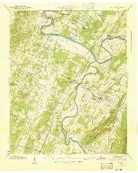 1940 Benton1940 Print · USGSPolk County life in the early 1940s centers on the fertile river bottoms and the rail lines connecting these valley communities. Researchers can trace family roots through numerous local landmarks, from Chestuee Mills to rural sites like New Harmony Ch and Baker Chapel Cem.3 unique versions available
 - 1940 Map of Ooltewah, 1954 Print
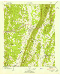 1940 Ooltewah1954 Print · USGSSoutheast Tennessee is captured here just before the mid-century as a landscape of ridge-and-valley farming and emerging education. Genealogists can trace family names at Sylar Cem and Pollard Cem or locate the early campus of Southern Junior College.
 - 1940 Map of Mc Donald, 1956 Print
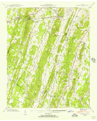 1940 Mc Donald1956 Print · USGSThe rural ridges of Bradley and Hamilton County are captured here just before the war, when rail sidings and country schools anchored local life. Genealogists can locate family landmarks like Tucker Cem and Triplett Cem or trace the old Lee Highway corridor.
Showing maps 1-25 of 137
Top cities of Bradley County
Frequently asked questions
- What are the different types of historical maps available for Bradley County?
- What is the oldest map of Bradley County?
- Where can I purchase historical maps of Bradley County for my home or office?
- Where can I download high-res historical maps of Bradley County?
- Are there historical topographic maps available for Bradley County?
- Is there historical aerial imagery available for Bradley County?
- Where are historical maps of Bradley County sourced from?