Old Maps of Cocke County, Tennessee for Genealogy
Trace your family roots with 146 historic maps of Cocke County. These high-res maps reveal old neighborhoods, homesites, landmarks, and streets — helping you uncover where your ancestors lived and how the area evolved over time.
- Explore historic neighborhoods: Identify where your relatives may have lived in the 1800s or 1900s.
- Compare maps over time: Trace the changes in streets, buildings, and landmarks for multi-generational research.
- Perfect for genealogy & ancestry research: Used by family historians and researchers to map out lineage and migration.
These maps are an incredible resource for exploring your personal connection to Cocke County's past.
Cocke County, TN maps
(146)- 1883 Map of Morristown
 1883 Morristown1883 Print · USGSEast Tennessee in the 1880s is defined by the convergence of mountain ridges and the vital rail corridor through Morristown. Researchers can trace the early industrial landscape of the region through landmarks like Witt's Foundry, Tate's Springs, and the historic Bean's Station.
 - 1892 Map of Greeneville
 1892 Greeneville1892 Print · USGSEast Tennessee in the late nineteenth century was a landscape of river-crossing ferries and mountain gaps centered on Greeneville. Genealogists and historians can trace the early rail corridor of the East Tennessee Virginia and Georgia R. R. and locate family-named sites like Britton Ferry and Evans X Rds.
 - 1893 Map of Mt Guyot
 1893 Mt Guyot1893 Print · USGSThe Tennessee and North Carolina borderlands are captured here in the 1890s, when isolated mountain coves and river towns relied on the Virginia and Georgia Railroad. Researchers can trace old family sites and transport routes through Fair Garden, Jones Cove, and along the Elliot Ferry Road.3 unique versions available
 - 1893 Map of Morristown
 1893 Morristown1893 Print · USGSEast Tennessee in the 1890s was a landscape of deep mountain ridges and vital rail junctions centered around Morristown. Researchers can trace the nineteenth-century river economy through numerous crossings like Cloud Ferry and find early industry at Lotspeachy Mill.
 - 1894 Map of Asheville
 1894 Asheville1894 Print · USGSAsheville and the French Broad River valley are shown here in the 1890s, when rail travel was transforming the Southern Appalachians. Genealogists can locate family landmarks like Gudgers Mill, Pendletons Mill, and the early development of Biltmore.2 unique versions available
 - 1895 Map of Morristown
 1895 Morristown1895 Print · USGSThe East Tennessee ridge-and-valley country comes alive in the late nineteenth century as a hub of rail and river transit. Trace the routes of old Evans Ferry or locate vanished stops along the Southern R.R. near Morristown and Bull Gap.5 unique versions available
 - 1896 Map of Greeneville
 1896 Greeneville1896 Print · USGSUpper East Tennessee thrives in the late nineteenth century as a hub of rail travel and river commerce centered around the county seat. Genealogists can trace family roots through numerous crossroads and post offices like Chissolms P. O., Hawes X Roads, and Britton Ferry.2 unique versions available
 - 1901 Map of Asheville
 1901 Asheville1901 Print · USGSWestern North Carolina at the turn of the century shows a mountain landscape adapting to the arrival of major railroads. Genealogists and historians can trace family-named peaks and early communities like Mars Hill, Hot Springs, and the estates at Biltmore.9 unique versions available
 - 1904 Map of Greeneville
 1904 Greeneville1904 Print · USGSEast Tennessee at the turn of the century reveals a land of ridge-valley farms and early educational centers. Genealogists can trace family roots through historic settlements like Surgoinsville, early institutions like Washington College, and landmarks such as Bashors Mill.4 unique versions available
 - 1912 Map of Mt Guyot
 1912 Mt Guyot1912 Print · USGSThe Tennessee and North Carolina borderlands come into focus in the early twentieth century, prior to the creation of the Great Smoky Mountains National Park. Trace ancestral locations like Cataloochee and Smokemont or follow the Southern RR to Newport.5 unique versions available
 - 1935 Map of Newport
 1935 Newport1935 Print · USGSIn the mid-1930s, this area of East Tennessee was a landscape of river-valley towns and mountain communities. Genealogists and historians can trace family locations through numerous rural landmarks like Rosenwald Sch, Jenkins Mill, and Bethel Ch.
 - 1935 Map of White Pine
 1935 White Pine1935 Print · USGSThe Jefferson County countryside around White Pine is shown here in the mid-1930s as the French Broad River valley hummed with rural industry. Researchers can trace family-named landmarks like Anderson Mill, Hawkins Chapel, and Westminster Cem.
 - 1935 Map of Hartford
 1935 Hartford1935 Print · USGSCocke County’s river valleys and mountain peaks are captured here in the mid-1930s as the national park took shape. Researchers can trace the river-economy through HARTFORD and Naillon Sta or locate family sites like Padgett Mill and Catons Grove.
 - 1935 Map of English Mountain
 1935 English Mountain1935 Print · USGSSevier County and the foothills of the Smokies are seen here during the mid-thirties as the national park was taking shape. Genealogists can trace family roots through scores of rural institutions like Smoky Mtn Academy, Pittman Center, and the Crockettville Sch.
 - 1935 Map of Parrottsville
 1935 Parrottsville1935 Print · USGSThe Nolichucky River valley in the mid-1930s reveals a dense rural fabric of Greene and Cocke counties before modern development. Genealogists can trace family landmarks like Baysinger Hollow alongside community centers such as Parrottsville, Reaves Mill, and Salem Ch.
 - 1935 Map of Paint Rock
 1935 Paint Rock1935 Print · USGSThe French Broad River corridor at the Tennessee-North Carolina border comes to life in this mid-1930s survey. Genealogists and local historians can trace family locations near Paint Rock and Harmony Grove or find old community centers like Wolf Creek Sch and Mt Olive Ch.
 - 1935 Map of Neddy Mountain
 1935 Neddy Mountain1935 Print · USGSThe French Broad River valley in the mid-1930s reveals a mountain landscape transitioning under new infrastructure. Genealogists can locate family landmarks like Faubion Cem, Long Creek Mill, and rural schoolhouses such as Reid Hill Sch.
 - 1935 Map of Clevenger
 1935 Clevenger1935 Print · USGSJefferson and Cocke Counties are shown in the mid-1930s, featuring the rural communities nestled against the slopes of English Mountain. Genealogists and historians can locate family landmarks like Bridges Ch, trace the site of CCC Camp No 1467, or find the old Blowing Cave Mill.
 - 1935 Map of Springvale
 1935 Springvale1935 Print · USGSIn the mid-thirties, the Nolichucky River valley supported a vibrant network of rural communities at the junction of three Tennessee counties. Genealogists and historians can trace family locations through numerous landmarks like Bethesda Ch, Silver City, and river crossings such as Inman Ford.
 - 1935 Map of Cedar Creek
 1935 Cedar Creek1935 Print · USGSMid-1930s Greene County life centers on the river and rural crossroads in this Tennessee Valley Authority study. Genealogists can locate family landmarks like Walter Crossroads, Whittenburg Ch, and the numerous islands of the Nolichucky River.
 - 1935 Map of Jones Cove
 1935 Jones Cove1935 Print · USGSSevier County mountain life in the mid-thirties is documented here as the national park boundary was being established. Researchers can locate the Mitchell Wilson Mill, the CCC Camp No 423, and numerous rural schools like Sunset Gap Sch.
 - 1935 Map of Rankin
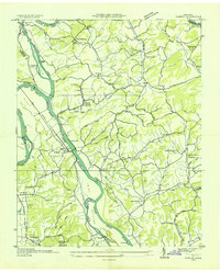 1935 Rankin1935 Print · USGSIn the mid-1930s, the river valleys of East Tennessee were still defined by small farming communities and country schools. Genealogists can trace family footprints at Atchleys Mill, Rorex Chapel, and the community of Rankin along the Southern railroad.
 - 1935 Map of Dandridge
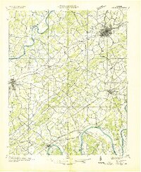 1935 Dandridge1935 Print · USGSEast Tennessee in the mid-1930s is mapped here in great detail as the region's river valleys prepared for the impacts of the Tennessee Valley Authority. Researchers can trace ancestral locations through dozens of landmarks like Martha Sunderland Cem, Panther Creek Mill, and Roe Ch.
 - 1935 Map of Small
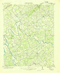 1935 Small1935 Print · USGSEast Tennessee river life in the mid-1930s centered on the fertile valley between the Bays Mountains and the French Broad River. Researchers can trace ancestral locations at Mohawk, Parrottsville, and dozens of rural sites like Alshieys Mill or Bethesda Ch.
 - 1935 Map of Lemon Gap
 1935 Lemon Gap1935 Print · USGSThe high ridges of the Madison County borderlands are shown in the mid-1930s as a network of gap settlements and mountain schools. Genealogists and hikers can trace the Appalachian Trail past early landmarks like the Joe PO. and Ebbs Mill.
Showing maps 1-25 of 146
Top cities of Cocke County
Frequently asked questions
- What are the different types of historical maps available for Cocke County?
- What is the oldest map of Cocke County?
- Where can I purchase historical maps of Cocke County for my home or office?
- Where can I download high-res historical maps of Cocke County?
- Are there historical topographic maps available for Cocke County?
- Is there historical aerial imagery available for Cocke County?
- Where are historical maps of Cocke County sourced from?