1980s Maps of Cumberland County, Tennessee
Explore 5 historic maps of Cumberland County from the 1980s. These maps offer a rare glimpse into what life looked like during the 1980s — showing old roads, neighborhoods, homes, and landmarks that have changed or disappeared over time.
Whether you're researching your family's past, planning a metal detecting trip, or studying how Cumberland County's landscape evolved across the 1980s, these high-resolution maps are a powerful tool for exploring the history of this region.
- Focus on a specific era: All maps on this page are from the 1980s, giving you a focused view of this time period.
- See what’s changed: Compare century-old streets, trails, and buildings to today's modern landscape using overlays and satellite layers.
- Research with precision: Use these maps for genealogy, historical research, land use analysis, or educational projects.
- View, download, or print: Maps are fully viewable online in high resolution, and can be downloaded or printed for your own records.
Start exploring Cumberland County's history through authentic maps from the 1980s. This is your window into the past.
Cumberland County, TN maps
(5)- 1981 Map of Mc Minnville
 1981 Mc Minnville1981 Print · USGSThe Cumberland Plateau and the Sequatchie Valley meet in this early 1980s look at Warren and White Counties. Researchers can locate vanished rural landmarks like Hutchins College, the old rail stops of the Tennessee Central, and Mount Zion Cem.
 - 1981 Map of Watts Bar Lake, 1984 Print
 1981 Watts Bar Lake1984 Print · USGSEast Tennessee's river valleys and industrial corridors are captured here during the expansion of the TVA power system in the early eighties. Researchers can trace the legacy of the Southern Railway and the development of Watts Bar Lake and Tellico Lake.2 unique versions available
 - 1982 Map of Crossville, 1983 Print
 1982 Crossville1983 Print · USGSCrossville and the surrounding Cumberland Plateau are shown during a period of significant growth in the early eighties. Researchers can trace family genealogy through numerous sites like Baisley Cem and Oaklawn Cem, or locate landmarks such as Cumberland Mountain State Park.2 unique versions available
 - 1982 Map of Cookeville, 1983 Print
 1982 Cookeville1983 Print · USGSThe Upper Cumberland region comes into focus during the early eighties as Cookeville and its surrounding counties adapt to new reservoirs and highways. Researchers can trace the Louisville and Nashville rail line and locate landmarks like Tennessee Technological University and Standing Stone State Forest.
 - 1983 Map of Vandever, 1989 Print
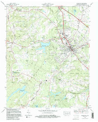
 1983 Vandever1989 Print · USGSCumberland County saw both suburban growth and preserved rural heritage in the 1980s. Genealogists and historians can trace family locations through Hale Chapel Cem, Musick Cem, and the historic Carding Machine Spring.
End of results
Showing maps 1-5 of 5
Top cities of Cumberland County
- Crossville historical maps
- Fairfield Glade historical maps
- Crab Orchard historical maps
- Pleasant Hill historical maps
Frequently asked questions
- What are the different types of historical maps available for Cumberland County?
- What is the oldest map of Cumberland County?
- Where can I purchase historical maps of Cumberland County for my home or office?
- Where can I download high-res historical maps of Cumberland County?
- Are there historical topographic maps available for Cumberland County?
- Is there historical aerial imagery available for Cumberland County?
- Where are historical maps of Cumberland County sourced from?