Old Maps of Cumberland County, Tennessee for Genealogy
Trace your family roots with 202 historic maps of Cumberland County. These high-res maps reveal old neighborhoods, homesites, landmarks, and streets — helping you uncover where your ancestors lived and how the area evolved over time.
- Explore historic neighborhoods: Identify where your relatives may have lived in the 1800s or 1900s.
- Compare maps over time: Trace the changes in streets, buildings, and landmarks for multi-generational research.
- Perfect for genealogy & ancestry research: Used by family historians and researchers to map out lineage and migration.
These maps are an incredible resource for exploring your personal connection to Cumberland County's past.
Cumberland County, TN maps
(202)- 1887 Map of Kingston
 1887 Kingston1887 Print · USGSCentral Tennessee in the late nineteenth century was a world of river landings and new rail lines. Genealogists can trace family roots through riverside sites like Sevier's Ferry or rural hubs like Bogges X Roads and Ten Mile Stand.
 - 1891 Map of Kingston
 1891 Kingston1891 Print · USGSEastern Tennessee in the 1890s reveals a river-driven economy at the edge of the Cumberland Plateau. Genealogists can trace early crossings and landings such as Mc Elwee's Ferry and Pinhook Landing, or locate vanished crossroads like Kemmers Old Stand.2 unique versions available
 - 1892 Map of Pikeville
 1892 Pikeville1892 Print · USGSThe Cumberland Plateau in the 1890s shows a rugged landscape of early river ferries and mountain gaps. Genealogists and historians can trace the paths between Sparta and Crossville, locating landmarks like Hodge Ferry and the Rock House tavern.
 - 1893 Map of Kingston, 1905 Print
 1893 Kingston1905 Print · USGSEastern Tennessee at the end of the nineteenth century is a landscape of mountain gaps and vital river landings. Researchers can trace early river crossings like Jackson Ferry, the path of the Cincinnati Southern Railroad, and settlements like Rhea Springs and Kingston.5 unique versions available
 - 1895 Map of Wartburg
 1895 Wartburg1895 Print · USGSThe Cumberland Plateau of the late nineteenth century comes to life through this record of high-country towns and rivers. Genealogists can trace early homesteads and rail stops from Oneida down to Wartburg, including the distinct colonies at Rugby and Allardt.
 - 1895 Map of Pikeville
 1895 Pikeville1895 Print · USGSThe Cumberland Plateau was a landscape of mountain settlements and critical gaps in the 1890s. Genealogists can trace family roots through upland communities like Pomona and Lantana, or locate old landmarks like Hale Chapel and Hodge Ferry along the river.7 unique versions available
 - 1896 Map of Wartburg
 1896 Wartburg1896 Print · USGSThe Cumberland Plateau in the late nineteenth century is captured here as railroads began to transform the mountain economy. Trace the development of utopian Rugby, the county seat at Wartburg, and remote crossings like Island Ford or Big Lick Gap.6 unique versions available
 - 1897 Map of Standingstone
 1897 Standingstone1897 Print · USGSThe Upper Cumberland Plateau at the end of the 19th century shows a landscape of deep coves and rising rail towns. Trace the early tracks of the Nashville and Knoxville railroad or find family roots near Livingston, Standingstone, and the Cedar Springs church.
 - 1898 Map of Standingstone
 1898 Standingstone1898 Print · USGSThe Cumberland Plateau of Middle Tennessee comes alive in the late nineteenth century, showing the isolated settlements and early industry of the western mountains. Trace the route of the Nashville and Knoxville RR through Monterey or locate family-named coves like Johnson Cove and Deck Cove.8 unique versions available
 - 1909 Map of Sequatchie Valley, 1955 Print
 1909 Sequatchie Valley1955 Print · USGSBledsoe County at the turn of the century shows a landscape of river-valley agriculture and rugged plateau crossings. Genealogists can locate family homesteads near landmarks like Mansfield Mill, Smyrna Church, or the Melvine Post Office.
 - 1910 Map of Pikeville
 1910 Pikeville1910 Print · USGSBledsoe County at the turn of the century shows a landscape of valley farms and mountain gaps connected by the Nashville Chattanooga and St Louis RR. Researchers can locate early milling sites like Hembree Mill and rural landmarks such as Melvine PO and Saratoga Springs.2 unique versions available
 - 1912 Map of Crossville
 1912 Crossville1912 Print · USGSCumberland County at the start of the twentieth century was a landscape of plateau settlements and developing rail lines. Genealogists and historians can trace early community hubs like Crossville, rural school sites such as Flynn School, and creek-side features like Hinch Mill.2 unique versions available
 - 1935 Map of Rockwood
 1935 Rockwood1935 Print · USGSMid-century Roane County comes into focus as a rail and river crossroads before the landscape was altered by large-scale TVA projects. Genealogists can trace family connections through numerous landmarks like Oak Grove Cem, Eureka, and the Winten Sch.
 - 1935 Map of Melvine
 1935 Melvine1935 Print · USGSBledsoe County’s rural mountain life is preserved here in the mid-1930s, as the valley floor and plateaus were still defined by family-named hollows and gaps. Researchers can locate remote community landmarks like Sunny Meadow Sch, the Lida Thurman Cem, and the village of Melvine.
 - 1935 Map of Isoline
 1935 Isoline1935 Print · USGSCumberland County during the mid-1930s shows a landscape of ridge-top schools and railroad stops. Genealogists and local historians can trace family roots through landmarks like Bethlehem Ch, Woody Sch, and the rail stops at Isoline and Plateau.
 - 1935 Map of Campbell Junction
 1935 Campbell Junction1935 Print · USGSCumberland County’s high plateau country is documented here in the mid-1930s as modern power and transit networks begin to cross the landscape. Researchers can trace the early path of Tennessee State Highway No 70 and the railroad at Campbell Junction.
 - 1935 Map of Clarkrange
 1935 Clarkrange1935 Print · USGSThe Cumberland plateau comes into focus during the mid-thirties as the newly constructed Alvin G York Highway began transforming the region. Genealogists and historians can trace old homestead paths and early settlements like Clarkrange and Rinnie.
 - 1935 Map of Lancing
 1935 Lancing1935 Print · USGSMorgan County, Tennessee, is captured here in the mid-1930s as the railroad and river networks shaped local life. Genealogists and researchers can trace family lands near Lancing, the settlement at Nemo, and community centers like Catoosa Sch and Clear Creek Ch.
 - 1935 Map of Vandever
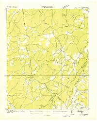 1935 Vandever1935 Print · USGSCumberland County saw significant changes in the 1930s as federal projects and new highways reshaped the plateau. Local historians can trace the early layout of Cumberland Homesteads and find landmarks like Hale Chapel and New Era Sch.
 - 1936 Map of Hebbertsburg
 1936 Hebbertsburg1936 Print · USGSCumberland and Morgan Counties come together in the mid-1930s along the winding Obed River and Daddy Creek. Researchers can locate old community hubs like Hebbertsburg and Frankfort, alongside river crossings at Hegler Ford and Potter Ford.
 - 1936 Map of Fox Creek
 1936 Fox Creek1936 Print · USGSCumberland County in the mid-1930s shows a landscape of river-tied settlements and rural schools before modern development. Researchers can locate the Peavine Cem, trace the trails around Genesis, or find the river crossing at Potter Ford.
 - 1936 Map of Twin Bridges
 1936 Twin Bridges1936 Print · USGSMorgan County life during the mid-1930s centered on the high ridges of the Cumberland Plateau and the waters of Clear Creek. Researchers can trace old mountain communities through sites like Deer Lodge, Island Ford Sch, and Lavender Ch.
 - 1936 Map of Roddy
 1936 Roddy1936 Print · USGSThe Tennessee Valley meets the high ridges of the plateau in the 1930s, showing a landscape of small schools, relief camps, and early highways. Genealogists can locate family landmarks such as Gibson Inn, Dogwood School, and Mt Zion Cemetery.
 - 1936 Map of Ozone
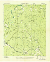 1936 Ozone1936 Print · USGSCumberland County's highland terrain in the mid-1930s reveals a landscape shaped by the Tennessee Central Railroad and early state highways. Genealogists and historians can trace family locations near Waldensia, Ozone, and the Gill Cem.
 - 1936 Map of Cardiff
 1936 Cardiff1936 Print · USGSThe Cumberland Plateau meets the valley floor in the mid-1930s, showing a landscape shaped by the ridge and rail. Researchers can trace the development of Rockwood and Cardiff or locate rural landmarks like Dry Hill Ch and Hatley Sch.2 unique versions available
Showing maps 1-25 of 202
Top cities of Cumberland County
- Crossville historical maps
- Fairfield Glade historical maps
- Crab Orchard historical maps
- Pleasant Hill historical maps
Frequently asked questions
- What are the different types of historical maps available for Cumberland County?
- What is the oldest map of Cumberland County?
- Where can I purchase historical maps of Cumberland County for my home or office?
- Where can I download high-res historical maps of Cumberland County?
- Are there historical topographic maps available for Cumberland County?
- Is there historical aerial imagery available for Cumberland County?
- Where are historical maps of Cumberland County sourced from?