1950s Maps of Decatur County, Tennessee
Explore 6 historic maps of Decatur County from the 1950s. These maps offer a rare glimpse into what life looked like during the 1950s — showing old roads, neighborhoods, homes, and landmarks that have changed or disappeared over time.
Whether you're researching your family's past, planning a metal detecting trip, or studying how Decatur County's landscape evolved across the 1950s, these high-resolution maps are a powerful tool for exploring the history of this region.
- Focus on a specific era: All maps on this page are from the 1950s, giving you a focused view of this time period.
- See what’s changed: Compare century-old streets, trails, and buildings to today's modern landscape using overlays and satellite layers.
- Research with precision: Use these maps for genealogy, historical research, land use analysis, or educational projects.
- View, download, or print: Maps are fully viewable online in high resolution, and can be downloaded or printed for your own records.
Start exploring Decatur County's history through authentic maps from the 1950s. This is your window into the past.
Decatur County, TN maps
(6)- 1950 Map of Scotts Hill, 1952 Print
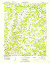 1950 Scotts Hill1952 Print · USGSHenderson and Decatur Counties are captured here in the early fifties, showing a rural landscape anchored by Scotts Hill and the western shore of Kentucky Lake. Genealogists can trace deep local roots at Rushing Grove Church, Dixie Mills, and numerous family cemeteries.3 unique versions available
 - 1950 Map of Holladay, 1953 Print
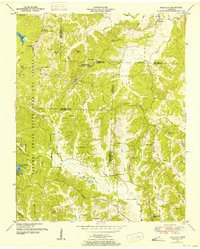 1950 Holladay1953 Print · USGSBenton and Carroll counties meet in this mid-century survey of West Tennessee just as the modern state park system was maturing. Genealogists can locate family names and rural centers like Shiloh, Poplar Springs Sch, and the Williams Cem.3 unique versions available
 - 1950 Map of Parsons, 1953 Print
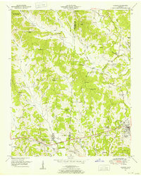 1950 Parsons1953 Print · USGSThe rural communities and creek-side settlements of West Tennessee are well-documented here just after the war. Family historians can trace the locations of Mt Ararat Church, Central School, and Hayes Cemetery across the Henderson and Decatur County line.2 unique versions available
 - 1956 Map of Columbia, 1960 Print
 1956 Columbia1960 Print · USGSMiddle Tennessee in the mid-fifties presents a landscape of established river towns and critical rail hubs before the arrival of the modern interstate system. Researchers can trace the routes of the Louisville and Nashville railroad or locate historic landmarks like Stones River National Military Park and the Tennessee National Wildlife Refuge.6 unique versions available
 - 1956 Map of Blytheville, 1964 Print
 1956 Blytheville1964 Print · USGSWest Tennessee and the Arkansas Delta come alive in this mid-century survey of the river-and-rail corridor connecting Memphis to Jackson. Genealogists and historians can trace the rail lines of the Louisville and Nashville RR and locate landmarks like Western State Hospital or Fort Pillow State Prison Farm.2 unique versions available
 - 1959 Map of Blytheville
 1959 Blytheville1959 Print · USGSWest Tennessee and Northeast Arkansas meet along the river in the late fifties, during a period of steady industrial and agricultural growth. Genealogists can trace the rail corridors of the Illinois Central through Jackson or explore landmarks like Shiloh National Military Park and Fort Pillow State Prison.
End of results
Showing maps 1-6 of 6
Top cities of Decatur County
Frequently asked questions
- What are the different types of historical maps available for Decatur County?
- What is the oldest map of Decatur County?
- Where can I purchase historical maps of Decatur County for my home or office?
- Where can I download high-res historical maps of Decatur County?
- Are there historical topographic maps available for Decatur County?
- Is there historical aerial imagery available for Decatur County?
- Where are historical maps of Decatur County sourced from?