1940s Maps of Decatur County, Tennessee
Explore 8 historic maps of Decatur County from the 1940s. These maps offer a rare glimpse into what life looked like during the 1940s — showing old roads, neighborhoods, homes, and landmarks that have changed or disappeared over time.
Whether you're researching your family's past, planning a metal detecting trip, or studying how Decatur County's landscape evolved across the 1940s, these high-resolution maps are a powerful tool for exploring the history of this region.
- Focus on a specific era: All maps on this page are from the 1940s, giving you a focused view of this time period.
- See what’s changed: Compare century-old streets, trails, and buildings to today's modern landscape using overlays and satellite layers.
- Research with precision: Use these maps for genealogy, historical research, land use analysis, or educational projects.
- View, download, or print: Maps are fully viewable online in high resolution, and can be downloaded or printed for your own records.
Start exploring Decatur County's history through authentic maps from the 1940s. This is your window into the past.
Decatur County, TN maps
(8)- 1949 Map of Perryville, 1952 Print
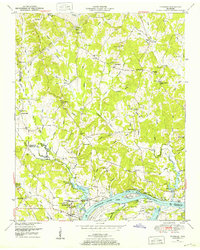
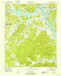 1949 Perryville1952 Print · USGSDecatur County was undergoing significant transformation in the late 1940s as the Tennessee River valley adjusted to the creation of Kentucky Lake. Researchers can trace historic river landings like Jennings Bluff Landing, early industry at the Furnace, and rural landmarks such as Cypress Creek School.3 unique versions available
 - 1949 Map of Pope, 1952 Print
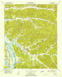 1949 Pope1952 Print · USGSThe Tennessee River valley underwent a massive transformation in the mid-twentieth century as Kentucky Lake reshaped the Perry County shoreline. Researchers can trace old river connections at Brownsport Landing and locate vanished landmarks like the abandoned ore furnace stack and Gumdale School.2 unique versions available
 - 1949 Map of Bath Springs, 1952 Print
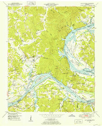 1949 Bath Springs1952 Print · USGSThe Tennessee River corridor in the late 1940s shows a landscape of river landings and ridge-top settlements along the Decatur and Perry county lines. Genealogists can locate family-named landmarks like Lafferty Cemetery and Tuckers Store or trace the rural river economy at Yarbro Landing.3 unique versions available
 - 1949 Map of Clifton, 1952 Print
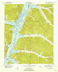
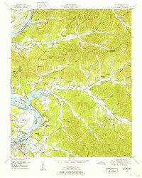 1949 Clifton1952 Print · USGSThe riverfront town of Clifton and its surrounding ridges are captured in the late 1940s as the Tennessee River valley adapted to the impacts of Kentucky Lake. Genealogists can trace family landmarks and community nodes like Peters Landing, New Zion Ch, and the Lone Chestnut Cem.4 unique versions available
 - 1949 Map of Thurman, 1952 Print
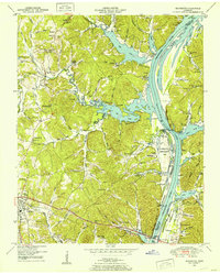
 1949 Thurman1952 Print · USGSThe Tennessee River shoreline at the turn of the 1950s is captured here in detail, showing the river-based economy of Decatur County. Researchers can trace old family names and settlements like Lick Skillet, find the Union Hall School, or locate river landings at Swallow Bluff.2 unique versions available
 - 1949 Map of Daniels Landing, 1953 Print
 1949 Daniels Landing1953 Print · USGSWest Tennessee river life is captured here in the late 1940s as the valley adapted to the creation of Kentucky Lake. Researchers can trace old family sites and river landings such as Daniels Landing, Blue Creek School, and Britta Chapel.3 unique versions available
 - 1949 Map of Jeannette, 1953 Print
 1949 Jeannette1953 Print · USGSDecatur County's riverfront landscape is shown here in the late 1940s as the Tennessee River valley adjusted to the presence of Kentucky Lake. Genealogists and historians can trace family locations through Rocky Hill School, Salem Ch, and the Dismantled RR near Parsons.2 unique versions available
 - 1949 Map of Sugar Tree, 1953 Print
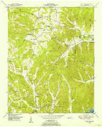 1949 Sugar Tree1953 Print · USGSBenton and Decatur Counties are captured in the late 1940s, showing a landscape of deep hollows and high ridges along the Tennessee River. Genealogists can trace family names at Manley Chapel Cemetery and locate vanished local landmarks like Spences Store or Mellwain.2 unique versions available
End of results
Showing maps 1-8 of 8
Top cities of Decatur County
Frequently asked questions
- What are the different types of historical maps available for Decatur County?
- What is the oldest map of Decatur County?
- Where can I purchase historical maps of Decatur County for my home or office?
- Where can I download high-res historical maps of Decatur County?
- Are there historical topographic maps available for Decatur County?
- Is there historical aerial imagery available for Decatur County?
- Where are historical maps of Decatur County sourced from?