2020s Maps of Rather, Tennessee
Explore 1 historic maps of Rather from the 2020s. These maps offer a rare glimpse into what life looked like during the 2020s — showing old roads, neighborhoods, homes, and landmarks that have changed or disappeared over time.
Whether you're researching your family's past, planning a metal detecting trip, or studying how Rather's landscape evolved across the 2020s, these high-resolution maps are a powerful tool for exploring the history of this region.
- Focus on a specific era: All maps on this page are from the 2020s, giving you a focused view of this time period.
- See what’s changed: Compare century-old streets, trails, and buildings to today's modern landscape using overlays and satellite layers.
- Research with precision: Use these maps for genealogy, historical research, land use analysis, or educational projects.
- View, download, or print: Maps are fully viewable online in high resolution, and can be downloaded or printed for your own records.
Start exploring Rather's history through authentic maps from the 2020s. This is your window into the past.
Rather, TN maps
(1)- 2022 Map of Moscow SE, 2022 Print
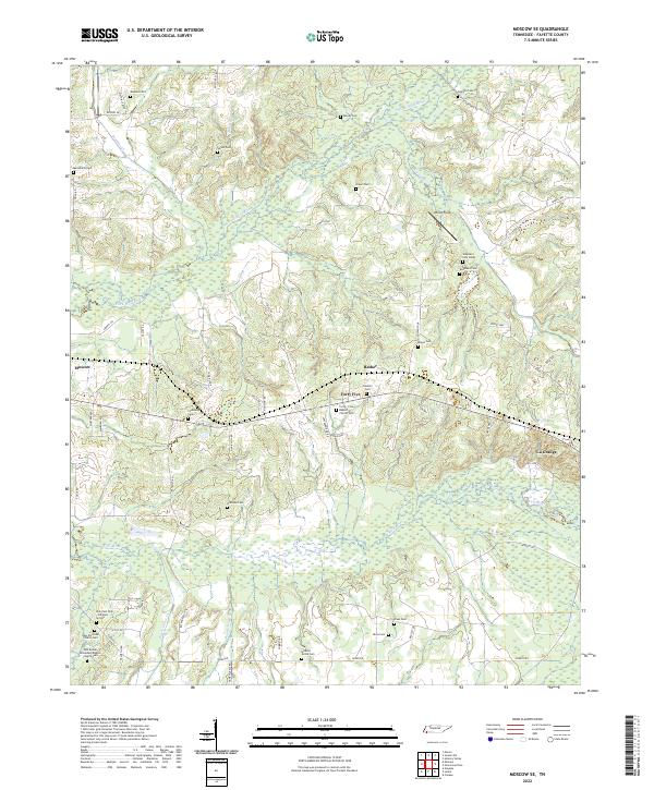 2022 Moscow SE2022 Print · USGSSoutheast Fayette County is defined by the winding Wolf River and its tributaries during the early twenty-first century. Genealogists and historians can trace an incredible density of family and church burial sites, from Watkins Cem to Forty-Five Baptist Church Cem.
End of results
Showing maps 1-1 of 1
Top cities near Rather
- Oakland historical maps
- Somerville historical maps
- Whiteville historical maps
- Ashland historical maps
- Moscow historical maps
- Rossville historical maps
See more
Frequently asked questions
- What are the different types of historical maps available for Rather?
- What is the oldest map of Rather?
- Where can I purchase historical maps of Rather for my home or office?
- Where can I download high-res historical maps of Rather?
- Are there historical topographic maps available for Rather?
- Is there historical aerial imagery available for Rather?
- Where are historical maps of Rather sourced from?