1900s (20th Century) Maps of Fentress County, Tennessee
Explore 26 historic maps of Fentress County from the 1900s (20th Century). These maps offer a rare glimpse into what life looked like during the 1900s — showing old roads, neighborhoods, homes, and landmarks that have changed or disappeared over time.
Whether you're researching your family's past, planning a metal detecting trip, or studying how Fentress County's landscape evolved across the 1900s, these high-resolution maps are a powerful tool for exploring the history of this region.
- Focus on a specific era: All maps on this page are from the 1900s, giving you a focused view of this time period.
- See what’s changed: Compare century-old streets, trails, and buildings to today's modern landscape using overlays and satellite layers.
- Research with precision: Use these maps for genealogy, historical research, land use analysis, or educational projects.
- View, download, or print: Maps are fully viewable online in high resolution, and can be downloaded or printed for your own records.
Start exploring Fentress County's history through authentic maps from the 1900s. This is your window into the past.
Fentress County, TN maps
(26)- 1929 Map of Byrdstown
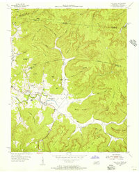
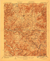 1929 Byrdstown1929 Print · USGSThe Tennessee-Kentucky state line comes alive in the late twenties, showing a landscape defined by the winding Obey River before the era of modern dams. Researchers can trace ancestral roots through dozens of local sites like Davidson Cem, Franklin Ferry, and the Almshouse.2 unique versions available
 - 1934 Map of Barthell
 1934 Barthell1934 Print · USGSMcCreary County during the late 1920s reveals a landscape of industrial outposts and river-bound settlements at the edge of the Tennessee line. Researchers can trace the Kentucky and Tennessee Railway corridor or find family roots at Kidds Crossing, Cooperative, and Laurel Hill Ch.
 - 1934 Map of Pall Mall
 1934 Pall Mall1934 Print · USGSThe Kentucky-Tennessee borderlands appear in great detail during the late interwar period, showing a landscape of remote mountain hamlets and schools. Genealogists can locate family landmarks such as Edwards Chapel, Slickford, and the Parmley Sch among the cliffs and ridges.
 - 1935 Map of Clarkrange
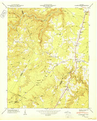
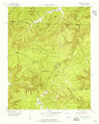
 1935 Clarkrange1935 Print · USGSThe Cumberland plateau comes into focus during the mid-thirties as the newly constructed Alvin G York Highway began transforming the region. Genealogists and historians can trace old homestead paths and early settlements like Clarkrange and Rinnie.
 - 1936 Map of Jones Knob
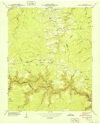
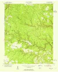
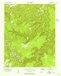
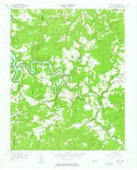
 1936 Jones Knob1936 Print · USGSFentress and Morgan counties in the mid-1930s reveal a landscape of high plateaus and vital river crossings. Researchers can locate remote rural landmarks including Jones Sch, Ashburn Ford, and the distinctive Jones Knob among the deep creek basins.
 - 1946 Map of Clarkrange, 1976 Print
 1946 Clarkrange1976 Print · USGSThe rural heart of the Tennessee Cumberland Plateau comes into focus in the mid-1940s, centered on the crossroads of Clarkrange. Genealogists and local historians can trace family locations near Union Grove Sch, Muddy Pond, and the Alvin C York Highway.
 - 1949 Map of Jones Knob
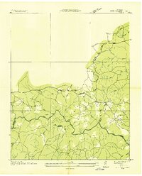
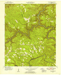
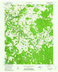
 1949 Jones Knob1949 Print · USGSThe Tennessee mountain plateau in the late 1940s is captured here, showing the rural communities of Fentress and Morgan counties. Researchers can locate remote schools and river crossings, from Roslin Sch and Springs Chapel to the historic Jones Ford.3 unique versions available
 - 1950 Map of Clarkrange
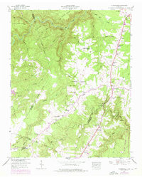
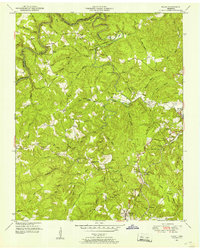
 1950 Clarkrange1950 Print · USGSMid-century Fentress County is defined here by the high-plateau route of the Alvin C York Highway and the rugged breaks of the Cumberland Plateau. You can trace family homesteads near Muddy Pond, local schools like Martha Washington School, and the crossroads at Clarkrange.2 unique versions available
 - 1952 Map of Honey Creek, 1953 Print
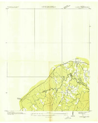
 1952 Honey Creek1953 Print · USGSScott and Fentress counties are documented in the early 1950s, showing a landscape of river-carved ridges and remote homesteads. Genealogists can trace family connections at Blevins Cem or locate the sites of Honey Creek School and Zenith.6 unique versions available
 - 1952 Map of Rugby, 1953 Print
 1952 Rugby1953 Print · USGSThe Morgan and Scott County borderlands appear here in the early fifties as a landscape of timbered hills and railway towns. Researchers can trace family history through numerous burial sites like Rugby Cem and Webb Cem or follow the Southern Railway through Sixteen Tunnel.4 unique versions available
 - 1954 Map of Stockton, 1955 Print
 1954 Stockton1955 Print · USGSMid-century Fentress County is captured here in a moment of rural stability before modern development altered the plateau landscape. Genealogists can trace family footprints through the Stockton Sch and numerous burial grounds like Royalston Cem and Christian Cem.6 unique versions available
 - 1954 Map of Burrville, 1955 Print
 1954 Burrville1955 Print · USGSMid-century Fentress County is defined here by the deep gorge of the Clear Fork and the remote settlements of the plateau. Local historians can locate vanished landmarks like Silver Pine Sch and Gatewood Bridge or trace family roots near Armathwaite.4 unique versions available
 - 1954 Map of Jamestown, 1955 Print
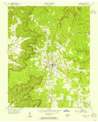 1954 Jamestown1955 Print · USGSJamestown and the surrounding Fentress County plateau are captured here in the mid-fifties, centered on the legacy of the Alvin C York Institute. Genealogists and historians can trace family sites at Crockett Cem, the settlement of Allardt, and local landmarks like the Drive-in Theater.4 unique versions available
 - 1954 Map of Grimsley, 1955 Print
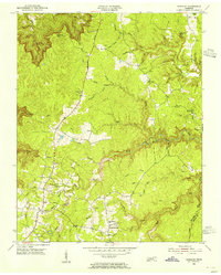 1954 Grimsley1955 Print · USGSMid-century Fentress County is captured here as the Cumberland Plateau plateau communities of Grimsley and Banner Springs centered along the Alvin C York Highway. Researchers can locate numerous family burial grounds and country schools like the Tench Sch and Ward Cem.4 unique versions available
 - 1954 Map of Pall Mall, 1956 Print
 1954 Pall Mall1956 Print · USGSThe borderlands of Tennessee and Kentucky come alive in the mid-1950s, centered on the community of Pall Mall. Trace local history through the many rural landmarks of the Wolf River valley, including York Bible Sch, Travisville Ch, and the Alvin C York Highway.4 unique versions available
 - 1955 Map of Sharp Place, 1956 Print
 1955 Sharp Place1956 Print · USGSThe Tennessee-Kentucky borderlands come alive in the mid-fifties, showing a landscape shaped by national forests and small ridge-top communities. Genealogists can locate family sites like Akers Chapel, Sharp Place Cemetery, and the Langham School.5 unique versions available
 - 1955 Map of Wilder, 1956 Print
 1955 Wilder1956 Print · USGSMid-century coal country in Fentress County is captured here just as the extractive economy reshaped the Cumberland Plateau. Researchers can trace the legacy of industrial sites like the Strip Mines and the Tennessee Central railroad near Wilder and Davidson.3 unique versions available
 - 1955 Map of Barthell SW, 1956 Print
 1955 Barthell SW1956 Print · USGSThe Tennessee and Kentucky borderlands in the mid-fifties reveal a landscape of deep river gorges and isolated ridge-top schools. Genealogists and historians can trace family locations along No Business Creek and find the site of the Station Camp Sch.4 unique versions available
 - 1956 Map of Riverton, 1957 Print
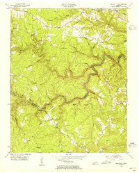
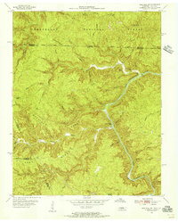
 1956 Riverton1957 Print · USGSThe Tennessee uplands near the Pickett and Fentress county line are seen here in the mid-fifties, just as the Dale Hollow Reservoir altered the local valleys. Genealogists can trace remote family sites like Hinds Cem, the Cedar Grove Ch, and schools like Broad Door Sch.3 unique versions available
 - 1956 Map of Corbin, 1966 Print
 1956 Corbin1966 Print · USGSThe Kentucky and Tennessee borderlands are captured here in the mid-fifties, showing the region's shift toward modern interstate travel and reservoir development. Genealogists and historians can trace old community lines near Albany and Monticello or locate early rail junctions along the Southern and Tennessee Central lines.3 unique versions available
 - 1958 Map of Corbin
 1958 Corbin1958 Print · USGSThe Upper Cumberland borderlands appear in the late 1950s as massive reservoirs and early atomic-era growth reshape the region. Trace family roots and vanished landmarks near Lake Cumberland, Oak Ridge, and the Cumberland National Forest.
 - 1962 Map of Moodyville, 1963 Print
 1962 Moodyville1963 Print · USGSThe Wolf River country along the Kentucky-Tennessee border appears here in the early sixties, showing a landscape of deep river bends and rural crossroads. Genealogists can locate dozens of family burial sites like Flowers Zachary Cem and Shadow Cem near settlements like Moodyville and Static.3 unique versions available
 - 1979 Map of Oakridge, 1980 Print
 1979 Oakridge1980 Print · USGSThe eastern Tennessee highlands are captured here in the late 1970s, showcasing a landscape of coal mining and mountain conservation. Genealogists and researchers can locate family landmarks such as Potter Cem, Sunbright Sch, and the historic settlement of Rugby.
 - 1981 Map of Corbin, 1984 Print
 1981 Corbin1984 Print · USGSThe Kentucky and Tennessee borderlands in the early eighties were characterized by coal towns and deep mountain ridges. Trace family history or rail routes through Stearns, Williamsburg, and the mining settlements near Jellico Mountain along the L & N RR.
 - 1982 Map of Cookeville, 1983 Print
 1982 Cookeville1983 Print · USGSThe Upper Cumberland region comes into focus during the early eighties as Cookeville and its surrounding counties adapt to new reservoirs and highways. Researchers can trace the Louisville and Nashville rail line and locate landmarks like Tennessee Technological University and Standing Stone State Forest.
Showing maps 1-25 of 26
Top cities of Fentress County
Frequently asked questions
- What are the different types of historical maps available for Fentress County?
- What is the oldest map of Fentress County?
- Where can I purchase historical maps of Fentress County for my home or office?
- Where can I download high-res historical maps of Fentress County?
- Are there historical topographic maps available for Fentress County?
- Is there historical aerial imagery available for Fentress County?
- Where are historical maps of Fentress County sourced from?