1930s Maps of Fentress County, Tennessee
Explore 4 historic maps of Fentress County from the 1930s. These maps offer a rare glimpse into what life looked like during the 1930s — showing old roads, neighborhoods, homes, and landmarks that have changed or disappeared over time.
Whether you're researching your family's past, planning a metal detecting trip, or studying how Fentress County's landscape evolved across the 1930s, these high-resolution maps are a powerful tool for exploring the history of this region.
- Focus on a specific era: All maps on this page are from the 1930s, giving you a focused view of this time period.
- See what’s changed: Compare century-old streets, trails, and buildings to today's modern landscape using overlays and satellite layers.
- Research with precision: Use these maps for genealogy, historical research, land use analysis, or educational projects.
- View, download, or print: Maps are fully viewable online in high resolution, and can be downloaded or printed for your own records.
Start exploring Fentress County's history through authentic maps from the 1930s. This is your window into the past.
Fentress County, TN maps
(4)- 1934 Map of Barthell
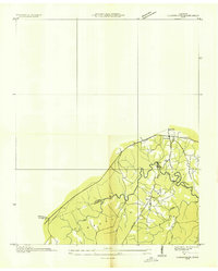
 1934 Barthell1934 Print · USGSMcCreary County during the late 1920s reveals a landscape of industrial outposts and river-bound settlements at the edge of the Tennessee line. Researchers can trace the Kentucky and Tennessee Railway corridor or find family roots at Kidds Crossing, Cooperative, and Laurel Hill Ch.
 - 1934 Map of Pall Mall
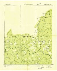
 1934 Pall Mall1934 Print · USGSThe Kentucky-Tennessee borderlands appear in great detail during the late interwar period, showing a landscape of remote mountain hamlets and schools. Genealogists can locate family landmarks such as Edwards Chapel, Slickford, and the Parmley Sch among the cliffs and ridges.
 - 1935 Map of Clarkrange
 1935 Clarkrange1935 Print · USGSThe Cumberland plateau comes into focus during the mid-thirties as the newly constructed Alvin G York Highway began transforming the region. Genealogists and historians can trace old homestead paths and early settlements like Clarkrange and Rinnie.
 - 1936 Map of Jones Knob
 1936 Jones Knob1936 Print · USGSFentress and Morgan counties in the mid-1930s reveal a landscape of high plateaus and vital river crossings. Researchers can locate remote rural landmarks including Jones Sch, Ashburn Ford, and the distinctive Jones Knob among the deep creek basins.
End of results
Showing maps 1-4 of 4
Top cities of Fentress County
Frequently asked questions
- What are the different types of historical maps available for Fentress County?
- What is the oldest map of Fentress County?
- Where can I purchase historical maps of Fentress County for my home or office?
- Where can I download high-res historical maps of Fentress County?
- Are there historical topographic maps available for Fentress County?
- Is there historical aerial imagery available for Fentress County?
- Where are historical maps of Fentress County sourced from?