2020s Maps of Fentress County, Tennessee
Explore 14 historic maps of Fentress County from the 2020s. These maps offer a rare glimpse into what life looked like during the 2020s — showing old roads, neighborhoods, homes, and landmarks that have changed or disappeared over time.
Whether you're researching your family's past, planning a metal detecting trip, or studying how Fentress County's landscape evolved across the 2020s, these high-resolution maps are a powerful tool for exploring the history of this region.
- Focus on a specific era: All maps on this page are from the 2020s, giving you a focused view of this time period.
- See what’s changed: Compare century-old streets, trails, and buildings to today's modern landscape using overlays and satellite layers.
- Research with precision: Use these maps for genealogy, historical research, land use analysis, or educational projects.
- View, download, or print: Maps are fully viewable online in high resolution, and can be downloaded or printed for your own records.
Start exploring Fentress County's history through authentic maps from the 2020s. This is your window into the past.
Fentress County, TN maps
(14)- 2022 Map of Wilder, 2022 Print
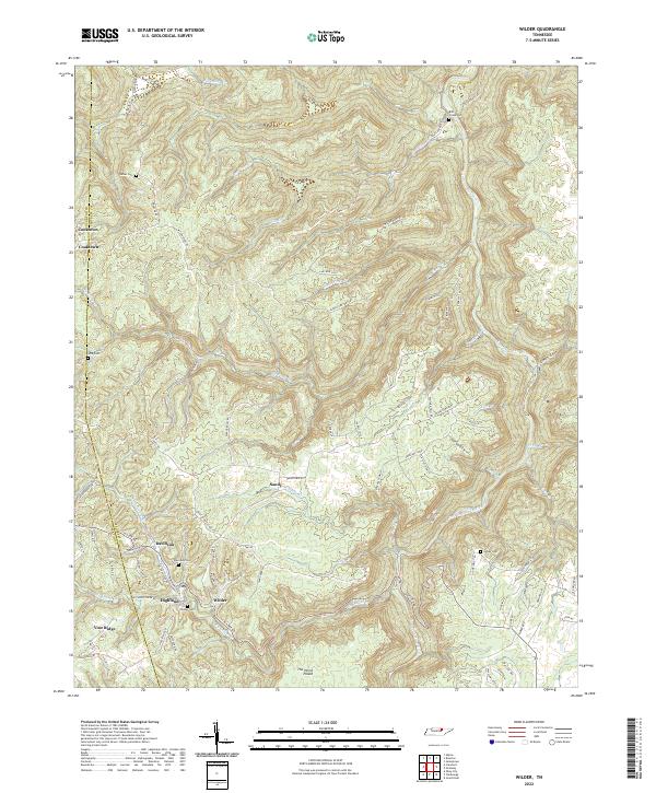 2022 Wilder2022 Print · USGSSettlements in the Overton and Fentress county borderlands appear in high detail during this recent period. Genealogists can trace family names at Bills Greek Cem or Turner Cem and explore the hills surrounding Davidson and Wilder.
 - 2022 Map of Grimsley, 2022 Print
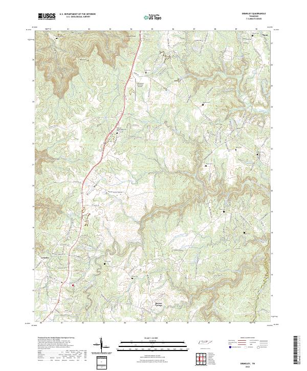 2022 Grimsley2022 Print · USGSFentress County's rural uplands and plateau gorges come into focus in this contemporary survey of the communities south of Jamestown. Genealogists and historians can trace local family landmarks through sites like the Roanoke United Methodist Church Cem, Tench Cem, and Banner Springs.
 - 2022 Map of Jamestown, 2022 Print
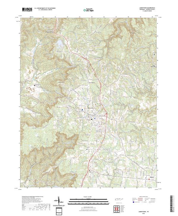 2022 Jamestown2022 Print · USGSJamestown and the surrounding Fentress County plateau are shown in fine detail during the early 2020s. Genealogists and local historians can trace family locations through numerous sites like Livingston Cemetery, the George Wood Family Cem, and landmarks such as The Temple.
 - 2022 Map of Riverton, 2022 Print
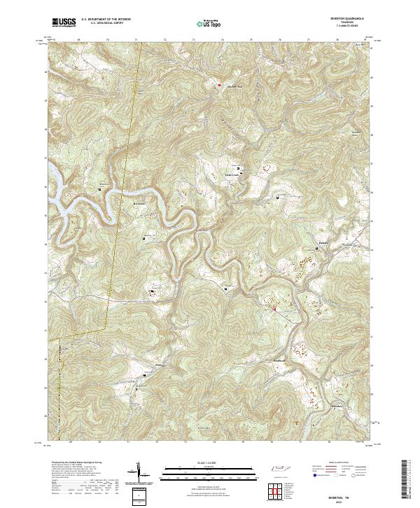 2022 Riverton2022 Print · USGSThe rural communities of Fentress County are shown here as they appeared in the early 2020s, centered on the winding East Fork Obey River. Researchers can trace local lineage through several family-named landmarks like Smith Cem, Wright Cem, and the settlement at Little Crab.
 - 2022 Map of Moodyville, 2022 Print
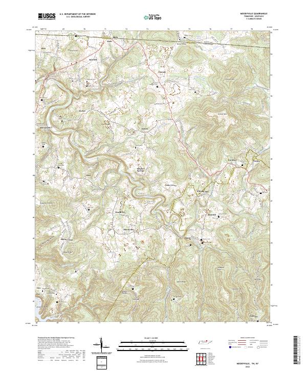 2022 Moodyville2022 Print · USGSThe Tennessee-Kentucky borderlands come alive in this survey of Pickett County, showing the region as it is today. Researchers can trace family history through dozens of sites like Gilreath Mill, Edgefield Cem, and the river community of Amonette Bend.
 - 2022 Map of Barthell SW, 2022 Print
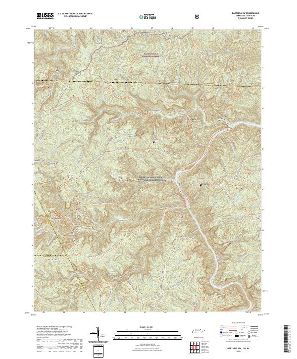 2022 Barthell SW2022 Print · USGSThe borderlands of Tennessee and Kentucky are captured here in a period of transition as timber and homesteading routes became a modern recreation network. Researchers can trace family history at Terry Cem and Slavens Cem or follow the Sheltowee Trace Trl.
 - 2022 Map of Pall Mall, 2022 Print
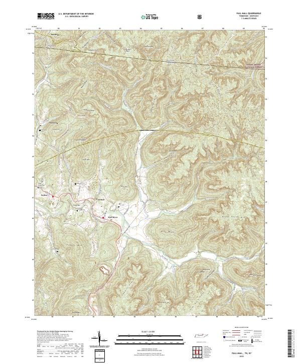 2022 Pall Mall2022 Print · USGSThe Wolf River valley in Fentress County reveals a landscape of enduring rural settlements and family landmarks. Genealogists can locate several historic burial grounds, including Wolf River Cem and Travisville Cem, along with the communities of Pall Mall and Forbus.
 - 2022 Map of Clarkrange, 2022 Print
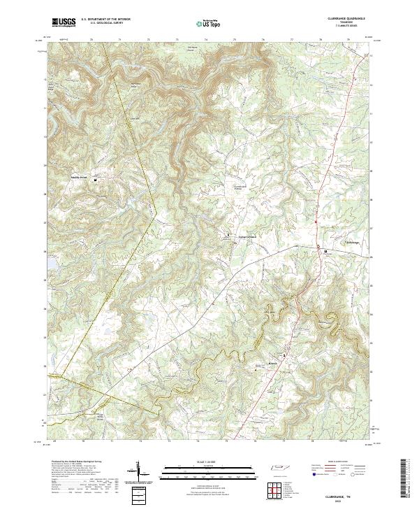 2022 Clarkrange2022 Print · USGSThe Cumberland Plateau landscape near Clarkrange is captured here in the twenty-first century, showing the rural communities and cemeteries of Fentress County. Genealogy enthusiasts can locate family burial grounds like Muddy Pond Cem and Mount Union Cem, or trace the Tennessee Valley Divide and the waters of Hurricane Cr.
 - 2022 Map of Sharp Place, 2022 Print
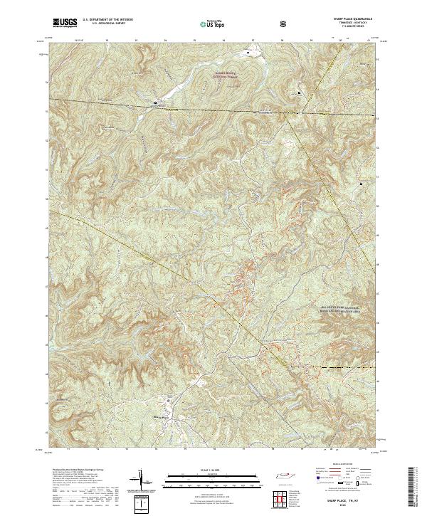 2022 Sharp Place2022 Print · USGSThe Tennessee-Kentucky borderlands come into focus in the early 2020s, showing a landscape defined by deep ridges and protected forests. Family historians can locate several local burial sites including Sharp Cem, Blevins Cem, and the Sharp Place Cem.
 - 2022 Map of Jones Knob, 2022 Print
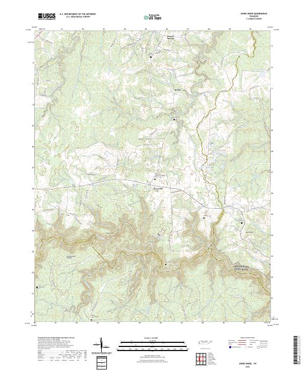 2022 Jones Knob2022 Print · USGSSettlement and terrain on the Cumberland Plateau are captured here as the twenty-first century began. Researchers can trace family history through several burial grounds, such as Durham Cem and Wattenbarger Cem, near the community of Jonesville.
 - 2022 Map of Burrville, 2022 Print
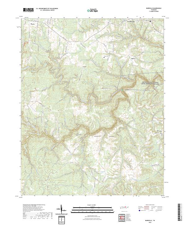 2022 Burrville2022 Print · USGSThe Cumberland Plateau in Fentress and Morgan counties is shown here as a landscape of deep river forks and high ridges. Genealogists can trace family locations near Burrville and Allardt, or locate burial sites like Fellowship Cem and Mount Vernon Cem.
 - 2022 Map of Honey Creek, 2022 Print
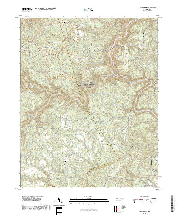 2022 Honey Creek2022 Print · USGSThe Big South Fork gorge in Scott County is shown here in the contemporary era, where deep river canyons meet high plateau ridges. Researchers can locate ancestral sites like Blevins Cem and Mount Helen Cem alongside settlements at Gernt and Zenith.
 - 2022 Map of Stockton, 2022 Print
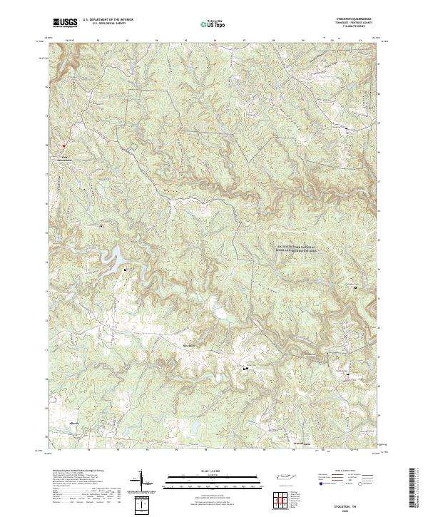 2022 Stockton2022 Print · USGSFentress County's rugged plateau country is shown here in the 2020s, dominated by the transition from rural settlements to protected wilderness. Local historians can trace family roots through numerous upland burial sites like Royalston Cem and Thompkin Cem or locate old crossings near The Narrows.
 - 2022 Map of Rugby, 2022 Print
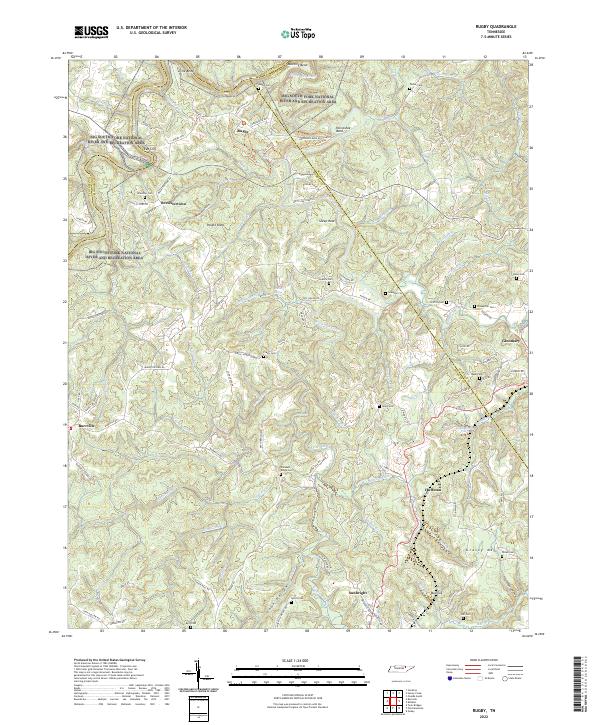 2022 Rugby2022 Print · USGSThe Tennessee Cumberland Plateau is shown here during a period of modern conservation and quiet rural life. Family researchers can trace ancestral locations through numerous scattered sites like Brewster Cem, Pleasant Ridge Cem, and the historic settlement of Rugby.
End of results
Showing maps 1-14 of 14
Top cities of Fentress County
Frequently asked questions
- What are the different types of historical maps available for Fentress County?
- What is the oldest map of Fentress County?
- Where can I purchase historical maps of Fentress County for my home or office?
- Where can I download high-res historical maps of Fentress County?
- Are there historical topographic maps available for Fentress County?
- Is there historical aerial imagery available for Fentress County?
- Where are historical maps of Fentress County sourced from?