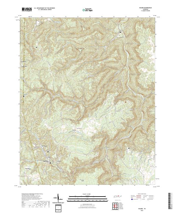
2022 Map of Wilder
USGS Topo · Published 2022About this map
Wilder and Davidson sit as the primary settlements in this deeply dissected portion of the Cumberland Plateau, where the Overton Co Fentress Co boundary line cuts through the high ridges. This 2022 survey illustrates a landscape defined by sharp elevation changes, with communities like Highland and Vine Ridge perched atop the highlands overlooking the narrow valleys of the East Fork Obey River and its numerous tributaries. The map serves as a vital record for family researchers, pinpointing several remote burial sites including Sells Cem, Wilder Cem, and Davidson Cem. The presence of The Horse Pound, a distinctive natural basin, and the winding course of Big Laurel Cr reflect the complex hydrology of the region. The transport network is a mix of older ridge-running paths like Wilson Ridge RD and newer access routes such as Veterans Loop, showing how modern infrastructure follows the traditional contours of the Tennessee hills.
Find a feature on this map
80 named features on this map. Tap any name to fly to it.
Don’t see what you’re looking for? This feature index may not catch every label — zoom into the map to look around manually.
Map Details
Editions of this 2022 Wilder Map
This is the sole edition of this map. No revisions or reprints were ever made.
Other maps of this area

1895 · Wartburg
USGS Topo · 1:125,000

1896 · Wartburg
USGS Topo · 1:125,000

1897 · Standingstone
USGS Topo · 1:125,000

1898 · Standingstone
USGS Topo · 1:125,000

1935 · Clarkrange
USGS Topo · 1:24,000

1936 · Jones Knob
USGS Topo · 1:24,000

1946 · Clarkrange
USGS Topo · 1:24,000

1946 · Obey City
USGS Topo · 1:24,000
1949 · Jones Knob
USGS Topo · 1:24,000
1950 · Clarkrange
USGS Topo · 1:24,000