Old Maps of Fentress County, Tennessee for Metal Detecting
Plan your next treasure hunt with 103 historic maps of Fentress County. Find old homesites, ghost towns, trails, and gathering spots that may be lost to time — perfect for identifying promising metal detecting locations.
- Locate forgotten sites: Uncover places like long-lost settlements, abandoned rail lines, or gathering spots.
- Plan better hunts: Use map overlays combined with LiDAR or satellite views to narrow in on historically rich areas.
- Made for detectorists: Thousands of hobbyists use these maps to discover relics, coins, and hidden history.
Use these historic maps to boost your research and find new opportunities beneath the surface of Fentress County.
Fentress County, TN maps
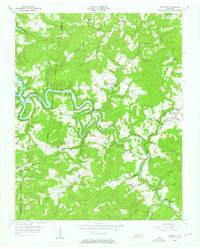
(103)- 1895 Map of Wartburg
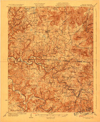
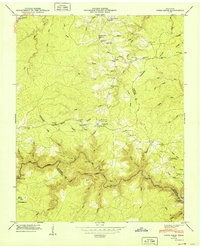
 1895 Wartburg1895 Print · USGSThe Cumberland Plateau of the late nineteenth century comes to life through this record of high-country towns and rivers. Genealogists can trace early homesteads and rail stops from Oneida down to Wartburg, including the distinct colonies at Rugby and Allardt.
 - 1896 Map of Wartburg
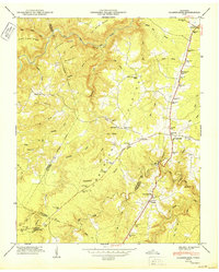
 1896 Wartburg1896 Print · USGSThe Cumberland Plateau in the late nineteenth century is captured here as railroads began to transform the mountain economy. Trace the development of utopian Rugby, the county seat at Wartburg, and remote crossings like Island Ford or Big Lick Gap.6 unique versions available
 - 1897 Map of Standingstone
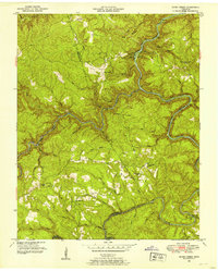
 1897 Standingstone1897 Print · USGSThe Upper Cumberland Plateau at the end of the 19th century shows a landscape of deep coves and rising rail towns. Trace the early tracks of the Nashville and Knoxville railroad or find family roots near Livingston, Standingstone, and the Cedar Springs church.
 - 1898 Map of Standingstone
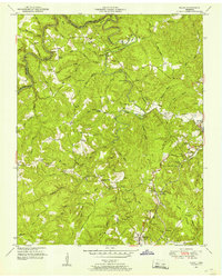
 1898 Standingstone1898 Print · USGSThe Cumberland Plateau of Middle Tennessee comes alive in the late nineteenth century, showing the isolated settlements and early industry of the western mountains. Trace the route of the Nashville and Knoxville RR through Monterey or locate family-named coves like Johnson Cove and Deck Cove.8 unique versions available
 - 1929 Map of Byrdstown
 1929 Byrdstown1929 Print · USGSThe Tennessee-Kentucky state line comes alive in the late twenties, showing a landscape defined by the winding Obey River before the era of modern dams. Researchers can trace ancestral roots through dozens of local sites like Davidson Cem, Franklin Ferry, and the Almshouse.2 unique versions available
 - 1934 Map of Barthell
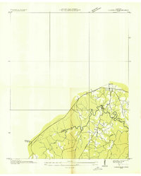
 1934 Barthell1934 Print · USGSMcCreary County during the late 1920s reveals a landscape of industrial outposts and river-bound settlements at the edge of the Tennessee line. Researchers can trace the Kentucky and Tennessee Railway corridor or find family roots at Kidds Crossing, Cooperative, and Laurel Hill Ch.
 - 1934 Map of Pall Mall
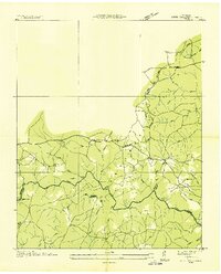
 1934 Pall Mall1934 Print · USGSThe Kentucky-Tennessee borderlands appear in great detail during the late interwar period, showing a landscape of remote mountain hamlets and schools. Genealogists can locate family landmarks such as Edwards Chapel, Slickford, and the Parmley Sch among the cliffs and ridges.
 - 1935 Map of Clarkrange
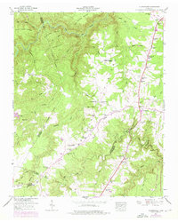
 1935 Clarkrange1935 Print · USGSThe Cumberland plateau comes into focus during the mid-thirties as the newly constructed Alvin G York Highway began transforming the region. Genealogists and historians can trace old homestead paths and early settlements like Clarkrange and Rinnie.
 - 1936 Map of Jones Knob
 1936 Jones Knob1936 Print · USGSFentress and Morgan counties in the mid-1930s reveal a landscape of high plateaus and vital river crossings. Researchers can locate remote rural landmarks including Jones Sch, Ashburn Ford, and the distinctive Jones Knob among the deep creek basins.
 - 1946 Map of Clarkrange, 1976 Print
 1946 Clarkrange1976 Print · USGSThe rural heart of the Tennessee Cumberland Plateau comes into focus in the mid-1940s, centered on the crossroads of Clarkrange. Genealogists and local historians can trace family locations near Union Grove Sch, Muddy Pond, and the Alvin C York Highway.
 - 1949 Map of Jones Knob
 1949 Jones Knob1949 Print · USGSThe Tennessee mountain plateau in the late 1940s is captured here, showing the rural communities of Fentress and Morgan counties. Researchers can locate remote schools and river crossings, from Roslin Sch and Springs Chapel to the historic Jones Ford.3 unique versions available
 - 1950 Map of Clarkrange
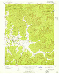
 1950 Clarkrange1950 Print · USGSMid-century Fentress County is defined here by the high-plateau route of the Alvin C York Highway and the rugged breaks of the Cumberland Plateau. You can trace family homesteads near Muddy Pond, local schools like Martha Washington School, and the crossroads at Clarkrange.2 unique versions available
 - 1952 Map of Honey Creek, 1953 Print
 1952 Honey Creek1953 Print · USGSScott and Fentress counties are documented in the early 1950s, showing a landscape of river-carved ridges and remote homesteads. Genealogists can trace family connections at Blevins Cem or locate the sites of Honey Creek School and Zenith.6 unique versions available
 - 1952 Map of Rugby, 1953 Print
 1952 Rugby1953 Print · USGSThe Morgan and Scott County borderlands appear here in the early fifties as a landscape of timbered hills and railway towns. Researchers can trace family history through numerous burial sites like Rugby Cem and Webb Cem or follow the Southern Railway through Sixteen Tunnel.4 unique versions available
 - 1954 Map of Stockton, 1955 Print
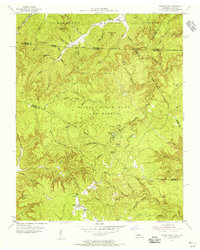
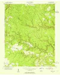 1954 Stockton1955 Print · USGSMid-century Fentress County is captured here in a moment of rural stability before modern development altered the plateau landscape. Genealogists can trace family footprints through the Stockton Sch and numerous burial grounds like Royalston Cem and Christian Cem.6 unique versions available
 - 1954 Map of Burrville, 1955 Print
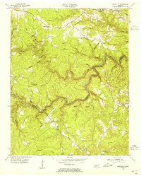 1954 Burrville1955 Print · USGSMid-century Fentress County is defined here by the deep gorge of the Clear Fork and the remote settlements of the plateau. Local historians can locate vanished landmarks like Silver Pine Sch and Gatewood Bridge or trace family roots near Armathwaite.4 unique versions available
 - 1954 Map of Jamestown, 1955 Print
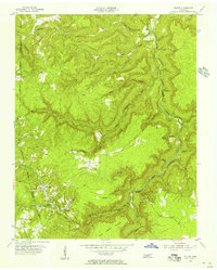
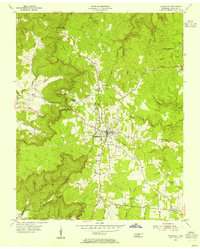 1954 Jamestown1955 Print · USGSJamestown and the surrounding Fentress County plateau are captured here in the mid-fifties, centered on the legacy of the Alvin C York Institute. Genealogists and historians can trace family sites at Crockett Cem, the settlement of Allardt, and local landmarks like the Drive-in Theater.4 unique versions available
 - 1954 Map of Grimsley, 1955 Print
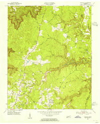 1954 Grimsley1955 Print · USGSMid-century Fentress County is captured here as the Cumberland Plateau plateau communities of Grimsley and Banner Springs centered along the Alvin C York Highway. Researchers can locate numerous family burial grounds and country schools like the Tench Sch and Ward Cem.4 unique versions available
 - 1954 Map of Pall Mall, 1956 Print
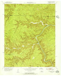
 1954 Pall Mall1956 Print · USGSThe borderlands of Tennessee and Kentucky come alive in the mid-1950s, centered on the community of Pall Mall. Trace local history through the many rural landmarks of the Wolf River valley, including York Bible Sch, Travisville Ch, and the Alvin C York Highway.4 unique versions available
 - 1955 Map of Sharp Place, 1956 Print
 1955 Sharp Place1956 Print · USGSThe Tennessee-Kentucky borderlands come alive in the mid-fifties, showing a landscape shaped by national forests and small ridge-top communities. Genealogists can locate family sites like Akers Chapel, Sharp Place Cemetery, and the Langham School.5 unique versions available
 - 1955 Map of Wilder, 1956 Print
 1955 Wilder1956 Print · USGSMid-century coal country in Fentress County is captured here just as the extractive economy reshaped the Cumberland Plateau. Researchers can trace the legacy of industrial sites like the Strip Mines and the Tennessee Central railroad near Wilder and Davidson.3 unique versions available
 - 1955 Map of Barthell SW, 1956 Print
 1955 Barthell SW1956 Print · USGSThe Tennessee and Kentucky borderlands in the mid-fifties reveal a landscape of deep river gorges and isolated ridge-top schools. Genealogists and historians can trace family locations along No Business Creek and find the site of the Station Camp Sch.4 unique versions available
 - 1956 Map of Riverton, 1957 Print
 1956 Riverton1957 Print · USGSThe Tennessee uplands near the Pickett and Fentress county line are seen here in the mid-fifties, just as the Dale Hollow Reservoir altered the local valleys. Genealogists can trace remote family sites like Hinds Cem, the Cedar Grove Ch, and schools like Broad Door Sch.3 unique versions available
 - 1956 Map of Corbin, 1966 Print
 1956 Corbin1966 Print · USGSThe Kentucky and Tennessee borderlands are captured here in the mid-fifties, showing the region's shift toward modern interstate travel and reservoir development. Genealogists and historians can trace old community lines near Albany and Monticello or locate early rail junctions along the Southern and Tennessee Central lines.3 unique versions available
 - 1958 Map of Corbin
 1958 Corbin1958 Print · USGSThe Upper Cumberland borderlands appear in the late 1950s as massive reservoirs and early atomic-era growth reshape the region. Trace family roots and vanished landmarks near Lake Cumberland, Oak Ridge, and the Cumberland National Forest.
Showing maps 1-25 of 103
Top cities of Fentress County
Frequently asked questions
- What are the different types of historical maps available for Fentress County?
- What is the oldest map of Fentress County?
- Where can I purchase historical maps of Fentress County for my home or office?
- Where can I download high-res historical maps of Fentress County?
- Are there historical topographic maps available for Fentress County?
- Is there historical aerial imagery available for Fentress County?
- Where are historical maps of Fentress County sourced from?