Old Maps of Franklin County, Tennessee for Metal Detecting
Plan your next treasure hunt with 185 historic maps of Franklin County. Find old homesites, ghost towns, trails, and gathering spots that may be lost to time — perfect for identifying promising metal detecting locations.
- Locate forgotten sites: Uncover places like long-lost settlements, abandoned rail lines, or gathering spots.
- Plan better hunts: Use map overlays combined with LiDAR or satellite views to narrow in on historically rich areas.
- Made for detectorists: Thousands of hobbyists use these maps to discover relics, coins, and hidden history.
Use these historic maps to boost your research and find new opportunities beneath the surface of Franklin County.
Franklin County, TN maps
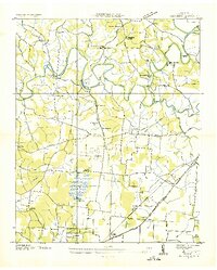
(185)- 1886 Map of Stevenson
 1886 Stevenson1886 Print · USGSNortheast Alabama at the peak of the railroad era shows a landscape tied to the river and the rails. Genealogists can trace family landmarks like Coffey's Store or locate river crossings such as Caperton Ferry and Snodgrass Ferry.
 - 1888 Map of Scottsboro
 1888 Scottsboro1888 Print · USGSNortheast Alabama is shown in the late nineteenth century as a land of steep plateaus and vital river crossings. Genealogists and researchers can trace the early rail-and-river economy through family landmarks like Caldwell's Ferry and the Bell Factory textile site.
 - 1892 Map of Scottsboro
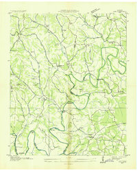
 1892 Scottsboro1892 Print · USGSJackson County and the Tennessee River valley are captured here in the late nineteenth century, just as railroads began to reshape local commerce. Genealogists can trace family-named sites like Owen's Cross Roads, Carrick Mill, and Larkin Landing.5 unique versions available
 - 1892 Map of Stevenson
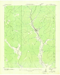
 1892 Stevenson1892 Print · USGSNortheast Alabama and the Tennessee border in the 1890s reveal a landscape of mountain coves and vital river crossings. Genealogists and historians can trace rail junctions at Stevenson, river landings like Coffey's Ferry, and landmarks like Nickajack Cave.
 - 1895 Map of Stevenson
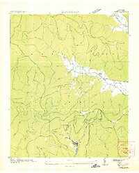
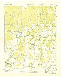
 1895 Stevenson1895 Print · USGSThe Tennessee River valley and surrounding plateaus were a hub of rail and river commerce at the close of the century. Genealogists can trace family crossings at Island Creek Ferry or locate old communities like Bellefonte, Stevenson, and Valley Head.6 unique versions available
 - 1895 Map of Sewanee
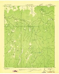
 1895 Sewanee1895 Print · USGSThe Cumberland Plateau and Sequatchie Valley come alive in the late nineteenth century, showing a landscape shaped by coal, iron, and the rails. Genealogists and historians can trace family-named coves and industrial sites like the Cowan Tunnel, Beersheba Springs, and the Stone Quarry.6 unique versions available
 - 1928 Map of Decherd
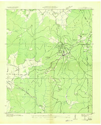
 1928 Decherd1928 Print · USGSFranklin County in the late twenties shows a landscape defined by the rise of the Cumberland Mountains and the busy lines of the Nashville Chattanooga and St Louis Railway. Genealogists can locate family landmarks in Motlow Cove or trace students at Peabody Sch and Hatchett Sch.3 unique versions available
 - 1936 Map of King Cove
 1936 King Cove1936 Print · USGSThe Alabama-Tennessee borderlands appear here in the mid-1930s, showing a landscape of high ridges and isolated mountain coves. Researchers can locate family landmarks like Crowell Cem and Maxwell Cem or rural centers like Howard Hill Sch.
 - 1936 Map of Sewanee
 1936 Sewanee1936 Print · USGSThe Cumberland Plateau and the Sewanee campus are captured here in the mid-1930s, showing a unique mountain landscape of academics and industry. Trace family roots at Cherry Cem or follow the path of the Cowan Tunnel and the Kelley Mine.
 - 1936 Map of Alto
 1936 Alto1936 Print · USGSThe Elk River valley at the Coffee and Franklin County line was a landscape of small settlements and river crossings in the mid-1930s. Genealogists can trace family roots through landmarks like Patton Sch, Bells Mill, and the Abernathy Cem.
 - 1936 Map of Orme
 1936 Orme1936 Print · USGSThe Cumberland Plateau mining economy and valley settlements are preserved in this mid-1930s survey of Marion County. Genealogists and industrial historians can trace the rail lines at Orme, the Battle Creek Mines, and community sites like Sweden Cove Sch.
 - 1936 Map of Sinking Cove
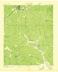
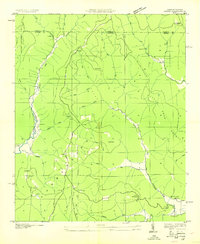
 1936 Sinking Cove1936 Print · USGSFranklin County and the Cumberland Plateau are captured here in the mid-1930s, showing a landscape of rail-dependent industry and isolated mountain hollows. Researchers can trace family roots through Sherwood and local landmarks like Sinking Cove Sch and Evans Cem.
 - 1936 Map of Cumberland Springs
 1936 Cumberland Springs1936 Print · USGSMoore County and Lynchburg are captured in the mid-1930s as a land of narrow hollows and high ridges. Researchers can trace the early layout of Lynchburg and find community centers like Raysville Sch, Smith Chapel, and Cumberland Springs.
 - 1936 Map of Beans Creek
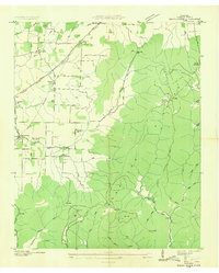 1936 Beans Creek1936 Print · USGSFranklin County at the height of the mid-thirties reveals a landscape of high plateau ridges and valley settlements connected by the Nashville Chattanooga and St Louis Railway. Genealogists and historians can trace several local landmarks, from Old Salem Ch and Walnut Grove Sch to the homes of Maxwell.
 - 1936 Map of Monteagle
 1936 Monteagle1936 Print · USGSMonteagle and the surrounding Cumberland Plateau are captured here in the mid-1930s, showing the complex interaction between mountain travel and valley settlement. Researchers can trace historic schools and churches like Jumpoff Sch, St Johns Ch, and the high-altitude Monteagle Falls.
 - 1936 Map of Hytop
 1936 Hytop1936 Print · USGSThe high plateau of Jackson County is captured here in the mid-1930s as the Tennessee Valley Authority began mapping the Cumberland region. Genealogists and historians can trace family-named landmarks and rural hubs like Hytop, the Walnut Grove Sch, and Jericho.
 - 1936 Map of Winchester
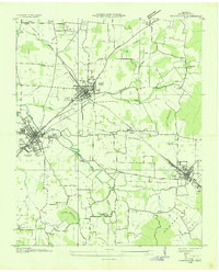 1936 Winchester1936 Print · USGSFranklin County's rail-connected towns of Winchester and Decherd are shown here in the mid-1930s as they transition during the TVA era. Genealogists can trace numerous local landmarks including Pig Trot Sch, Owen Chapel, and the Mc Illhearn Cem.
 - 1936 Map of Huntland
 1936 Huntland1936 Print · USGSFranklin County's rail-and-mill economy is on full display in the mid-thirties as the Nashville Chattanooga and St Louis Ry connects Huntland and Elora. Researchers can trace the heritage of rural communities through sites like Stonewall Mill, Simmons Chapel, and the Mc Clure Cem.
 - 1936 Map of Belvidere
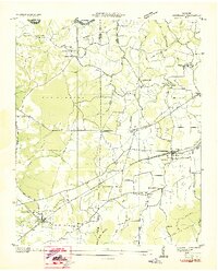
 1936 Belvidere1936 Print · USGSFranklin County's rural landscape is captured here in the mid-1930s as a network of river-bottom farms and small rail towns. Genealogists can locate family landmarks like Sorrick Cem, Owl Hollow Mill, and the Winchester Springs Sch along the river.
 - 1936 Map of Pitcher Ridge
 1936 Pitcher Ridge1936 Print · USGSFranklin County mountain life is detailed in this mid-1930s survey of the high plateau and its deep, spring-fed coves. Researchers can trace the footprints of highland schools like Little Mountain Sch and find remote landmarks such as the Lookout Tower and The Sinks.
 - 1936 Map of Camp Peay
 1936 Camp Peay1936 Print · USGSIn the mid-1930s, the area around Tullahoma and Estill Springs was a hub of military and rail activity. Genealogists and historians can trace the National Guard Reservation at Camp Peay, family burial sites like Maplewood Cem, and local landmarks including the Girls Vocational Sch.
 - 1936 Map of Doran Cove
 1936 Doran Cove1936 Print · USGSJackson County and the Tennessee River are captured here in the mid-1930s as the Tennessee Valley Authority planned the region's modernization. Researchers can locate family landmarks like the Rosenwald Sch, Widows Bar Lock and Dam, and Bonaventure Cem.
 - 1936 Map of Eureka
 1936 Eureka1936 Print · USGSThe Alabama-Tennessee borderlands appear here in the mid-1930s, showing a landscape of deep coves and plateau summits. Genealogists can trace family landmarks like Allison Mill, Bell Store, and the John Sumach Reservation along the creek bottoms.
 - 1936 Map of Capitol Hill
 1936 Capitol Hill1936 Print · USGSThe Tennessee Valley during the mid-1930s shows a landscape of river-dependent industry and small rural crossroads. Genealogists can trace family roots through landmarks like Knight Ch, Call Sch, and the riverside operations at Dixon Mill.
 - 1936 Map of Lois
 1936 Lois1936 Print · USGSMoore County at the start of the Tennessee Valley Authority era shows a landscape of river-bend farms and scattered crossroads settlements. Genealogists can locate family-named landmarks such as Gray Cem, Browningtown, and the Liberty Hill Sch along the Elk River.
Showing maps 1-25 of 185
Top cities of Franklin County
- Winchester historical maps
- Sewanee historical maps
- Estill Springs historical maps
- Decherd historical maps
- Cowan historical maps
- Huntland historical maps
Frequently asked questions
- What are the different types of historical maps available for Franklin County?
- What is the oldest map of Franklin County?
- Where can I purchase historical maps of Franklin County for my home or office?
- Where can I download high-res historical maps of Franklin County?
- Are there historical topographic maps available for Franklin County?
- Is there historical aerial imagery available for Franklin County?
- Where are historical maps of Franklin County sourced from?