2020s Maps of Hardeman County, Tennessee
Explore 24 historic maps of Hardeman County from the 2020s. These maps offer a rare glimpse into what life looked like during the 2020s — showing old roads, neighborhoods, homes, and landmarks that have changed or disappeared over time.
Whether you're researching your family's past, planning a metal detecting trip, or studying how Hardeman County's landscape evolved across the 2020s, these high-resolution maps are a powerful tool for exploring the history of this region.
- Focus on a specific era: All maps on this page are from the 2020s, giving you a focused view of this time period.
- See what’s changed: Compare century-old streets, trails, and buildings to today's modern landscape using overlays and satellite layers.
- Research with precision: Use these maps for genealogy, historical research, land use analysis, or educational projects.
- View, download, or print: Maps are fully viewable online in high resolution, and can be downloaded or printed for your own records.
Start exploring Hardeman County's history through authentic maps from the 2020s. This is your window into the past.
Hardeman County, TN maps
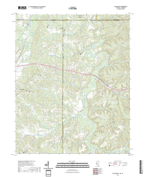
(24)- 2020 Map of Chalybeate, 2020 Print
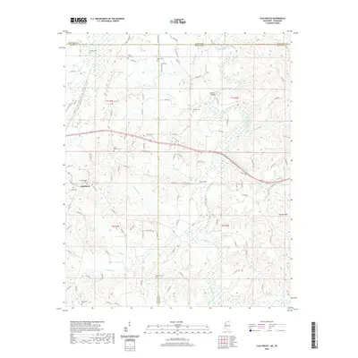 2020 Chalybeate2020 Print · USGSCovers Hardeman County, including Chalybeate, Alcorn County, and other nearby areas
 - 2021 Map of Canaan, 2021 Print
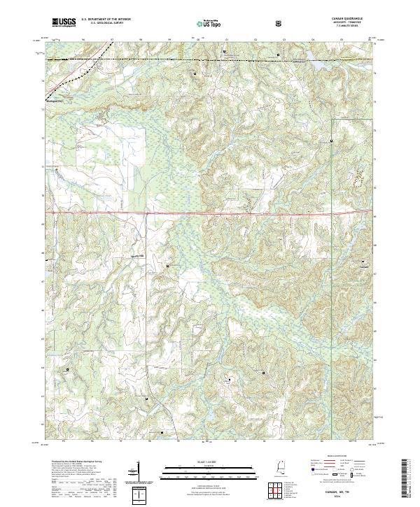
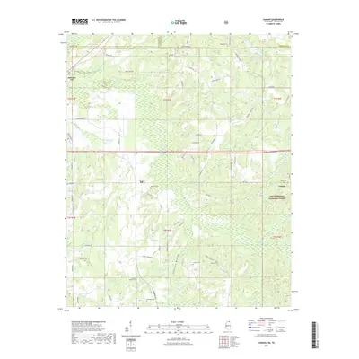 2021 Canaan2021 Print · USGSCovers Hardeman County, including Canaan, Spring Hill, and other nearby areas
 - 2021 Map of Camp Hill, 2021 Print
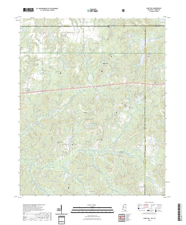
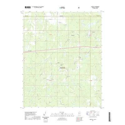 2021 Camp Hill2021 Print · USGSCovers Hardeman County, including Black Jack, Brody, and other nearby areas
 - 2021 Map of Walnut, 2021 Print
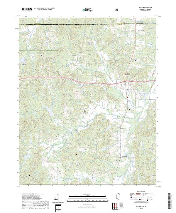
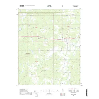 2021 Walnut2021 Print · USGSCovers Hardeman County, including Walnut, Mount Moriah, and other nearby areas
 - 2022 Map of Grand Junction, 2022 Print
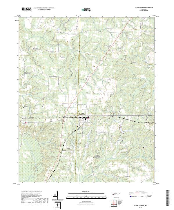 2022 Grand Junction2022 Print · USGSGrand Junction and La Grange are depicted in this recent survey, capturing the agricultural character of the Tennessee borderlands. Genealogists can locate numerous burial sites including John Walker Jones Family Cem and Spring Chapel African Methodist Episcopal Church Cem.
 - 2022 Map of Middleburg, 2022 Print
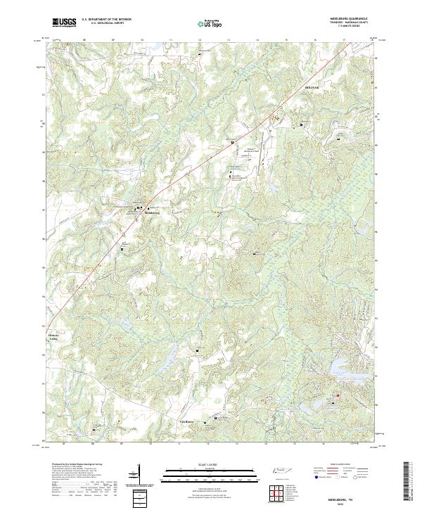 2022 Middleburg2022 Print · USGSHardeman County settlements like Middleburg and Van Buren are documented here in the early twenty-first century. Family history researchers can trace local roots through numerous sites including Spring Hill Cem, Clifft Cem, and Mount Zion Cem.
 - 2022 Map of Saulsbury, 2022 Print
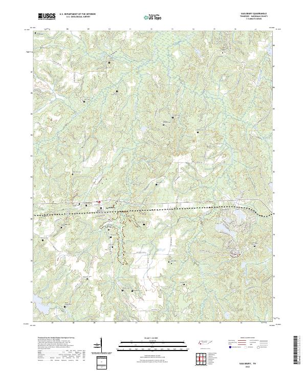 2022 Saulsbury2022 Print · USGSSaulsbury and the southern borderlands of Tennessee are shown here as they appeared in the early 2020s. Researchers can locate dozens of family burial sites and rural landmarks, including the Saulsbury Methodist Church Cem, Elliott Chapel Cem, and Liberty Hill Cem.
 - 2022 Map of Mercer, 2022 Print
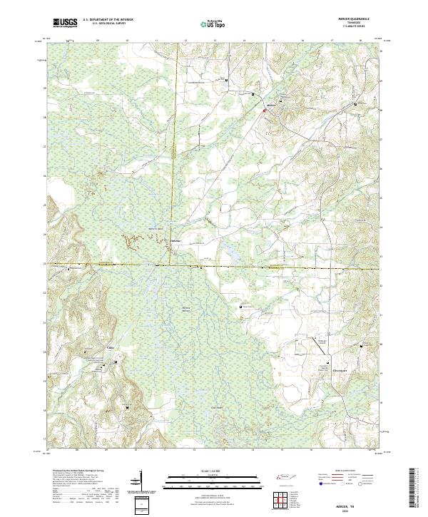 2022 Mercer2022 Print · USGSWest Tennessee's river bottoms and rural crossroads are preserved here in the early twenty-first century. Family historians can trace numerous burial grounds and settlements like Vildo, Hatchie, and the Johnson Chapel Christian Methodist Episcopal Church Cem.
 - 2022 Map of Bolivar West, 2022 Print
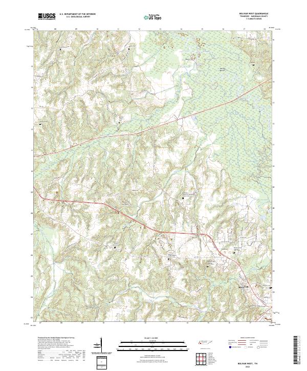 2022 Bolivar West2022 Print · USGSThe rural landscape west of Bolivar is captured here in the early 2020s, showing a region defined by the Hatchie River and its extensive bottoms. Family researchers can locate numerous historic sites, including Pirtle Cem, Norment Cem, and the Green Grove Baptist Church.
 - 2022 Map of Hillville, 2022 Print
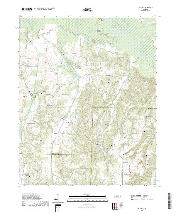 2022 Hillville2022 Print · USGSWest Tennessee's rural landscape at the intersection of Haywood and Hardeman counties reveals a network of historic river bottoms and family settlements. Researchers can trace genealogical roots through numerous sites like Simon Chapel Cem, Eurekaton, and the Hatchie River floodplains.
 - 2022 Map of Hickory Valley, 2022 Print
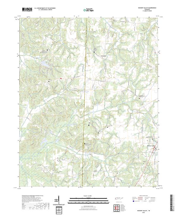 2022 Hickory Valley2022 Print · USGSHardeman and Fayette Counties meet in this rural Tennessee landscape during the early 2020s, showing a well-preserved network of country churches and family cemeteries. Genealogists can locate legacy sites like Mays Hill Missionary Baptist Church Cem and the Hickory Valley Cemetery.
 - 2022 Map of Whiteville, 2022 Print
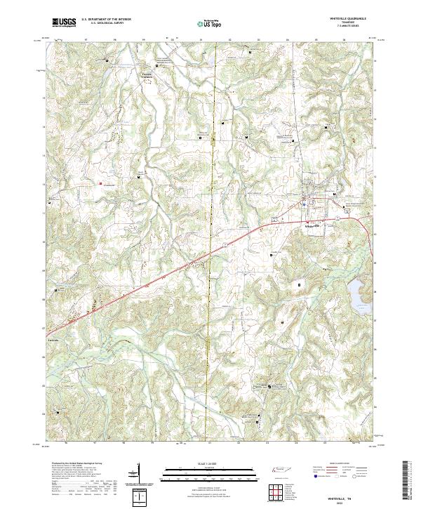 2022 Whiteville2022 Print · USGSThe rural landscape of Hardeman County and Fayette County comes to life in this contemporary survey of the West Tennessee interior. Genealogists can trace family heritage through numerous landmarks like Fayette Corners, Smyrna Cem, and Antioch Missionary Baptist Church Cem.
 - 2022 Map of Middleton, 2022 Print
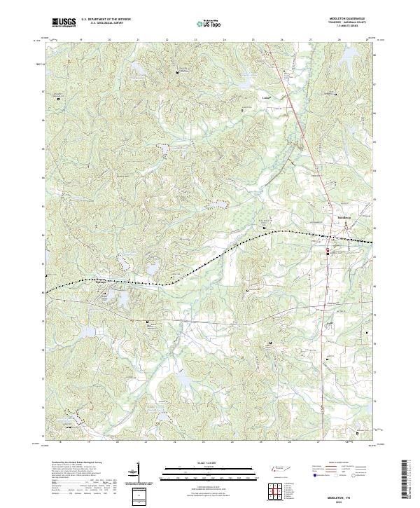 2022 Middleton2022 Print · USGSMiddleton and the rural reaches of Hardeman County are shown here in the early 2020s, dominated by the winding Porters Creek system. Genealogists can locate numerous family burial sites, such as the Bryan Bishop Family Cem, Luttrell Cem, and the Macon Jordan Family Cem.
 - 2022 Map of Hebron, 2022 Print
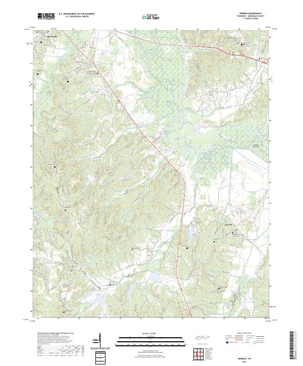 2022 Hebron2022 Print · USGSHardeman County's rural landscape is mapped here in the early 2020s, defined by the winding Hatchie River and its vast bottomlands. Genealogists can locate numerous family-named landmarks including Hazelgrove Cem, Sasser Cem, and the community of Hebron.
 - 2022 Map of Medon, 2022 Print
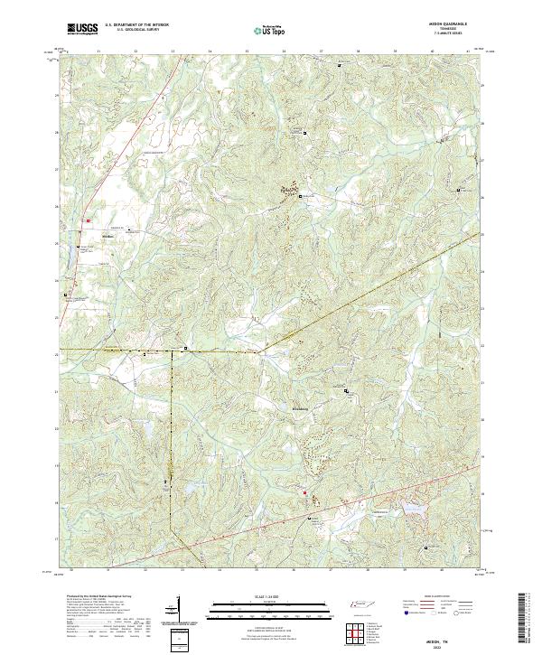 2022 Medon2022 Print · USGSMadison County and its neighboring borders are documented here in recent years, showing a landscape of rural crossroads and family homesteads. Genealogists can trace local heritage through numerous sites like Clover Creek Baptist Church Cem, Parkburg, and Lake Placid.
 - 2022 Map of Bolivar East, 2022 Print
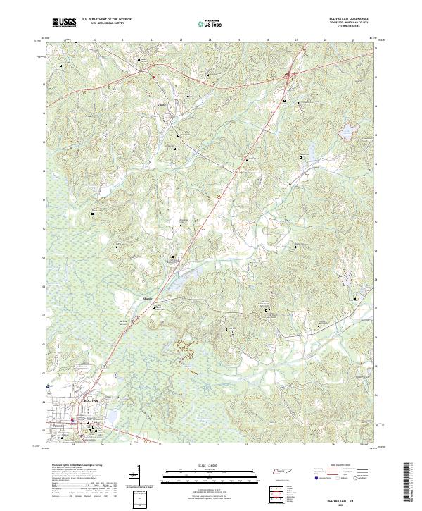 2022 Bolivar East2022 Print · USGSThe Hatchie River floodplain and the community of Bolivar are captured in this recent survey of Hardeman County. Researchers can trace family history through dozens of landmarks like Parker Hill Cem, Toone, and the Hardeman County Courthouse.
 - 2022 Map of Hornsby, 2022 Print
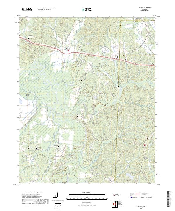 2022 Hornsby2022 Print · USGSHornsby and the Hatchie River bottomlands are captured here in the early twenty-first century, showing a landscape defined by wetlands and small rural communities. Researchers can locate numerous family-named landmarks and burial sites, including McCalip Chapel Cem, Brint Family Cem, and Serles.
 - 2022 Map of Pocahontas, 2022 Print
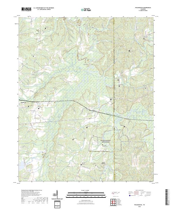 2022 Pocahontas2022 Print · USGSSouthern Hardeman County is captured here in the modern era, showing the quiet landscape around Pocahontas and Essary Springs. Trace local family history at Earnest Family Cem and the Civil War legacy within Shiloh National Battlefield.
 - 2022 Map of Silerton, 2022 Print
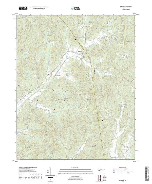 2022 Silerton2022 Print · USGSHardeman and Chester counties are documented here in the early 2020s, showing a rural landscape defined by creek valleys and high ridges. Genealogists can trace numerous historic burial sites such as Hickory Grove Cem, Old Center Cem, and Palestine Church Cem.
 - 2022 Map of Teague, 2022 Print
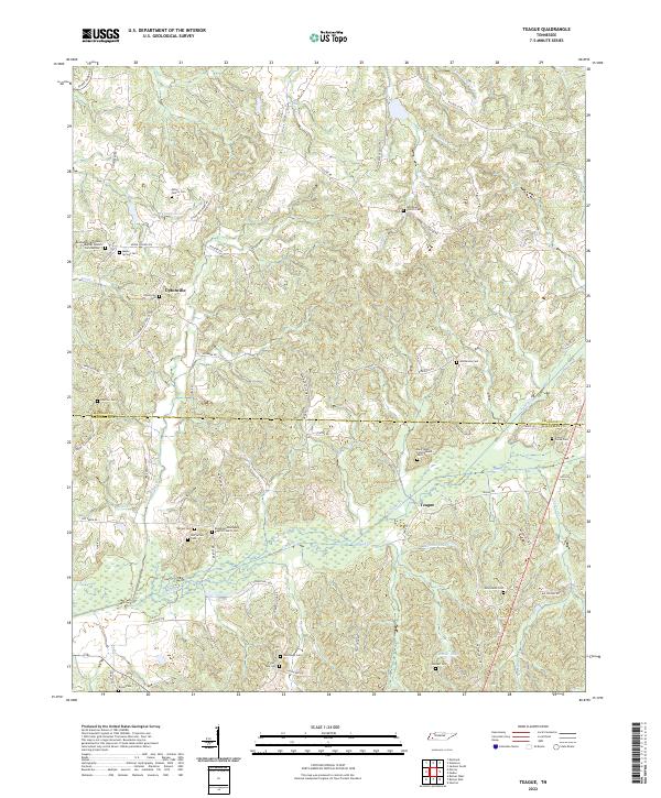 2022 Teague2022 Print · USGSThe border of Madison and Hardeman counties comes alive in this modern survey of rural West Tennessee. Genealogists can trace family roots through numerous sites like Old Vernon Cem, Uptonville Cem, and the Bethlehem Missionary Baptist Church.
 - 2024 Map of Walnut, 2024 Print
 2024 Walnut2024 Print · USGSThe Tippah County hills come into focus in this contemporary survey of the Mississippi-Tennessee borderlands. Genealogists can trace family roots through numerous sites like Mount Hebron Cem, New Salem Cem, and Tipplersville Cem.
 - 2024 Map of Camp Hill, 2024 Print
 2024 Camp Hill2024 Print · USGSBenton and Tippah counties meet at the Tennessee state line in this modern study of the northern Mississippi borderlands. Researchers can locate numerous family burial grounds and rural landmarks such as Zion Chapel Cem, Medlock Cem, and the settlement of Brody.
 - 2024 Map of Canaan, 2024 Print
 2024 Canaan2024 Print · USGSThe borderlands of Benton County and Fayette County come into focus in this recent survey of the North Mississippi countryside. Genealogists can trace family roots through a dozen named burial sites, from McKinzie Cem to the Saint Paul Skipper Springs Church Cem.
 - 2024 Map of Chalybeate, 2024 Print
 2024 Chalybeate2024 Print · USGSThe Tennessee-Mississippi borderlands come alive in this survey of the area around Chalybeate and Essary Springs. Family historians can trace local roots through numerous sites like Camp Ground Cem, Keith Cem, and Ebenezer Methodist Church.
End of results
Showing maps 1-24 of 24
Top cities of Hardeman County
- Bolivar historical maps
- Whiteville historical maps
- Middleton historical maps
- Toone historical maps
- Hornsby historical maps
- Hickory Valley historical maps
See more
Frequently asked questions
- What are the different types of historical maps available for Hardeman County?
- What is the oldest map of Hardeman County?
- Where can I purchase historical maps of Hardeman County for my home or office?
- Where can I download high-res historical maps of Hardeman County?
- Are there historical topographic maps available for Hardeman County?
- Is there historical aerial imagery available for Hardeman County?
- Where are historical maps of Hardeman County sourced from?