Old Maps of Hardeman County, Tennessee for Metal Detecting
Plan your next treasure hunt with 146 historic maps of Hardeman County. Find old homesites, ghost towns, trails, and gathering spots that may be lost to time — perfect for identifying promising metal detecting locations.
- Locate forgotten sites: Uncover places like long-lost settlements, abandoned rail lines, or gathering spots.
- Plan better hunts: Use map overlays combined with LiDAR or satellite views to narrow in on historically rich areas.
- Made for detectorists: Thousands of hobbyists use these maps to discover relics, coins, and hidden history.
Use these historic maps to boost your research and find new opportunities beneath the surface of Hardeman County.
Hardeman County, TN maps
(146)- 1950 Map of Ashland, 1952 Print
 1950 Ashland1952 Print · USGSBenton County at the mid-century is captured here as a landscape of small timber towns and forest clearings before modern development. You can trace early school sites like Holloway Sch and family-centered landmarks such as Whitten Town and Hunters Chapel.3 unique versions available
 - 1950 Map of Pocahontas, 1972 Print
 1950 Pocahontas1972 Print · USGSMid-century Hardeman County is defined here by the meeting of the Hatchie River and Tuscumbia River near the crossroads of two major rail lines. Genealogists can trace family roots through numerous rural landmarks like Oak Grove Ch, Pleasant Hill Sch, and the Essary Springs Cem.
 - 1950 Map of Hebron, 1973 Print
 1950 Hebron1973 Print · USGSThe Hatchie River floodplain and the small community of Hebron are captured at mid-century during a period of rural stability. Family researchers can pinpoint Oak Hill Sch, Salem Cem, and Bowder Hill Ch among the many local landmarks.3 unique versions available
 - 1950 Map of Hornsby, 1973 Print
 1950 Hornsby1973 Print · USGSHardeman County in the early fifties is captured here through its river-bottom landscapes and rural centers like Hornsby. Researchers can trace old family burial sites at Wyatt Cemetery, locate rural schools like Walnut Grove School, and follow the Gulf Mobile and Ohio rail line.3 unique versions available
 - 1950 Map of Middleburg, 1975 Print
 1950 Middleburg1975 Print · USGSHardeman County, Tennessee, is captured here at mid-century as the ILLINOIS CENTRAL railroad linked rural outposts. Local historians can trace family roots through several landmarks, including Good Shepherd Cem, Sugar Hill Sch, and Now Bethel Ch.2 unique versions available
 - 1950 Map of Middleton, 1975 Print
 1950 Middleton1975 Print · USGSHardeman County, Tennessee, is captured here in the early post-war era as a vital rail crossroads. Genealogists and historians can trace established family landmarks such as Sandy Springs Cemetery, Old Antioch School, and the junction of two major railroads in Middleton.2 unique versions available
 - 1950 Map of Grand Junction, 1981 Print
 1950 Grand Junction1981 Print · USGSRailroads converge at Grand Junction in the 1950s, anchoring a landscape of rural schoolhouses and family plantations. Genealogists can trace property and community roots through Ames Plantation, Jones Chapel Sch, and La Grange Cem.
 - 1951 Map of Middleton
 1951 Middleton1951 Print · USGSMiddleton and Hardeman County are shown at a mid-century crossroads where major rail lines intersect. Researchers can trace family sites like Old Bethlehem Cem, Gentrys Chapel, and old schools including Old Antioch Sch.
 - 1951 Map of Middleburg
 1951 Middleburg1951 Print · USGSHardeman County in the early fifties shows a rural landscape where the Illinois Central railroad connects small crossroads. Trace family roots at Good Shepherd Cem or locate the sites of Mathews Sch and New Bethel Ch.
 - 1951 Map of Hebron
 1951 Hebron1951 Print · USGSHardeman County settlements and the winding Hatchie River valley are captured here at mid-century during a period of traditional rural life. Researchers can locate family landmarks like Salem Cem, Oak Hill Sch, and the community of Hebron.
 - 1951 Map of Hornsby
 1951 Hornsby1951 Print · USGSThe area around Hornsby in the early fifties was a landscape of river bottoms and rail-side settlements. Researchers can trace family roots at Brints Chapel and Grantham Cem or follow the old Gulf Mobile and Ohio line.
 - 1951 Map of Hickory Valley
 1951 Hickory Valley1951 Print · USGSHardeman County in the early fifties is captured here as a landscape of small schools and rail-side commerce. Genealogists can trace family roots through the numerous local landmarks, including Woods Cem, Hickory Valley Sch, and Stuart Chapel.3 unique versions available
 - 1951 Map of Grand Junction
 1951 Grand Junction1951 Print · USGSThe rail-and-river landscape of the Tennessee borderlands comes alive in this mid-century survey of the junction between the Southern and Illinois Central lines. Genealogists and historians can trace community roots at Ames Plantation, Jones Chapel Sch, and Pleasant Grove Cem.2 unique versions available
 - 1951 Map of Walnut, 1953 Print
 1951 Walnut1953 Print · USGSThe Mississippi-Tennessee borderlands in the early 1950s show a landscape defined by the Gulf Mobile and Ohio railroad and winding creek valleys. Genealogists can trace family roots through numerous sites like Old Mt Zion Cem, Providence Sch, and Chalybeate.4 unique versions available
 - 1952 Map of Pocahontas
 1952 Pocahontas1952 Print · USGSHardeman and McNairy Counties are shown here in the early fifties, where the Hatchie River and Tuscumbia River converge. Researchers can trace family roots at Essary Springs, Oak Grove Ch, and the Mosses Creek Cem.
 - 1952 Map of Saulsbury
 1952 Saulsbury1952 Print · USGSSaulsbury and its surrounding Tennessee farm country are captured here in the early fifties, centered on the vital Southern railway line. Genealogists can trace family names through landmarks like Pruette Cem and Elliots Chapel or find old school sites like Pleasant Grove Sch.3 unique versions available
 - 1956 Map of Blytheville, 1964 Print
 1956 Blytheville1964 Print · USGSWest Tennessee and the Arkansas Delta come alive in this mid-century survey of the river-and-rail corridor connecting Memphis to Jackson. Genealogists and historians can trace the rail lines of the Louisville and Nashville RR and locate landmarks like Western State Hospital or Fort Pillow State Prison Farm.2 unique versions available
 - 1956 Map of Tupelo, 1967 Print
 1956 Tupelo1967 Print · USGSNortheast Mississippi and parts of Tennessee and Alabama are shown here during the mid-fifties, a time of major reservoir construction and forestry management. Researchers can trace the St Louis-San Francisco RR through Tupelo or locate historic sites like Tishomingo State Park and the University.2 unique versions available
 - 1958 Map of Tupelo
 1958 Tupelo1958 Print · USGSNortheast Mississippi and neighboring Alabama and Tennessee appear here during the late fifties as a region defined by new reservoirs and historic rail lines. Genealogists can trace family locations near Sardis Lake, Woodall Mountain, and the St Louis-San Francisco Ry.
 - 1959 Map of Blytheville
 1959 Blytheville1959 Print · USGSWest Tennessee and Northeast Arkansas meet along the river in the late fifties, during a period of steady industrial and agricultural growth. Genealogists can trace the rail corridors of the Illinois Central through Jackson or explore landmarks like Shiloh National Military Park and Fort Pillow State Prison.
 - 1959 Map of Whiteville, 1960 Print
 1959 Whiteville1960 Print · USGSWest Tennessee’s rural landscape comes into focus during the late fifties as the Louisville and Nashville railroad connects small towns. Local historians can trace family-named sites like Clover Garden Cem, Lewis Sch, and the grounds of Whiteville Lake.3 unique versions available
 - 1959 Map of Hillville, 1964 Print
 1959 Hillville1964 Print · USGSThe tri-county border of Haywood, Hardeman, and Fayette counties comes alive in this late 1950s survey of the Hatchie River basin. Researchers can trace rural life through numerous family cemeteries and country churches like Cedar Chapel, Mt Tabor Ch, and the crossroads at Hillville.
 - 1961 Map of Bolivar West, 1963 Print
 1961 Bolivar West1963 Print · USGSHardeman County's river-bottom landscape and rural communities are preserved here as they appeared in the early sixties. Genealogists and local historians can trace family sites like Norment Cem, Bethlehem Ch, and the extensive grounds of Western State Hospital.2 unique versions available
 - 1961 Map of Medon, 1964 Print
 1961 Medon1964 Print · USGSThe West Tennessee borderlands of Madison, Chester, and Hardeman counties are captured here in the early sixties as a network of rail lines and rural parishes. Genealogists can locate family landmarks like the Rosenwald Sch, Farlow Cem, and Big Springs Ch.3 unique versions available
 - 1961 Map of Silerton, 1964 Print
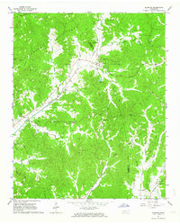 1961 Silerton1964 Print · USGSThe Tennessee countryside along the Hardeman and Chester county line is shown here in the early sixties as a region of deep creek bottoms and rail-side hamlets. Researchers can trace rural family sites through numerous landmarks like Coopers Chapel Cem, Old Center Ch, and the small siding at Todd Siding.2 unique versions available
Showing maps 1-25 of 146
Top cities of Hardeman County
- Bolivar historical maps
- Whiteville historical maps
- Middleton historical maps
- Toone historical maps
- Hornsby historical maps
- Hickory Valley historical maps
See more
Frequently asked questions
- What are the different types of historical maps available for Hardeman County?
- What is the oldest map of Hardeman County?
- Where can I purchase historical maps of Hardeman County for my home or office?
- Where can I download high-res historical maps of Hardeman County?
- Are there historical topographic maps available for Hardeman County?
- Is there historical aerial imagery available for Hardeman County?
- Where are historical maps of Hardeman County sourced from?