1900s (20th Century) Maps of Hardin County, Tennessee
Explore 59 historic maps of Hardin County from the 1900s (20th Century). These maps offer a rare glimpse into what life looked like during the 1900s — showing old roads, neighborhoods, homes, and landmarks that have changed or disappeared over time.
Whether you're researching your family's past, planning a metal detecting trip, or studying how Hardin County's landscape evolved across the 1900s, these high-resolution maps are a powerful tool for exploring the history of this region.
- Focus on a specific era: All maps on this page are from the 1900s, giving you a focused view of this time period.
- See what’s changed: Compare century-old streets, trails, and buildings to today's modern landscape using overlays and satellite layers.
- Research with precision: Use these maps for genealogy, historical research, land use analysis, or educational projects.
- View, download, or print: Maps are fully viewable online in high resolution, and can be downloaded or printed for your own records.
Start exploring Hardin County's history through authentic maps from the 1900s. This is your window into the past.
Hardin County, TN maps
(59)- 1905 Map of Waynesboro
 1905 Waynesboro1905 Print · USGSWayne County and the Tennessee-Alabama borderlands are captured here at the start of the century, showing a network of river landings and old stage stands. Researchers can trace the Nathez Trace and locate historic community hubs like Martins Mills, Whittens Stand, and Clifton.2 unique versions available
 - 1911 Map of Iuka
 1911 Iuka1911 Print · USGSThe tri-state border region of Mississippi, Alabama, and Tennessee is captured here at the peak of the river-landing era. Genealogists can trace family connections through numerous river access points like Shellbank Landing and rural landmarks such as Salem Church and Jackson Ridge School.2 unique versions available
 - 1914 Map of Iuka
 1914 Iuka1914 Print · USGSThe Tennessee River valley at the Mississippi and Alabama border was a busy network of landings and rail junctions in the early twentieth century. Researchers can trace riverfront life at Eastport Landing or locate rural family landmarks like Salem Church and Guthrie School.4 unique versions available
 - 1935 Map of Doskie
 1935 Doskie1935 Print · USGSTishomingo County and the Tennessee borderlands are captured here in the mid-1930s just as the Tennessee Valley Authority began reshaping the local geography. Researchers can trace the rural communities of Doskie and Cross Roads or find family history at Pleasant Hill Ch and Mulberry Sch.
 - 1936 Map of Savannah
 1936 Savannah1936 Print · USGSHardin County was undergoing a major modernization in the mid-1930s as the Tennessee Valley Authority expanded its reach. Researchers can trace early family settlements and rural landmarks from Walkers Academy and Burnt Church to the crossroads at Maddox.
 - 1936 Map of Wolf Pit Ridge
 1936 Wolf Pit Ridge1936 Print · USGSHardin County was a landscape of remote hollows and family homesteads in the mid-1930s, just as modern power lines began to cross the ridges. Genealogists can trace family footprints at Gillises Mills and locate ancestral sites such as Pickins Cem or the Center Star Sch.
 - 1936 Map of Hookers Bend
 1936 Hookers Bend1936 Print · USGSHardin County river life is captured here in the mid-1930s, showing the early infrastructure of the Tennessee Valley Authority along the river. Researchers can trace rural family roots through landmarks like Saltillo Ferry, Goshen Cem, and Antioch Sch.
 - 1936 Map of Counce
 1936 Counce1936 Print · USGSHardin County was in the midst of a massive transformation in the mid-1930s as the TVA began modernizing the river. Genealogists can locate family landmarks like Roberts Cem, Childers Hill Hamburg PO, and the Shady Grove Cem.
 - 1936 Map of Kendrick
 1936 Kendrick1936 Print · USGSAlcorn County and the Tennessee borderlands are captured here in the mid-1930s as the TVA began modernizing the region. Local historians can trace family roots through sites like Barnes Chapel, Field Sch, and the community of Kendrick.
 - 1936 Map of Eagle Creek
 1936 Eagle Creek1936 Print · USGSThe Tennessee borderlands of Wayne and Hardin Counties appear in the mid-1930s as a landscape of rural schoolhouses and family hollows. Researchers can trace the community life of the era through sites like Shady Grove Sch, Bethany Ch, and Old Mill Spring.
 - 1936 Map of Thurman
 1936 Thurman1936 Print · USGSThe Tennessee River valley at Pitts Bend is captured here in the mid-thirties, showing a landscape of riverfront landings and upland farms. Genealogists can trace family names at Altillo Cem and Bethel Cem or find old school sites like Doe Creek Sch.
 - 1936 Map of Olivehill
 1936 Olivehill1936 Print · USGSHardin County and Wayne County meet along the ridges of the Tennessee Valley during the mid-1930s. Genealogists can trace family footprints through rural landmarks like Piney Grove, Bethlehem, and schools such as Havana Sch and Hannah Sch.
 - 1936 Map of Bath Springs
 1936 Bath Springs1936 Print · USGSThe Tennessee River valley in the mid-1930s was a landscape defined by its river landings and rural crossroads. You can trace dozens of historic river access points like Furnace Landing and Jeter Landing alongside local landmarks like Bath Springs Ch.
 - 1936 Map of Sardis
 1936 Sardis1936 Print · USGSWest Tennessee rural life is documented here during the mid-1930s as the regional electrical grid began to expand across the landscape. Genealogists and local historians can locate early landmarks such as Taylors Store, New Hurricane Ch, and the Tri County Sch near the county lines.
 - 1936 Map of Shaws
 1936 Shaws1936 Print · USGSThe Tennessee Valley was undergoing a massive transformation in the mid-1930s as the Pickwick Landing project reshaped the tri-state border. Genealogists and local historians can trace rural family-named sites like Hubbard Cem, Panther Creek Sch, and Beckman Landing.
 - 1936 Map of Milledgeville
 1936 Milledgeville1936 Print · USGSNear the Tennessee River in the mid-1930s, this area of West Tennessee reveals a landscape shaped by river landings and extensive drainage projects. Genealogists and historians can trace community roots through Sweeney Cem, Morris Chapel, and schools like Rock Spring Sch.
 - 1936 Map of Pickwick
 1936 Pickwick1936 Print · USGSThe Tennessee-Alabama border country stands at the brink of change during the New Deal era as the valley prepares for inundation. Genealogists can locate family landmarks like Shanghai Ch, the CCC Camp, and numerous schools including Walnut Grove Sch.
 - 1936 Map of Ransom Stand
 1936 Ransom Stand1936 Print · USGSThe Tennessee-Alabama state line in the mid-1930s reveals a rural landscape defined by family-named hollows and creek-side settlements. Genealogists can trace local roots through the Centenary Cem, Stout Cem, and neighborhood schoolhouses like the Dodd Sch.
 - 1936 Map of Lowryville
 1936 Lowryville1936 Print · USGSThe Tennessee-Alabama borderlands come alive in this mid-1930s survey of the rural communities near Lowryville. Genealogists and historians can trace family roots through numerous local landmarks like Pollards Mill, Duncans Chapel Sch, and the uniquely named Faint Hope Cem.
 - 1936 Map of Pittsburg Landing
 1936 Pittsburg Landing1936 Print · USGSHardin County during the mid-1930s shows a landscape defined by the Tennessee River and the grounds of Shiloh National Military Park. Researchers can trace early river crossings like Pittsburg Ferry and find vanished landmarks like CCC Camp No 2425.
 - 1936 Map of Martins Mills
 1936 Martins Mills1936 Print · USGSWayne County's rural landscape is captured here in the mid-1930s, showing a network of creeks and small settlements. Researchers can locate family landmarks like Mt Heber Cem, early schools such as Rayburn Sch, and the community of Lutts.
 - 1936 Map of Michie
 1936 Michie1936 Print · USGSMcNairy County's rural communities and early power infrastructure are documented in this mid-1930s survey. Researchers can locate vanished landmarks like the Michie Po, McCullar Ch, and the Brooks Sch as electrification reached the valley.
 - 1949 Map of Eagle Creek, 1952 Print
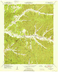 1949 Eagle Creek1952 Print · USGSWayne and Hardin counties in the late 1940s reveal a deeply rural Tennessee landscape structured by winding creek bottoms and isolated ridges. Genealogists can trace family names through numerous remote burial sites like Montague Cem and Friendship Cem, or locate landmarks such as Evans Chapel and the Lookout Tower.3 unique versions available
 - 1949 Map of Hookers Bend, 1952 Print
 1949 Hookers Bend1952 Print · USGSHardin County during the late 1940s reveals a river-centered society adapting to the creation of Kentucky Lake. Genealogists and historians can trace family locations through sites like Cerro Gordo, the Anderson Cem, and old river stops at Cravens Landing.2 unique versions available
 - 1949 Map of Bath Springs, 1952 Print
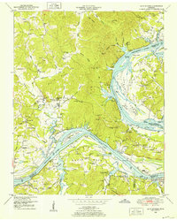 1949 Bath Springs1952 Print · USGSThe Tennessee River corridor in the late 1940s shows a landscape of river landings and ridge-top settlements along the Decatur and Perry county lines. Genealogists can locate family-named landmarks like Lafferty Cemetery and Tuckers Store or trace the rural river economy at Yarbro Landing.3 unique versions available
Showing maps 1-25 of 59
Top cities of Hardin County
Frequently asked questions
- What are the different types of historical maps available for Hardin County?
- What is the oldest map of Hardin County?
- Where can I purchase historical maps of Hardin County for my home or office?
- Where can I download high-res historical maps of Hardin County?
- Are there historical topographic maps available for Hardin County?
- Is there historical aerial imagery available for Hardin County?
- Where are historical maps of Hardin County sourced from?