1940s Maps of Hardin County, Tennessee
Explore 14 historic maps of Hardin County from the 1940s. These maps offer a rare glimpse into what life looked like during the 1940s — showing old roads, neighborhoods, homes, and landmarks that have changed or disappeared over time.
Whether you're researching your family's past, planning a metal detecting trip, or studying how Hardin County's landscape evolved across the 1940s, these high-resolution maps are a powerful tool for exploring the history of this region.
- Focus on a specific era: All maps on this page are from the 1940s, giving you a focused view of this time period.
- See what’s changed: Compare century-old streets, trails, and buildings to today's modern landscape using overlays and satellite layers.
- Research with precision: Use these maps for genealogy, historical research, land use analysis, or educational projects.
- View, download, or print: Maps are fully viewable online in high resolution, and can be downloaded or printed for your own records.
Start exploring Hardin County's history through authentic maps from the 1940s. This is your window into the past.
Hardin County, TN maps
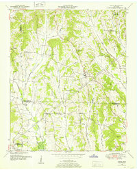
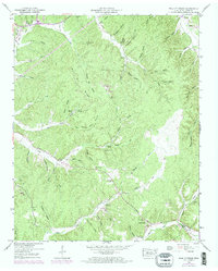
(14)- 1949 Map of Eagle Creek, 1952 Print
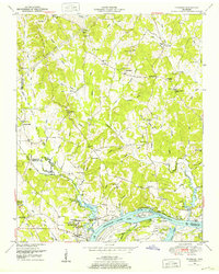
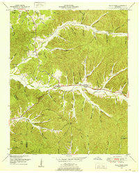 1949 Eagle Creek1952 Print · USGSWayne and Hardin counties in the late 1940s reveal a deeply rural Tennessee landscape structured by winding creek bottoms and isolated ridges. Genealogists can trace family names through numerous remote burial sites like Montague Cem and Friendship Cem, or locate landmarks such as Evans Chapel and the Lookout Tower.3 unique versions available
 - 1949 Map of Hookers Bend, 1952 Print
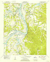 1949 Hookers Bend1952 Print · USGSHardin County during the late 1940s reveals a river-centered society adapting to the creation of Kentucky Lake. Genealogists and historians can trace family locations through sites like Cerro Gordo, the Anderson Cem, and old river stops at Cravens Landing.2 unique versions available
 - 1949 Map of Bath Springs, 1952 Print
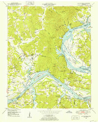 1949 Bath Springs1952 Print · USGSThe Tennessee River corridor in the late 1940s shows a landscape of river landings and ridge-top settlements along the Decatur and Perry county lines. Genealogists can locate family-named landmarks like Lafferty Cemetery and Tuckers Store or trace the rural river economy at Yarbro Landing.3 unique versions available
 - 1949 Map of Pittsburg Landing, 1952 Print
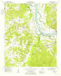
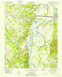 1949 Pittsburg Landing1952 Print · USGSHardin County history is centered on the hallowed grounds of Shiloh National Military Park and the vital banks of the Tennessee River in the late 1940s. Genealogists and historians can trace the riverside at Pittsburg Landing, locate the National Cem, or find rural family sites like Ledbetter Cem and Mt Zion Ch.
 - 1949 Map of Sardis, 1952 Print
 1949 Sardis1952 Print · USGSSardis and the borderlands of Henderson, Chester, and Hardin Counties are captured here at the end of the 1940s. Genealogists and historians can locate family landmarks such as Brazelton Cem, Maria Bluff Ch, and the rural Tri-County School among the area's many drainage canals.2 unique versions available
 - 1949 Map of Savannah, 1952 Print
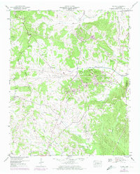
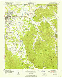 1949 Savannah1952 Print · USGSHardin County during the late 1940s shows a landscape of riverfront growth near the Tennessee River and scattered rural hamlets. You can trace early family sites and community centers like Burnt Church, Walkertown, and the Sevier Chapel School.
 - 1949 Map of Milledgeville, 1952 Print
 1949 Milledgeville1952 Print · USGSWest Tennessee rural life and river geography are captured here in the late forties at the junction of Chester, McNairy, and Hardin counties. Researchers can trace family history at Sweeney Cem or locate the rural crossroads of Morris Chapel and Coffee Landing.2 unique versions available
 - 1949 Map of Counce, 1952 Print
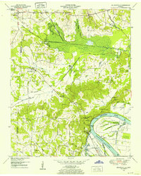
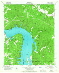
 1949 Counce1952 Print · USGSHardin County and the Tennessee River valley are captured here just after the war, showing the area's transition into the TVA era. Researchers can trace historic river access at Nash Landing, the grounds of Shiloh National Military Park, and local landmarks like Wayne Sch.
 - 1949 Map of Thurman, 1952 Print
 1949 Thurman1952 Print · USGSThe Tennessee River shoreline at the turn of the 1950s is captured here in detail, showing the river-based economy of Decatur County. Researchers can trace old family names and settlements like Lick Skillet, find the Union Hall School, or locate river landings at Swallow Bluff.2 unique versions available
 - 1949 Map of Olivehill, 1952 Print
 1949 Olivehill1952 Print · USGSThe Tennessee and Wayne County border comes alive in the late 1940s, showing a landscape defined by its river crossings and hollows. Genealogists can locate family landmarks like Patterson Cem, Bolden Spring, and the rural community of Olivehill.3 unique versions available
 - 1949 Map of Pickwick, 1967 Print
 1949 Pickwick1967 Print · USGSThe Tennessee and Alabama borderlands were being reshaped by hydroelectric power in the late 1940s. Researchers can trace family history through local landmarks like Shanghai Ch, Bryson Sch, and the Old White Sulphur Springs Cem.
 - 1949 Map of Lowryville, 1973 Print
 1949 Lowryville1973 Print · USGSThe Tennessee-Alabama borderlands come to life in this mid-century survey of the creeks and hollows south of Savannah. Researchers can trace family roots through numerous landmarks like Pollards Mill, Cherry Chapel Cem, and Walnut Grove.2 unique versions available
 - 1949 Map of Wolf Pit Ridge, 1973 Print
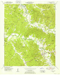
 1949 Wolf Pit Ridge1973 Print · USGSHardin County during the late 1940s was a landscape of tightly-knit ridge communities and small valley mills. Genealogists and local historians can trace family roots through numerous sites like Gillises Mills, Hardin Hills Academy, and Boon Cem.2 unique versions available
 - 1949 Map of Michie, 1974 Print
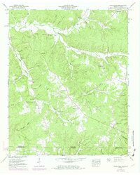
 1949 Michie1974 Print · USGSMcNairy County south of Stantonville is captured here mid-century, showing the crossroads communities and drainage canal projects of the era. Genealogists and local historians can trace the sites of Sand Hill Ch, the Chambers school, and burial grounds like Pleasant Site Cem.2 unique versions available
End of results
Showing maps 1-14 of 14
Top cities of Hardin County
Frequently asked questions
- What are the different types of historical maps available for Hardin County?
- What is the oldest map of Hardin County?
- Where can I purchase historical maps of Hardin County for my home or office?
- Where can I download high-res historical maps of Hardin County?
- Are there historical topographic maps available for Hardin County?
- Is there historical aerial imagery available for Hardin County?
- Where are historical maps of Hardin County sourced from?