1950s Maps of Hardin County, Tennessee
Explore 14 historic maps of Hardin County from the 1950s. These maps offer a rare glimpse into what life looked like during the 1950s — showing old roads, neighborhoods, homes, and landmarks that have changed or disappeared over time.
Whether you're researching your family's past, planning a metal detecting trip, or studying how Hardin County's landscape evolved across the 1950s, these high-resolution maps are a powerful tool for exploring the history of this region.
- Focus on a specific era: All maps on this page are from the 1950s, giving you a focused view of this time period.
- See what’s changed: Compare century-old streets, trails, and buildings to today's modern landscape using overlays and satellite layers.
- Research with precision: Use these maps for genealogy, historical research, land use analysis, or educational projects.
- View, download, or print: Maps are fully viewable online in high resolution, and can be downloaded or printed for your own records.
Start exploring Hardin County's history through authentic maps from the 1950s. This is your window into the past.
Hardin County, TN maps
(14)- 1950 Map of Kendrick, 1953 Print
 1950 Kendrick1953 Print · USGSThe Mississippi-Tennessee borderlands in the mid-twentieth century show a landscape of rural schools and rail intersections. Genealogists can trace family names at Marvin Cem and Wyly Cem, or locate lost landmarks like McGlathery Sch and Fraley Chapel.3 unique versions available
 - 1950 Map of Ransom Stand, 1954 Print
 1950 Ransom Stand1954 Print · USGSThe Tennessee-Alabama borderlands at the start of the fifties reveal a landscape of deep hollows and high ridges. Genealogists can locate family names at Ransom Stand, McFalls Ch, and the Centenary Cem.2 unique versions available
 - 1950 Map of Doskie, 1954 Print
 1950 Doskie1954 Print · USGSNortheast Mississippi and southern Tennessee appear here just after the war, showing the area near Doskie and the Tishomingo County Game Refuge. Researchers can trace rural life at Lambs Chapel School, Shady Grove Ch, and the Beaver Pond gaging station.3 unique versions available
 - 1950 Map of Martins Mills, 1954 Print
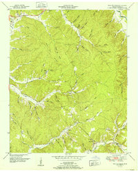
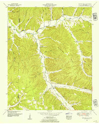 1950 Martins Mills1954 Print · USGSWayne County is shown here in the early postwar era, highlighting a landscape of ridge-top farms and valley hamlets. Researchers can trace ancestral roots at Martins Mills and Lutts, or locate rural landmarks like Pinhook School and Greeson Chapel.2 unique versions available
 - 1952 Map of Pickwick
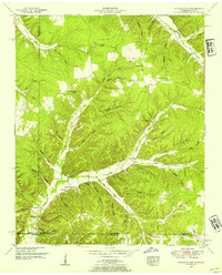
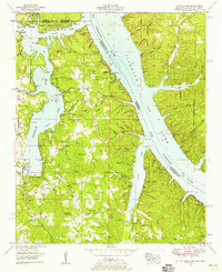
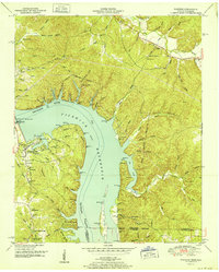 1952 Pickwick1952 Print · USGSThe Tennessee River valley at mid-century reveals a landscape transformed by the Pickwick Landing Dam and the rising Pickwick Reservoir. Genealogists can locate rural landmarks like Shanghai Ch, Bryson Sch, and the Old White Sulphur Springs Cem.
 - 1952 Map of Lowryville
 1952 Lowryville1952 Print · USGSCovers Hardin County, including Lowryville, Walnut Grove, and other nearby areas
 - 1952 Map of Wolf Pit Ridge
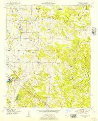
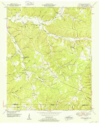
 1952 Wolf Pit Ridge1952 Print · USGSHardin County's upland hollows and ridges come into focus in the early fifties, showing a rural Tennessee landscape of small mills and family homesteads. Trace ancestors at Gillises Mills, Abrams Chapel, or burial sites like the Lacefield Cem.
 - 1952 Map of Michie
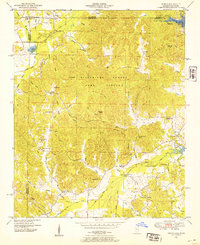
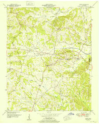 1952 Michie1952 Print · USGSMcNairy and Hardin counties come into focus in the early fifties, showing a rural landscape defined by the Tennessee Valley Divide. Trace family roots at McCullar Chapel, Sand Hill Sch, and forgotten crossroads like Needmore or Tulu.
 - 1953 Map of Yellow Creek, 1958 Print
 1953 Yellow Creek1958 Print · USGSTishomingo County sits at a three-state crossroads during the early fifties as the river valley adjusts to the presence of Pickwick Lake. Researchers can trace old family landmarks like Hubbard Cem and Short Creek Cem or the river landing at Cooks Landing.6 unique versions available
 - 1956 Map of Columbia, 1960 Print
 1956 Columbia1960 Print · USGSMiddle Tennessee in the mid-fifties presents a landscape of established river towns and critical rail hubs before the arrival of the modern interstate system. Researchers can trace the routes of the Louisville and Nashville railroad or locate historic landmarks like Stones River National Military Park and the Tennessee National Wildlife Refuge.6 unique versions available
 - 1956 Map of Blytheville, 1964 Print
 1956 Blytheville1964 Print · USGSWest Tennessee and the Arkansas Delta come alive in this mid-century survey of the river-and-rail corridor connecting Memphis to Jackson. Genealogists and historians can trace the rail lines of the Louisville and Nashville RR and locate landmarks like Western State Hospital or Fort Pillow State Prison Farm.2 unique versions available
 - 1956 Map of Tupelo, 1967 Print
 1956 Tupelo1967 Print · USGSNortheast Mississippi and parts of Tennessee and Alabama are shown here during the mid-fifties, a time of major reservoir construction and forestry management. Researchers can trace the St Louis-San Francisco RR through Tupelo or locate historic sites like Tishomingo State Park and the University.2 unique versions available
 - 1958 Map of Tupelo
 1958 Tupelo1958 Print · USGSNortheast Mississippi and neighboring Alabama and Tennessee appear here during the late fifties as a region defined by new reservoirs and historic rail lines. Genealogists can trace family locations near Sardis Lake, Woodall Mountain, and the St Louis-San Francisco Ry.
 - 1959 Map of Blytheville
 1959 Blytheville1959 Print · USGSWest Tennessee and Northeast Arkansas meet along the river in the late fifties, during a period of steady industrial and agricultural growth. Genealogists can trace the rail corridors of the Illinois Central through Jackson or explore landmarks like Shiloh National Military Park and Fort Pillow State Prison.
End of results
Showing maps 1-14 of 14
Top cities of Hardin County
Frequently asked questions
- What are the different types of historical maps available for Hardin County?
- What is the oldest map of Hardin County?
- Where can I purchase historical maps of Hardin County for my home or office?
- Where can I download high-res historical maps of Hardin County?
- Are there historical topographic maps available for Hardin County?
- Is there historical aerial imagery available for Hardin County?
- Where are historical maps of Hardin County sourced from?