2020s Maps of Henry County, Tennessee
Explore 20 historic maps of Henry County from the 2020s. These maps offer a rare glimpse into what life looked like during the 2020s — showing old roads, neighborhoods, homes, and landmarks that have changed or disappeared over time.
Whether you're researching your family's past, planning a metal detecting trip, or studying how Henry County's landscape evolved across the 2020s, these high-resolution maps are a powerful tool for exploring the history of this region.
- Focus on a specific era: All maps on this page are from the 2020s, giving you a focused view of this time period.
- See what’s changed: Compare century-old streets, trails, and buildings to today's modern landscape using overlays and satellite layers.
- Research with precision: Use these maps for genealogy, historical research, land use analysis, or educational projects.
- View, download, or print: Maps are fully viewable online in high resolution, and can be downloaded or printed for your own records.
Start exploring Henry County's history through authentic maps from the 2020s. This is your window into the past.
Henry County, TN maps
(20)- 2022 Map of Palmersville, 2022 Print
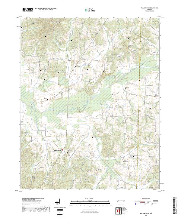 2022 Palmersville2022 Print · USGSThe rural Tennessee landscape around Palmersville comes into sharp focus in this recent survey, showcasing a high density of family burial sites. Genealogists and historians can trace lineage across Bumpas Bottom to Hays Chapel Cem or Lemon Springs Cem.
 - 2022 Map of Paris, 2022 Print
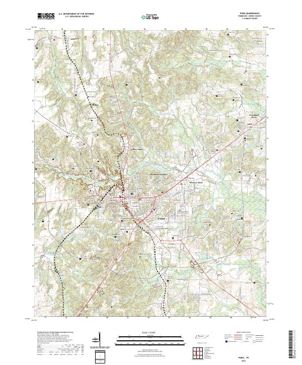 2022 Paris2022 Print · USGSThe Henry County seat and its rural surroundings are captured here during a period of steady growth. Researchers can trace decades of local heritage through sites like the Henry County Courthouse, Maplewood Cem, and the old settlement of India.
 - 2022 Map of Puryear, 2022 Print
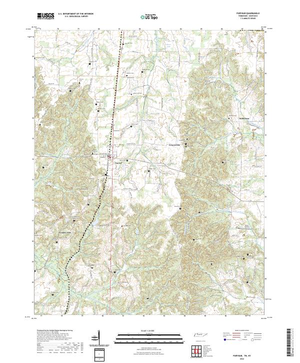 2022 Puryear2022 Print · USGSHenry County near the Kentucky border reveals a quiet landscape of family cemeteries and rural crossroads in the early twenty-first century. Genealogists can trace local heritage at Foundry Hill Baptist Cem, Littleton Cem, and the historic site of Conyersville.
 - 2022 Map of Buchanan, 2022 Print
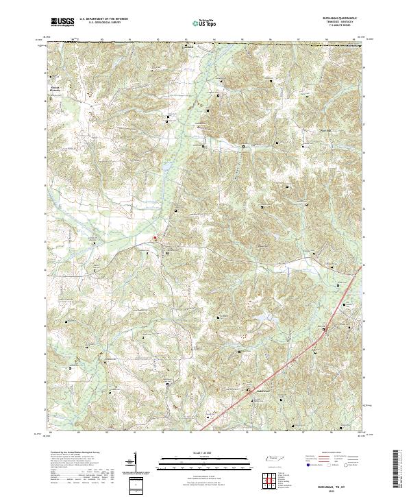 2022 Buchanan2022 Print · USGSThe Tennessee and Kentucky borderlands near Buchanan are captured here during a time of settled agricultural life. Genealogists can trace dozens of family burial sites including the Old Soldiers Cem, Heglar Chapel Cem, and Valentine Cem.
 - 2022 Map of Osage, 2022 Print
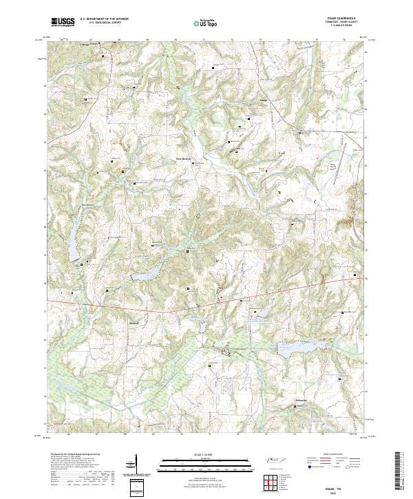 2022 Osage2022 Print · USGSHenry County rural life is captured here in the early twenty-first century, centered on the river bottoms and small communities. Researchers can trace family history through dozens of local burial sites like Speight Cem and Tharp Cem, or follow the course of the Middle Fork Obion River.
 - 2022 Map of Big Sandy, 2022 Print
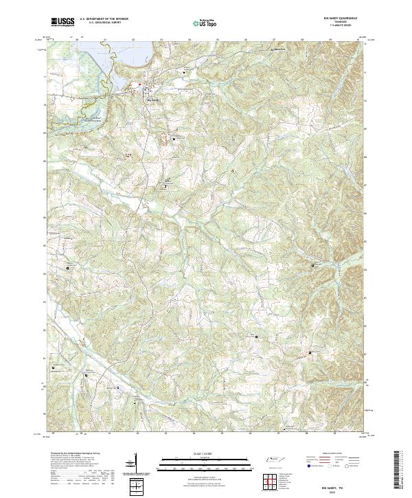 2022 Big Sandy2022 Print · USGSBenton County river life and rural family heritage are documented here during the early twenty-first century. Researchers can trace ancestral locations near Big Sandy and several historic burial grounds, including Rushings Creek Cem and Mount Zion Cem.
 - 2022 Map of Mansfield, 2022 Print
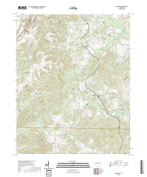 2022 Mansfield2022 Print · USGSThe rural landscape of southern Henry County remains centered on historic hamlets and family landholdings. Genealogists can trace decades of local lineage through dozens of burial sites, including Claxton-Myrick Cem, Haglerville Cem, and Shiloh Cem.
 - 2022 Map of Cottage Grove, 2022 Print
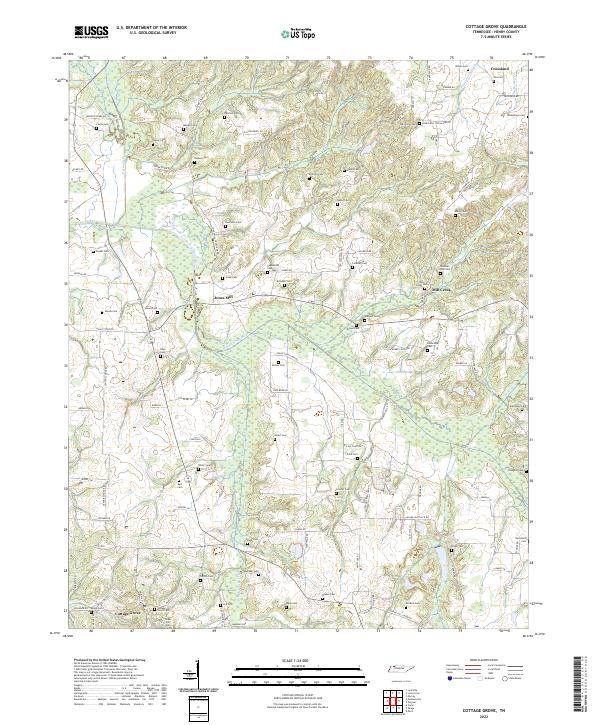 2022 Cottage Grove2022 Print · USGSCottage Grove and the rural reaches of Henry County are shown in detail as they appeared in the early 2020s. Researchers can locate dozens of family burial sites like Kuykendall Cem and Allison Cem or trace the winding course of the North Fork Obion River.
 - 2022 Map of Manleyville, 2022 Print
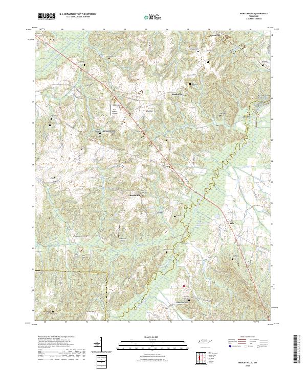 2022 Manleyville2022 Print · USGSNorthwest Tennessee near the Big Sandy River remains a landscape of family history and managed waterways in the early twenty-first century. Genealogists can trace deep roots through the Patterson Family Burying Ground or Manleys Chapel Cem, while exploring the valley's drainage network near Bain.
 - 2022 Map of McKinnon, 2022 Print
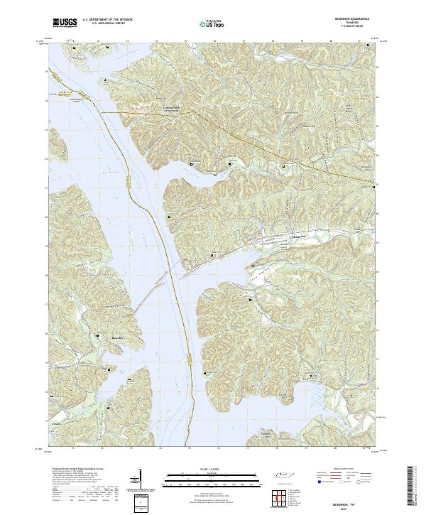 2022 McKinnon2022 Print · USGSThe Tennessee River and Kentucky Lake shoreline are captured here in the early 2020s, revealing a landscape of deep hollows and active ferry crossings. Researchers can trace family names at Martin Cem and Askew Cem or locate the historic crossing at Houston-Benton Ferry.
 - 2022 Map of Murray, 2022 Print
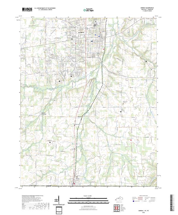 2022 Murray2022 Print · USGSThe college town of Murray and the Tennessee borderlands are captured in this recent survey. Genealogists can trace deep local roots at Old Salem Cem, Green Plains Cem, and the Murray City Cem African American.
 - 2022 Map of Bruceton, 2022 Print
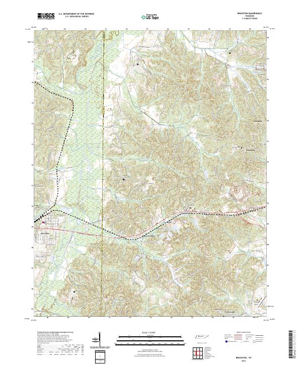 2022 Bruceton2022 Print · USGSWest Tennessee hill country and the Big Sandy River valley are shown in detail as they appeared in 2022. Researchers can trace family history at Parks Cem and Mount Carmel Cem or locate rural centers like Sawyers Mill.
 - 2022 Map of West Sandy Dike, 2022 Print
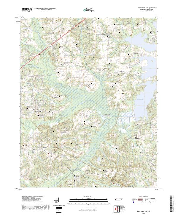 2022 West Sandy Dike2022 Print · USGSHenry County, Tennessee, is shown here as it appears in the early twenty-first century, defined by the waters of Kentucky Lake. Genealogists and historians can trace numerous family burial sites like Old Beaverdam Cem and explore the historic location of Old Springville.
 - 2022 Map of McKenzie, 2022 Print
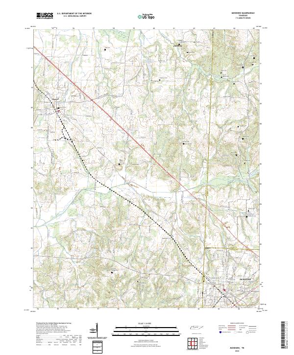 2022 McKenzie2022 Print · USGSNorthwest Tennessee’s rural landscapes are captured here in the early twenty-first century as the borders of Weakley, Henry, and Carroll counties meet. Genealogists and local historians can trace family ties through numerous landmarks like Bethel University, Everett Chapel Cem, and Smyth Cem.
 - 2022 Map of Paris Landing, 2022 Print
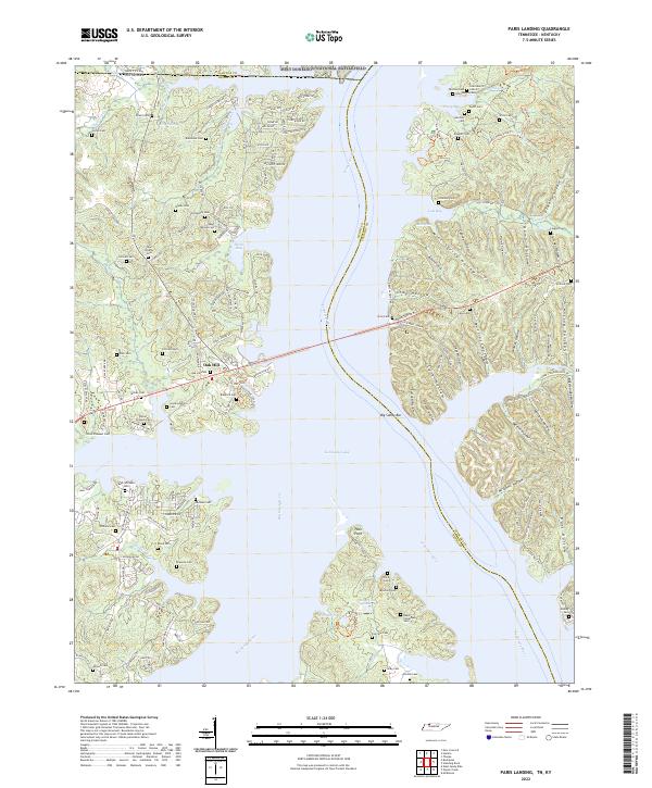 2022 Paris Landing2022 Print · USGSThe Tennessee and Big Sandy rivers meet at the state line in this recent study of Henry and Stewart counties. Genealogists can trace family names through dozens of burial sites like Saint Mary's Cem, Parker-Presnell Cem, and Taylor Cem.
 - 2022 Map of Henry, 2022 Print
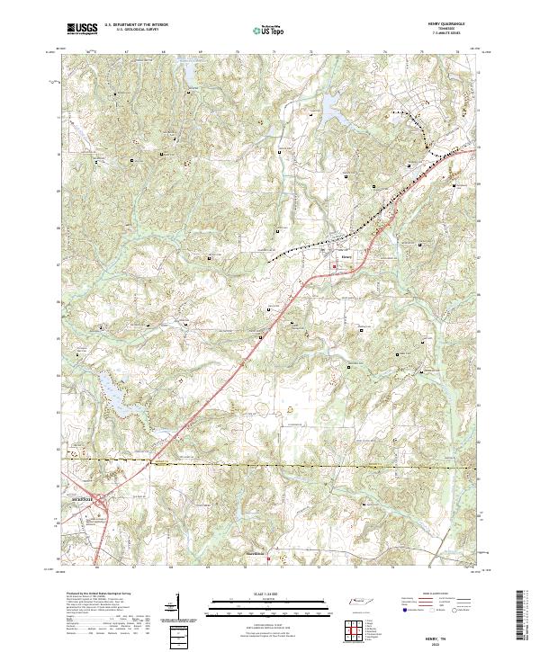 2022 Henry2022 Print · USGSHenry and the northwestern Carroll County line appear here in the early 2020s, showing a landscape densely populated by ancestral sites. Genealogists can trace family names at Brogdon Cem, Covington Wall Cem, and Bird Miller Cem along the headwaters of Caledonia Cr.
 - 2022 Map of Poplar Creek, 2022 Print
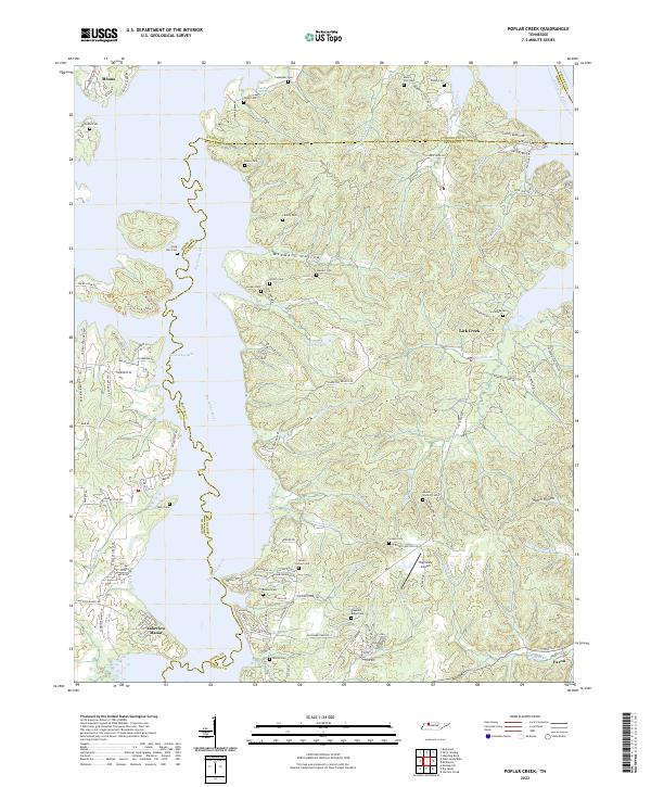 2022 Poplar Creek2022 Print · USGSBenton and Henry counties come alive in the early 2020s as the Big Sandy River meets Kentucky Lake. Genealogists can locate numerous family burial sites such as Beaton Cem and Liberty Cem, or trace the rural roads leading to Faxon.
 - 2022 Map of Como, 2022 Print
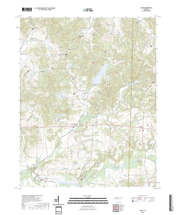 2022 Como2022 Print · USGSWeakley and Henry counties come together in this rural Tennessee landscape during the early 2020s, defined by the winding Middle Fork Obion River. Researchers can trace deep family roots through numerous local sites like Jolley Springs Cem, Allman Cem, and the settlement of Ore Springs.
 - 2022 Map of Lynnville, 2022 Print
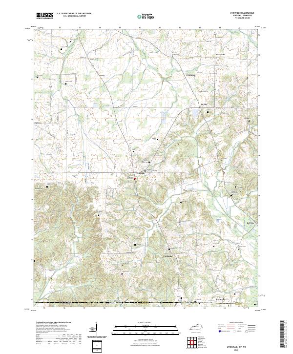 2022 Lynnville2022 Print · USGSThe Kentucky-Tennessee borderlands come alive in this survey of the region south of Lynnville. Genealogists can trace family connections through dozens of local burial sites, including the Old Beech Grove Cem, Rhodes Chapel Cem, and Mooney Cem.
 - 2022 Map of Lynn Grove, 2022 Print
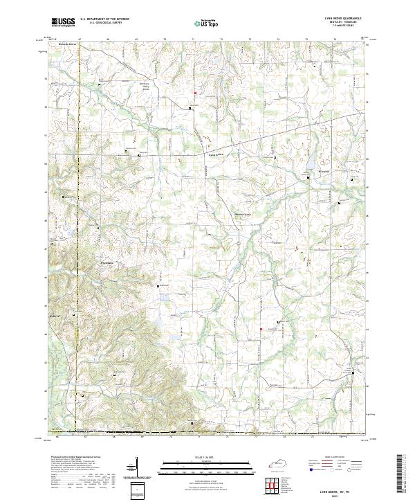 2022 Lynn Grove2022 Print · USGSCalloway County and the Kentucky-Tennessee borderlands appear in great detail during the early 2020s. Genealogists can trace family names at Salem Cem, Harmony Cem, and South Pleasant Grove Cem near the Middle Fork Clarks River.
End of results
Showing maps 1-20 of 20
Top cities of Henry County
Frequently asked questions
- What are the different types of historical maps available for Henry County?
- What is the oldest map of Henry County?
- Where can I purchase historical maps of Henry County for my home or office?
- Where can I download high-res historical maps of Henry County?
- Are there historical topographic maps available for Henry County?
- Is there historical aerial imagery available for Henry County?
- Where are historical maps of Henry County sourced from?