Old Maps of Henry County, Tennessee for Metal Detecting
Plan your next treasure hunt with 149 historic maps of Henry County. Find old homesites, ghost towns, trails, and gathering spots that may be lost to time — perfect for identifying promising metal detecting locations.
- Locate forgotten sites: Uncover places like long-lost settlements, abandoned rail lines, or gathering spots.
- Plan better hunts: Use map overlays combined with LiDAR or satellite views to narrow in on historically rich areas.
- Made for detectorists: Thousands of hobbyists use these maps to discover relics, coins, and hidden history.
Use these historic maps to boost your research and find new opportunities beneath the surface of Henry County.
Henry County, TN maps
(149)- 1936 Map of Poplar Creek
 1936 Poplar Creek1936 Print · USGSBenton and Henry counties are shown in the mid-1930s as the Tennessee Valley Authority began shaping the region's river systems. Researchers can trace rural life through numerous country schools and landmarks like Sulphur Well, Murphy Landing, and Odem Sch.
 - 1936 Map of Conyersville
 1936 Conyersville1936 Print · USGSHenry County, Tennessee, and the Kentucky borderlands are shown here in the mid-1930s during a period of infrastructure expansion. Genealogists can trace family names at Bradley Cem, Mandels, and Old Antioch Ch while exploring the rail-industrial landscape of Puryear.
 - 1936 Map of Buchanan
 1936 Buchanan1936 Print · USGSBuchanan and the surrounding Henry County farmlands are captured in the mid-1930s just as the Tennessee Valley Authority began its work. Family historians can locate numerous rural landmarks like Blood River Ch, King Cem, and Delno Sch.
 - 1936 Map of Hazel
 1936 Hazel1936 Print · USGSCalloway County and the Tennessee borderlands are captured here in the mid-thirties, showing the rail-linked settlements of Murray and Hazel. Genealogists can trace rural family life through dozens of local landmarks like Old Salem Ch, Smotherman Sch, and CCC Camp No 1517.
 - 1936 Map of Crossland
 1936 Crossland1936 Print · USGSHenry County farmland near the Kentucky border comes into focus during the mid-1930s, documenting the rural landscape and early TVA hydrological planning. Researchers can locate Oak Grove Ch and trace the drainage patterns near Crossland and the Tennessee Basin.
 - 1936 Map of McKinnon
 1936 McKinnon1936 Print · USGSThe Tennessee River valley in the 1930s is revealed as a bustling hub of river landings and rail traffic before the landscape was transformed. Researchers can trace the river economy through the Danville Ferry, community ties at Griffin Ch, and the local rail stop at McKinnon.
 - 1936 Map of Lynn Grove
 1936 Lynn Grove1936 Print · USGSSouthern Calloway County in the mid-1930s shows a landscape of small farming communities and country churches before many were consolidated. Researchers can trace family roots through sites like Salem Ch Cem, Paschall Sch, and the crossroads at Lynn Grove.
 - 1936 Map of Big Sandy
 1936 Big Sandy1936 Print · USGSBig Sandy and its river valleys appear here in the mid-1930s just as the Tennessee Valley Authority was documenting the region's rural infrastructure. Genealogists and historians can locate dozens of country landmarks including McCarthy Chapel, Byer Sch, and Benton Cut along the rail line.
 - 1936 Map of Mansfield
 1936 Mansfield1936 Print · USGSWest Tennessee’s rural landscape is captured here in the mid-1930s, documenting a network of rail-dependent settlements and family homesteads. Genealogists can trace local roots through numerous sites like Walton Cem, Shiloh Ch, and the Mansfield Sch.
 - 1936 Map of Centerville Landing
 1936 Centerville Landing1936 Print · USGSThe Tennessee and Big Sandy Rivers meet here in the mid-1930s, showing a landscape defined by seasonal landings and rural family settlements. Researchers can trace numerous country schools and churches like Mullins Sch, Hephzibah Ch, and St Mary Ch.2 unique versions available
 - 1936 Map of Bruceton
 1936 Bruceton1936 Print · USGSBruceton was a bustling rail junction in the 1930s where the Tennessee Central met the St. Louis line. Genealogists can locate family landmarks like Sawyers Mill Zach PO, Cedar Grove Ch, and schools like Garfield Sch.
 - 1936 Map of Manleyville
 1936 Manleyville1936 Print · USGSHenry County during the mid-1930s shows a landscape of small farming communities organized around local schools and rural churches. Researchers can locate family landmarks like Mc Davids Cem, Spring Creek Sch, and the community at Manleyville.
 - 1936 Map of Paris
 1936 Paris1936 Print · USGSHenry County is captured here in the mid-1930s as a bustling railroad hub and a focus of New Deal-era development. Genealogists and historians can trace family locations near Paris, CCC Camp TVA No 36, and numerous rural landmarks like Vandyke Grove Ch and Maplewood Cem.
 - 1936 Map of Springville
 1936 Springville1936 Print · USGSHenry County is captured here in the mid-1930s during a period of significant landscape engineering by the Tennessee Valley Authority. Genealogists can locate family landmarks like Sulphur Well Academy, Providence Sch, and the Beaverdam Cem.
 - 1938 Map of Springville
 1938 Springville1938 Print · USGSIn the hills of West Tennessee during the late 1930s, rural life centered on the rail corridor and a network of country schools. Genealogists can trace family names through dozens of landmarks like Boothe Cem, Oakland Sch, and the Sulphur Well Academy.2 unique versions available
 - 1940 Map of Manleyville
 1940 Manleyville1940 Print · USGSThe West Tennessee river bottoms and hill country are shown just before the war, when the Big Sandy River valley was a patchwork of small farms and family cemeteries. Trace vanished local landmarks like Smith College, McDavid Sch, and the isolated Rushing Chapel among the network of drainage ditches.
 - 1941 Map of Manleyville
 1941 Manleyville1941 Print · USGSHenry and Benton County borderlands come into focus in the early 1940s, showing a rural landscape organized around the Big Sandy River. Researchers can locate several country schools and cemeteries, including Smith College, McDavid School, and Kemp Cemetery.
 - 1949 Map of Poplar Creek, 1953 Print
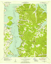 1949 Poplar Creek1953 Print · USGSBenton County river life and upland farming are documented here just after the war, as the reservoir system reshaped the shoreline. Researchers can locate dozens of family sites and landmarks, including Culpepper Cem, Antioch Boat Harbor, and the Louisville and Nashville rail stop at Faxon.3 unique versions available
 - 1950 Map of Osage
 1950 Osage1950 Print · USGSHenry County in the early fifties shows a landscape of established farmsteads and rural social centers. Genealogists can trace family names through dozens of landmarks like Central Point School, Oak Hill Church, and the Palestine Cem burial grounds.3 unique versions available
 - 1950 Map of Paris
 1950 Paris1950 Print · USGSMid-century Paris, Tennessee, thrived as a vital railroad crossroads where two major lines intersected amidst the ridges of the Tennessee Valley Divide. Genealogists can trace family roots through numerous sites like Jones Chapel, Greenwood Cem, and the Nelson Sch.
 - 1950 Map of Buchanan, 1953 Print
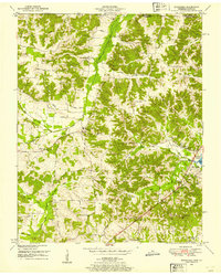 1950 Buchanan1953 Print · USGSThe Kentucky-Tennessee line comes alive in the early fifties, showing a rural landscape shaped by the new Kentucky Lake. Genealogists can trace family names at Buchanan Cem, Mt Zion Ch, and the small community of Freeland.2 unique versions available
 - 1950 Map of Big Sandy, 1953 Print
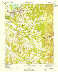 1950 Big Sandy1953 Print · USGSThe Tennessee riverfront near the Big Sandy settlement and the newly formed Kentucky Lake appears here in the early fifties. Genealogists and local historians can trace rural family life through landmarks like McRae Chapel, Morgan Claxton School, and Baker Chapel Cem.3 unique versions available
 - 1950 Map of Bruceton, 1953 Print
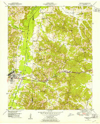 1950 Bruceton1953 Print · USGSBruceton and the surrounding Tennessee lowlands appear here in the early 1950s, showing a landscape defined by the Nashville Chattanooga and St Louis railway. Local historians can trace old landmarks like Sawyers Mill, Sandy Point Sch, and the historical path of the Natchez Trace.3 unique versions available
 - 1950 Map of Paris Landing, 1953 Print
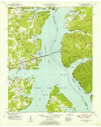 1950 Paris Landing1953 Print · USGSKentucky Lake and the Tennessee River valley are shown here just as the post-war recreational and conservation landscape began to take shape. Researchers can locate family homesteads near Old Liberty Ch, Bradford Cem, and the Cypress Creek Cabin Area.5 unique versions available
 - 1950 Map of Mansfield, 1953 Print
 1950 Mansfield1953 Print · USGSHenry and Carroll counties are captured here in the early fifties, showcasing a rural landscape defined by the Tennessee Valley Divide. Researchers can trace old family sites like Dumpling Hill Cem and settlements at Mansfield and Routon.3 unique versions available
Showing maps 1-25 of 149
Top cities of Henry County
Frequently asked questions
- What are the different types of historical maps available for Henry County?
- What is the oldest map of Henry County?
- Where can I purchase historical maps of Henry County for my home or office?
- Where can I download high-res historical maps of Henry County?
- Are there historical topographic maps available for Henry County?
- Is there historical aerial imagery available for Henry County?
- Where are historical maps of Henry County sourced from?