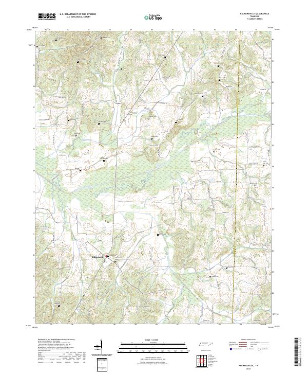
2022 Map of Palmersville
USGS Topo · Published 2022About this map
The North Fork Obion River meanders across this Weakley County landscape, anchoring a rural topography defined by small-scale agriculture and a remarkably high density of family and community burial grounds. Near the settlement of Palmersville, the terrain shifts from the flat wetlands of Bumpas Bottom and the river’s floodplain to the rolling uplands divided by tributaries like Hurricane Cr and Cane Creek. For those tracing family histories in the Tennessee backlands, the map identifies dozens of specific sites including Hays Chapel Cem, McClain Cem, and Union Hall Cem. The infrastructure follows the natural ridges, with local routes like Boydsville Rd and Stephenson Rd connecting long-established farms. The boundary between Weakley Co and Henry Co is clearly demarcated, showing the transition into the neighboring county's western edge.
Find a feature on this map
88 named features on this map. Tap any name to fly to it.
Don’t see what you’re looking for? This feature index may not catch every label — zoom into the map to look around manually.
Map Details
Editions of this 2022 Palmersville Map
This is the sole edition of this map. No revisions or reprints were ever made.
Other maps of this area

1936 · Crossland
USGS Topo · 1:24,000

1936 · Lynn Grove
USGS Topo · 1:24,000

1950 · Osage
USGS Topo · 1:24,000

1950 · Cottage Grove
USGS Topo · 1:24,000
1951 · Murray
USGS Topo · 1:62,500
1951 · Lynn Grove
USGS Topo · 1:24,000

1952 · Dresden
USGS Topo · 1:24,000

1952 · Cuba
USGS Topo · 1:24,000

1952 · Mayfield
USGS Topo · 1:62,500
1952 · Lynnville
USGS Topo · 1:24,000