Old Maps of Dandridge, Tennessee for Metal Detecting
Plan your next treasure hunt with 33 historic maps of Dandridge. Find old homesites, ghost towns, trails, and gathering spots that may be lost to time — perfect for identifying promising metal detecting locations.
- Locate forgotten sites: Uncover places like long-lost settlements, abandoned rail lines, or gathering spots.
- Plan better hunts: Use map overlays combined with LiDAR or satellite views to narrow in on historically rich areas.
- Made for detectorists: Thousands of hobbyists use these maps to discover relics, coins, and hidden history.
Use these historic maps to boost your research and find new opportunities beneath the surface of Dandridge.
Dandridge, TN maps
(33)- 1883 Map of Morristown
 1883 Morristown1883 Print · USGSEast Tennessee in the 1880s is defined by the convergence of mountain ridges and the vital rail corridor through Morristown. Researchers can trace the early industrial landscape of the region through landmarks like Witt's Foundry, Tate's Springs, and the historic Bean's Station.
 - 1893 Map of Mt Guyot
 1893 Mt Guyot1893 Print · USGSThe Tennessee and North Carolina borderlands are captured here in the 1890s, when isolated mountain coves and river towns relied on the Virginia and Georgia Railroad. Researchers can trace old family sites and transport routes through Fair Garden, Jones Cove, and along the Elliot Ferry Road.3 unique versions available
 - 1893 Map of Morristown
 1893 Morristown1893 Print · USGSEast Tennessee in the 1890s was a landscape of deep mountain ridges and vital rail junctions centered around Morristown. Researchers can trace the nineteenth-century river economy through numerous crossings like Cloud Ferry and find early industry at Lotspeachy Mill.
 - 1895 Map of Morristown
 1895 Morristown1895 Print · USGSThe East Tennessee ridge-and-valley country comes alive in the late nineteenth century as a hub of rail and river transit. Trace the routes of old Evans Ferry or locate vanished stops along the Southern R.R. near Morristown and Bull Gap.5 unique versions available
 - 1912 Map of Mt Guyot
 1912 Mt Guyot1912 Print · USGSThe Tennessee and North Carolina borderlands come into focus in the early twentieth century, prior to the creation of the Great Smoky Mountains National Park. Trace ancestral locations like Cataloochee and Smokemont or follow the Southern RR to Newport.5 unique versions available
 - 1935 Map of English Mountain
 1935 English Mountain1935 Print · USGSSevier County and the foothills of the Smokies are seen here during the mid-thirties as the national park was taking shape. Genealogists can trace family roots through scores of rural institutions like Smoky Mtn Academy, Pittman Center, and the Crockettville Sch.
 - 1935 Map of Shady Grove
 1935 Shady Grove1935 Print · USGSThe French Broad River valley at the border of Jefferson and Sevier counties is documented here just as the Tennessee Valley Authority began its regional work. Researchers can locate Depression-era rural landmarks like Lee Academy, Island Ford Mill, and Roaring Spring.
 - 1935 Map of Jefferson City
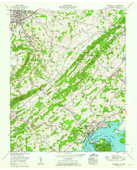
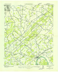 1935 Jefferson City1935 Print · USGSJefferson County in the mid-1930s shows a landscape of river-valley farming and mountain ridges before major Tennessee Valley Authority changes. Genealogists can trace family landmarks like Wesley Chapel, Grants Chapel, and the Cedar Ridge Sch along the French Broad River.
 - 1935 Map of Dandridge
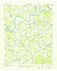
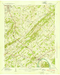
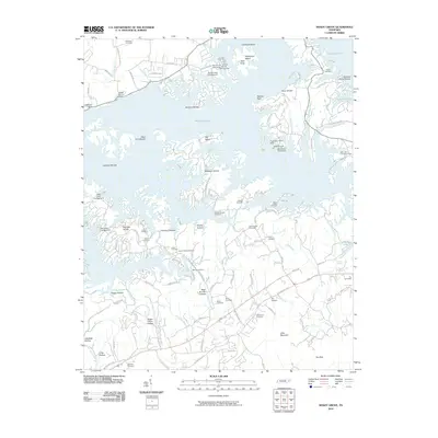
 1935 Dandridge1935 Print · USGSEast Tennessee in the mid-1930s is mapped here in great detail as the region's river valleys prepared for the impacts of the Tennessee Valley Authority. Researchers can trace ancestral locations through dozens of landmarks like Martha Sunderland Cem, Panther Creek Mill, and Roe Ch.
 - 1939 Map of Shady Grove
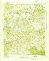 1939 Shady Grove1939 Print · USGSThe French Broad River valley in the late 1930s was a landscape of river-bottom farms and small upland communities. Genealogists and historians can trace family locations through numerous rural landmarks like Lee Academy, Island Ford Mill, and Shady Grove Cem.2 unique versions available
 - 1939 Map of Jefferson City
 1939 Jefferson City1939 Print · USGSJefferson County in the late thirties is a landscape of ridge-and-valley farming and early industry along the French Broad River. Genealogists can trace family footprints at Hebron Cem, Hunnicutt Mill, and rural schools like Greenhill Sch.2 unique versions available
 - 1955 Map of Knoxville
 1955 Knoxville1955 Print · USGSThe Southern Appalachians and the Smoky Mountains are shown here at a peak of mid-century development and conservation. Genealogists and historians can trace the early road networks connecting Gatlinburg, Waynesville, and the Cherokee Indian Reservation across the high ridges.
 - 1955 Map of Johnson City
 1955 Johnson City1955 Print · USGSEast Tennessee and the bordering highlands of Virginia and Kentucky appear here during the post-war industrial boom. You can trace the complex network of mountain ridges and new TVA lakes, from Johnson City to the coalfields near Middlesboro and Lynch.
 - 1957 Map of Knoxville, 1966 Print
 1957 Knoxville1966 Print · USGSThe Southern Appalachians of Tennessee and North Carolina are mapped here during the mid-twentieth century as new highways reached the high country. Genealogists and historians can trace the topography between Knoxville and Asheville, locating family landmarks near Fontana Lake or along the Blue Ridge Parkway.4 unique versions available
 - 1957 Map of Johnson City, 1966 Print
 1957 Johnson City1966 Print · USGSUpper East Tennessee and Southwest Virginia are shown here during the mid-sixties transition of the Appalachians. Researchers can trace the industrial rail hubs of Kingsport, the sprawling waters of Cherokee Lake, and the historic Cumberland Gap.
 - 1960 Map of Knoxville
 1960 Knoxville1960 Print · USGSThe Southern Appalachians come alive in the 1950s, showing the intersection of new national park tourism and deep-rooted mountain industry. Trace old rail lines like the Clinchfield RR and find high-altitude landmarks from Mt Le Conte to the Cherokee Indian Reservation.2 unique versions available
 - 1960 Map of Johnson City
 1960 Johnson City1960 Print · USGSUpper East Tennessee and the surrounding tri-state area are shown in the mid-fifties during the height of the TVA reservoir era. Trace the industrial rail lines of the Southern and Louisville and Nashville between Kingsport and Johnson City.
 - 1961 Map of Shady Grove, 1963 Print
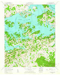 1961 Shady Grove1963 Print · USGSDouglas Lake and its winding shoreline define this 1960s landscape along the border of Jefferson and Sevier Counties. Genealogists and local historians can trace legacy landmarks like Derrick Cemetery, Hills Union Ch, and New Center School.2 unique versions available
 - 1961 Map of Jefferson City, 1963 Print
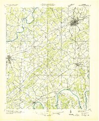
 1961 Jefferson City1963 Print · USGSJefferson and Dandridge are captured here in the early sixties as industrial mining and the rising waters of Douglas Lake reshape the valley. Genealogists can trace family names at Hebron Cem and Wesley Chapel, or locate the Hunnicutt Mill and Coy Mine.3 unique versions available
 - 1963 Map of Johnson City
 1963 Johnson City1963 Print · USGSThe Tri-Cities and the surrounding Appalachian ridges are shown in detail during the early sixties, highlighting the era's vital rail and river networks. Genealogists and historians can trace the routes of the Clinchfield RR and locate settlements from Rogersville to Elizabethton.
 - 1964 Map of Knoxville
 1964 Knoxville1964 Print · USGSThe Southern Appalachians and Great Smokies are captured here during the mid-sixties, showing the rugged borderlands of Tennessee and North Carolina. Researchers can trace historic mountain routes like U S 441, the expanse of Pisgah National Forest, and the growing footprints of Asheville and Knoxville.
 - 1981 Map of Morristown
 1981 Morristown1981 Print · USGSEast Tennessee's ridge-and-valley corridor is captured here in the early eighties, showing the region's transformation by TVA reservoirs. Genealogists and historians can trace family locations near Alpha Ch, follow the Southern Railway, or locate the Young Mine.
 - 1983 Map of Knoxville, 1984 Print
 1983 Knoxville1984 Print · USGSThe Tennessee valley and the rising Smokies are captured here in the early eighties, showing the region as the tourism and transit hub of the Southern Appalachians. Researchers can trace the layout of the University of Tennessee or locate rural landmarks like Shady Grove Ch and Pleasant Hill Cem.
 - 2010 Map of Jefferson City, 2010 Print
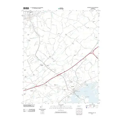 2010 Jefferson City2010 Print · USGSCovers Dandridge, including Jefferson City, Colliers Corner, and other nearby areas
 - 2010 Map of Shady Grove, 2010 Print
 2010 Shady Grove2010 Print · USGSCovers Dandridge, including Walnut Grove, Sandy Ridge, and other nearby areas
Showing maps 1-25 of 33
Top cities near Dandridge
- Morristown historical maps
- Sevierville historical maps
- Jefferson City historical maps
- Newport historical maps
- Pigeon Forge historical maps
- White Pine historical maps
See more
Top neighborhoods of Dandridge
- Hunnicutt Mill historical maps
- Grants Chapel historical maps
- Oakland historical maps
- Jefferson County Industrial Park historical maps
- Lake View Park historical maps
- Sugar Forks historical maps
Frequently asked questions
- What are the different types of historical maps available for Dandridge?
- What is the oldest map of Dandridge?
- Where can I purchase historical maps of Dandridge for my home or office?
- Where can I download high-res historical maps of Dandridge?
- Are there historical topographic maps available for Dandridge?
- Is there historical aerial imagery available for Dandridge?
- Where are historical maps of Dandridge sourced from?