1900s (20th Century) Maps of Lawrenceburg, Tennessee
Explore 12 historic maps of Lawrenceburg from the 1900s (20th Century). These maps offer a rare glimpse into what life looked like during the 1900s — showing old roads, neighborhoods, homes, and landmarks that have changed or disappeared over time.
Whether you're researching your family's past, planning a metal detecting trip, or studying how Lawrenceburg's landscape evolved across the 1900s, these high-resolution maps are a powerful tool for exploring the history of this region.
- Focus on a specific era: All maps on this page are from the 1900s, giving you a focused view of this time period.
- See what’s changed: Compare century-old streets, trails, and buildings to today's modern landscape using overlays and satellite layers.
- Research with precision: Use these maps for genealogy, historical research, land use analysis, or educational projects.
- View, download, or print: Maps are fully viewable online in high resolution, and can be downloaded or printed for your own records.
Start exploring Lawrenceburg's history through authentic maps from the 1900s. This is your window into the past.
Lawrenceburg, TN maps
(12)- 1936 Map of Deerfield
 1936 Deerfield1936 Print · USGSLawrence County, Tennessee, is captured here in the mid-1930s as a landscape of rural schools, small churches, and creek-bottom farms. Genealogists and local historians can locate specific landmarks like Mt Lebanon School, Pleasant Grove Church, and the settlement of Deerfield.
 - 1936 Map of Lawrenceburg
 1936 Lawrenceburg1936 Print · USGSLawrence County enters the mid-1930s as a landscape of rural communities and emerging infrastructure tied to the Tennessee Valley Authority. Genealogists and local historians can trace family locations near Wesley Chapel, Bumpass Cem, and the old rail stops along the Louisville and Nashville Railroad.
 - 1936 Map of Ethridge
 1936 Ethridge1936 Print · USGSLawrence County settlements and rural schoolhouses are captured here in the mid-1930s as the regional infrastructure modernized. Researchers can locate family landmarks such as Lawrenceburg Sanitarium, New Liberty Sch, and the Zion Cem.
 - 1936 Map of Long Branch
 1936 Long Branch1936 Print · USGSLawrence County's rural landscape is captured here in the mid-1930s, showing a transition between traditional creek-side settlements and new transportation corridors. Researchers can locate the Stribling Orphan Home, small schools like Eagle Sch, and the rail stop at Springers Station.
 - 1950 Map of Deerfield, 1954 Print
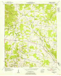 1950 Deerfield1954 Print · USGSLawrence County, Tennessee, is captured here in the mid-twentieth century as a landscape of isolated farmsteads and rural social hubs. Genealogists and local historians can trace the foundations of the community at Mt Lebanon Sch, Pleasant Grove Church, and Lourdes Lake.2 unique versions available
 - 1951 Map of Ethridge, 1954 Print
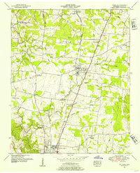 1951 Ethridge1954 Print · USGSLawrence County is captured in the early fifties as the rural communities of Ethridge and Lawrenceburg expanded along the rail lines. Researchers can pinpoint long-standing landmarks such as Union Hill Sch, the Lawrenceburg Sanitarium, and the Yoder Cem burial ground.
 - 1951 Map of Lawrenceburg, 1956 Print
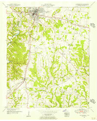 1951 Lawrenceburg1956 Print · USGSLawrence County during the early fifties reveals a landscape defined by the LOUISVILLE AND NASHVILLE rail line and rural outposts. Trace family history at Mimosa Cem, Dunn Sch, or the small settlement of Leoma.
 - 1951 Map of Long Branch, 1956 Print
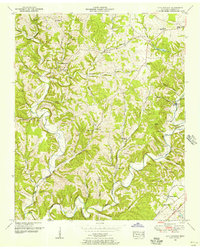 1951 Long Branch1956 Print · USGSLawrence County was a landscape of quiet hollows and family-owned lands in the early 1950s. Genealogists can locate specific burial sites like Ander Smith Cem, while historians can trace the Louisville and Nashville rail line through Springers Station.2 unique versions available
 - 1956 Map of Columbia, 1960 Print
 1956 Columbia1960 Print · USGSMiddle Tennessee in the mid-fifties presents a landscape of established river towns and critical rail hubs before the arrival of the modern interstate system. Researchers can trace the routes of the Louisville and Nashville railroad or locate historic landmarks like Stones River National Military Park and the Tennessee National Wildlife Refuge.6 unique versions available
 - 1966 Map of Lawrenceburg, 1969 Print
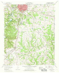 1966 Lawrenceburg1969 Print · USGSLawrenceburg and its rural surroundings thrive in the mid-1960s, balanced between a growing urban center and traditional farming communities. Genealogists can trace family footprints across Mimosa Cem, visit New Prospect Church, or follow the historic Old Andrew Jackson Highway.2 unique versions available
 - 1966 Map of Ethridge, 1969 Print
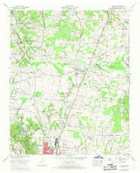 1966 Ethridge1969 Print · USGSMiddle Tennessee's rural landscape comes into focus in the mid-1960s as Ethridge and Lawrenceburg expand along the rail line. Researchers can trace family sites at Lay Cem, Shady Grove Ch, and the old Lawrenceburg Sanitarium and Hospital.2 unique versions available
 - 1985 Map of Lawrenceburg
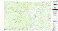 1985 Lawrenceburg1985 Print · USGSMiddle Tennessee and Northern Alabama are captured in the mid-1980s, showcasing a landscape of high ridges and winding river valleys. Genealogists and historians can trace rail lines like the Seaboard System Railroad or locate community landmarks such as Saint Marys Church and Three Churches.2 unique versions available
End of results
Showing maps 1-12 of 12
Top cities near Lawrenceburg
Top neighborhoods of Lawrenceburg
- Belmont historical maps
- Clearview Heights historical maps
- Meadowview historical maps
- Hickory Heights historical maps
- Hood Lake historical maps
- Dunn historical maps
See more
Frequently asked questions
- What are the different types of historical maps available for Lawrenceburg?
- What is the oldest map of Lawrenceburg?
- Where can I purchase historical maps of Lawrenceburg for my home or office?
- Where can I download high-res historical maps of Lawrenceburg?
- Are there historical topographic maps available for Lawrenceburg?
- Is there historical aerial imagery available for Lawrenceburg?
- Where are historical maps of Lawrenceburg sourced from?