1950s Maps of Maury County, Tennessee
Explore 11 historic maps of Maury County from the 1950s. These maps offer a rare glimpse into what life looked like during the 1950s — showing old roads, neighborhoods, homes, and landmarks that have changed or disappeared over time.
Whether you're researching your family's past, planning a metal detecting trip, or studying how Maury County's landscape evolved across the 1950s, these high-resolution maps are a powerful tool for exploring the history of this region.
- Focus on a specific era: All maps on this page are from the 1950s, giving you a focused view of this time period.
- See what’s changed: Compare century-old streets, trails, and buildings to today's modern landscape using overlays and satellite layers.
- Research with precision: Use these maps for genealogy, historical research, land use analysis, or educational projects.
- View, download, or print: Maps are fully viewable online in high resolution, and can be downloaded or printed for your own records.
Start exploring Maury County's history through authentic maps from the 1950s. This is your window into the past.
Maury County, TN maps
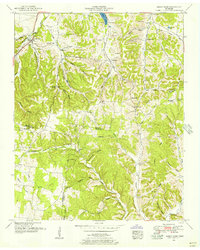
(11)- 1950 Map of Mount Pleasant
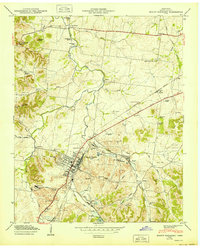 1950 Mount Pleasant1950 Print · USGSMaury County at the peak of its mid-century phosphate mining era reveals a landscape shaped by industry and community. Trace family roots at Arlington Cem or explore established neighborhoods like Red Row and Frierson Town near the LOUISVILLE & NASHVILLE rail line.2 unique versions available
 - 1951 Map of Campbells Station
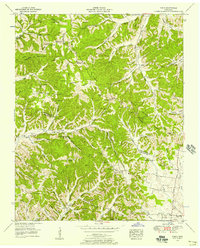
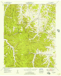
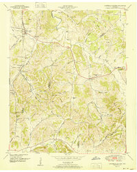 1951 Campbells Station1951 Print · USGSThe hills of Maury and Marshall counties are captured here in the early fifties, showing the rural communities along the Louisville and Nashville railroad. Genealogists can locate numerous family burial grounds and community hubs like Culleoka, Lowery Chapel, and the Mooresville School.3 unique versions available
 - 1951 Map of Lynnville, 1956 Print
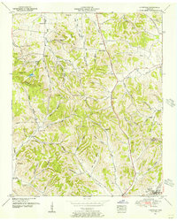 1951 Lynnville1956 Print · USGSThe hills of Middle Tennessee are captured here in the early 1950s, showing the ridge-and-hollow terrain along the Maury and Giles County line. Researchers can locate numerous family cemeteries and remote churches like Taylor Chapel and the Old Camping Ground Cemetery.2 unique versions available
 - 1951 Map of Summertown, 1956 Print
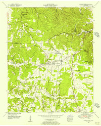 1951 Summertown1956 Print · USGSSummertown and the surrounding Lawrence County uplands are shown here in the early fifties, caught between old agrarian roots and mid-century transit growth. Trace family history at Hinestown Ch, Porter Chapel, or the old Brace Sch near the Buffalo River.3 unique versions available
 - 1951 Map of Sandy Hook, 1956 Print
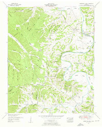
 1951 Sandy Hook1956 Print · USGSSouthern Maury County and neighboring Giles and Lawrence counties were dominated by phosphate mining and rail transit in the early fifties. Genealogists and historians can trace the foundations of local life through the L and N RR, rural strip mines, and community landmarks like Willis Chapel and Scotts Mill.2 unique versions available
 - 1951 Map of Williamsport, 1956 Print
 1951 Williamsport1956 Print · USGSMaury County at mid-century reveals a landscape shaped by the winding Duck River and burgeoning industrial mining. Researchers can trace family sites at Williamsport, find old rural landmarks like Woodrow Sch, or locate numerous cemeteries including McKennon Cem and Greenfield Cem.3 unique versions available
 - 1951 Map of Theta, 1957 Print
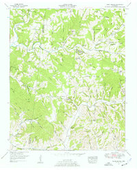
 1951 Theta1957 Print · USGSThe border of Williamson and Maury counties in the early fifties shows a landscape of ridge-top settlements and deep hollows. Trace family roots at Theta or Boston, and locate landmarks like the Natchez Trace, Stanley Cave, and Mossy Spring Sch.4 unique versions available
 - 1951 Map of Greenfield Bend, 1957 Print
 1951 Greenfield Bend1957 Print · USGSThe Duck River valley on the border of Hickman and Maury Counties is shown here in the early fifties, a landscape of deep hollows and river bends. Researchers can trace family sites like Kettle Mills, the Forty Thicket School, and Bingham Cem.3 unique versions available
 - 1951 Map of Mt. Joy, 1957 Print
 1951 Mt. Joy1957 Print · USGSMid-century Lewis and Maury Counties are captured here as a network of ridge-top schools and valley-bottom farmsteads. Genealogists can trace family footprints through sites like the Kittrell Cem, Wills Chapel, and the Ridge Top Sch.2 unique versions available
 - 1951 Map of Primm Springs, 1957 Print
 1951 Primm Springs1957 Print · USGSThe rural borders of Maury, Williamson, and Hickman counties are shown in the early 1950s as a landscape of family farms and creek-side industry. Researchers can trace the path of the Natchez Trace past landmarks like Johnsons Mill, Primm Springs, and several abandoned mines.3 unique versions available
 - 1956 Map of Columbia, 1960 Print
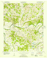
 1956 Columbia1960 Print · USGSMiddle Tennessee in the mid-fifties presents a landscape of established river towns and critical rail hubs before the arrival of the modern interstate system. Researchers can trace the routes of the Louisville and Nashville railroad or locate historic landmarks like Stones River National Military Park and the Tennessee National Wildlife Refuge.6 unique versions available
End of results
Showing maps 1-11 of 11
Top cities of Maury County
Frequently asked questions
- What are the different types of historical maps available for Maury County?
- What is the oldest map of Maury County?
- Where can I purchase historical maps of Maury County for my home or office?
- Where can I download high-res historical maps of Maury County?
- Are there historical topographic maps available for Maury County?
- Is there historical aerial imagery available for Maury County?
- Where are historical maps of Maury County sourced from?