2020s Maps of Columbia, Tennessee
Explore 5 historic maps of Columbia from the 2020s. These maps offer a rare glimpse into what life looked like during the 2020s — showing old roads, neighborhoods, homes, and landmarks that have changed or disappeared over time.
Whether you're researching your family's past, planning a metal detecting trip, or studying how Columbia's landscape evolved across the 2020s, these high-resolution maps are a powerful tool for exploring the history of this region.
- Focus on a specific era: All maps on this page are from the 2020s, giving you a focused view of this time period.
- See what’s changed: Compare century-old streets, trails, and buildings to today's modern landscape using overlays and satellite layers.
- Research with precision: Use these maps for genealogy, historical research, land use analysis, or educational projects.
- View, download, or print: Maps are fully viewable online in high resolution, and can be downloaded or printed for your own records.
Start exploring Columbia's history through authentic maps from the 2020s. This is your window into the past.
Columbia, TN maps
(5)- 2022 Map of Carters Creek, 2022 Print
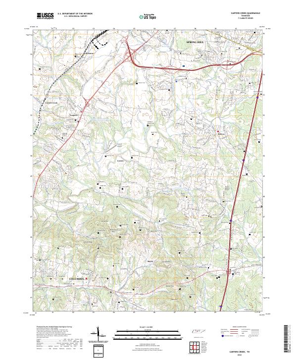 2022 Carters Creek2022 Print · USGSThe northern edge of Maury County comes into focus in this contemporary survey of the lands between Spring Hill and COLUMBIA. Genealogists can trace family names across Old Brick Church Cem, Aiken Ridge, and the University of Tennessee Experimental Farm Lake.
 - 2022 Map of Godwin, 2022 Print
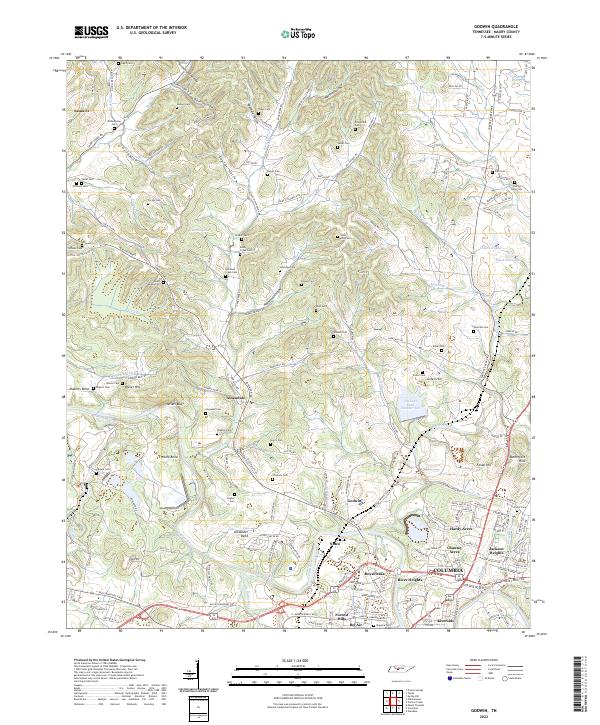 2022 Godwin2022 Print · USGSMaury County's bend in the Duck River appears in this recent record of rural Tennessee life and suburban expansion. Genealogists can locate numerous family burial grounds like Lasting Hope Cem or trace old roadbeds such as Pigg Schoolhouse Rd.
 - 2022 Map of Columbia, 2022 Print
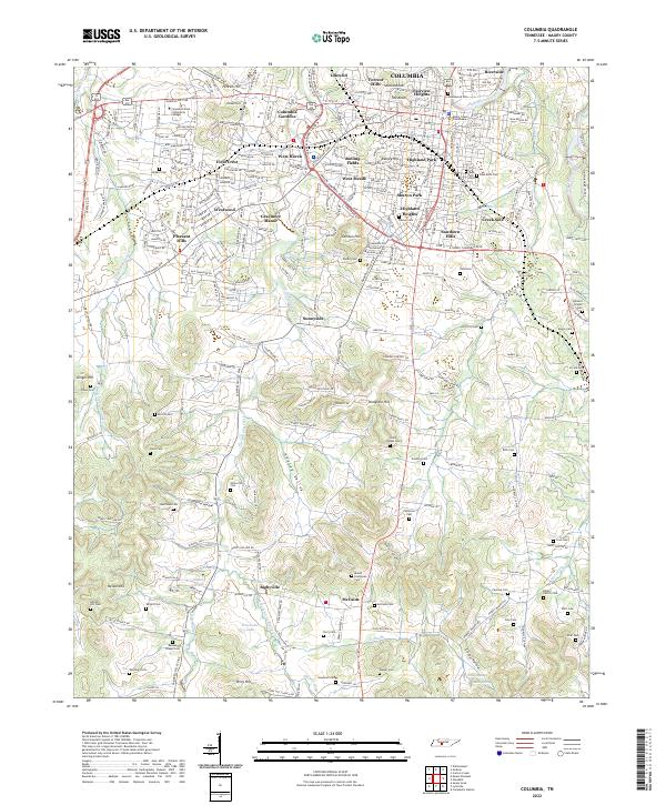 2022 Columbia2022 Print · USGSMaury County is shown here in its modern era, centered on the city of Columbia and its surrounding valleys. Genealogists can trace family burial sites at Zollicoffer Cem and Mount Evergreen Cem or explore the rural landscapes of Bigbyville.
 - 2022 Map of Mount Pleasant, 2022 Print
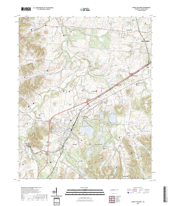 2022 Mount Pleasant2022 Print · USGSMaury County in the early twenty-first century reflects a complex landscape of industrial centers and historic family settlements. Researchers can trace the roots of communities like Needmore and Frierson Town or locate family plots at Cross Bridges Cem and Saint Johns Cem.
 - 2022 Map of Williamsport, 2022 Print
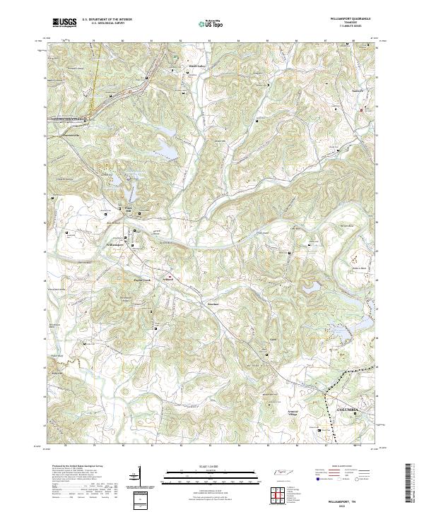 2022 Williamsport2022 Print · USGSCentral Tennessee’s river valleys and ridgelines are captured here in the 2020s, showing the intersection of modern infrastructure and deep-rooted local history. Researchers can trace family sites at Blackburn Cem or explore the corridor of the Natchez Trace Parkway near Williamsport.
End of results
Showing maps 1-5 of 5
Top cities near Columbia
- Franklin historical maps
- Spring Hill historical maps
- Lewisburg historical maps
- Mount Pleasant historical maps
- Thompson's Station historical maps
Top neighborhoods of Columbia
- Neapolis historical maps
- Fairview Heights historical maps
- Field Crest historical maps
- Forrest Hills historical maps
- Graymere Manor historical maps
- Highland Heights historical maps
See more
Frequently asked questions
- What are the different types of historical maps available for Columbia?
- What is the oldest map of Columbia?
- Where can I purchase historical maps of Columbia for my home or office?
- Where can I download high-res historical maps of Columbia?
- Are there historical topographic maps available for Columbia?
- Is there historical aerial imagery available for Columbia?
- Where are historical maps of Columbia sourced from?