1940s Maps of Sweetwater, Tennessee
Explore 5 historic maps of Sweetwater from the 1940s. These maps offer a rare glimpse into what life looked like during the 1940s — showing old roads, neighborhoods, homes, and landmarks that have changed or disappeared over time.
Whether you're researching your family's past, planning a metal detecting trip, or studying how Sweetwater's landscape evolved across the 1940s, these high-resolution maps are a powerful tool for exploring the history of this region.
- Focus on a specific era: All maps on this page are from the 1940s, giving you a focused view of this time period.
- See what’s changed: Compare century-old streets, trails, and buildings to today's modern landscape using overlays and satellite layers.
- Research with precision: Use these maps for genealogy, historical research, land use analysis, or educational projects.
- View, download, or print: Maps are fully viewable online in high resolution, and can be downloaded or printed for your own records.
Start exploring Sweetwater's history through authentic maps from the 1940s. This is your window into the past.
Sweetwater, TN maps
(5)- 1940 Map of Philadelphia
 1940 Philadelphia1940 Print · USGSThe Tennessee Valley just before the height of the war era shows a landscape of ridge-top schools and creek-side settlements. Researchers can trace ancestral locations at Philadelphia, the Roberson Cem, and rural centers like New Hope Ch.
 - 1941 Map of Sweetwater, 1954 Print
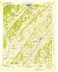
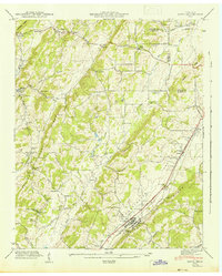
 1941 Sweetwater1954 Print · USGSIn the early 1940s, this Monroe County corridor was a bustling intersection of rail and road transport centered on Sweetwater. Genealogists can trace family roots through numerous country churches and schools like Watson Chapel, Liberality Sch, and Sharps Chapel Sch.
 - 1941 Map of Niota, 1960 Print
 1941 Niota1960 Print · USGSNiota and the surrounding McMinn County countryside are captured here in the early 1940s, following the path of the Southern Railway. Researchers can trace old agrarian roots at Barton Mill, local landmarks like Beulah Chapel, and small settlements including Prigmore.2 unique versions available
 - 1942 Map of Sweetwater
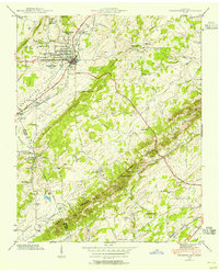
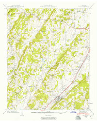
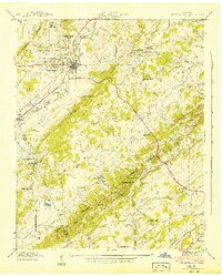 1942 Sweetwater1942 Print · USGSMonroe and McMinn counties in the early 1940s reveal a landscape of ridge-and-valley farming and early transit corridors. Genealogists can locate family landmarks like West View Cem, Tennessee Military Institute, and rural schools such as Sharps Chapel Sch.2 unique versions available
 - 1942 Map of Niota
 1942 Niota1942 Print · USGSNiota and the surrounding McMinn County valleys are captured here in the early 1940s as a landscape of small farms, railroad stops, and rural industry. Genealogists can locate family landmarks like Shearman Cem, Barton Mill, and the Murray Store.
End of results
Showing maps 1-5 of 5
Top cities near Sweetwater
- Athens historical maps
- Lenoir City historical maps
- Tellico Village historical maps
- Loudon historical maps
- Madisonville historical maps
- Etowah historical maps
See more
Top neighborhoods of Sweetwater
Frequently asked questions
- What are the different types of historical maps available for Sweetwater?
- What is the oldest map of Sweetwater?
- Where can I purchase historical maps of Sweetwater for my home or office?
- Where can I download high-res historical maps of Sweetwater?
- Are there historical topographic maps available for Sweetwater?
- Is there historical aerial imagery available for Sweetwater?
- Where are historical maps of Sweetwater sourced from?