1950s Maps of Polk County, Tennessee
Explore 11 historic maps of Polk County from the 1950s. These maps offer a rare glimpse into what life looked like during the 1950s — showing old roads, neighborhoods, homes, and landmarks that have changed or disappeared over time.
Whether you're researching your family's past, planning a metal detecting trip, or studying how Polk County's landscape evolved across the 1950s, these high-resolution maps are a powerful tool for exploring the history of this region.
- Focus on a specific era: All maps on this page are from the 1950s, giving you a focused view of this time period.
- See what’s changed: Compare century-old streets, trails, and buildings to today's modern landscape using overlays and satellite layers.
- Research with precision: Use these maps for genealogy, historical research, land use analysis, or educational projects.
- View, download, or print: Maps are fully viewable online in high resolution, and can be downloaded or printed for your own records.
Start exploring Polk County's history through authentic maps from the 1950s. This is your window into the past.
Polk County, TN maps
(11)- 1953 Map of Chattanooga
 1953 Chattanooga1953 Print · USGSSoutheast Tennessee in the early fifties shows a landscape reshaped by river management and rail power. Trace the rail lines of the Southern Ry through riverside towns or locate the preserved grounds of the Chickamauga and Chattanooga National Military Park.
 - 1955 Map of Rome
 1955 Rome1955 Print · USGSThe tri-state borderlands of Georgia, Alabama, and Tennessee appear in the mid-fifties as a landscape of ridge-and-valley industry and river navigation. Genealogists can trace family footprints near Chattanooga, the iron works of Gadsden, and textile towns like Trion or Summerville.
 - 1957 Map of Farner, 1959 Print
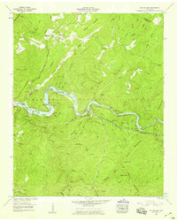
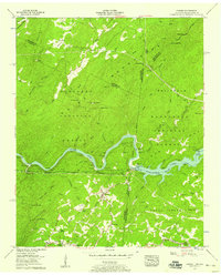 1957 Farner1959 Print · USGSThe Tennessee-North Carolina border country in the late fifties was a landscape of steep ridges and river-driven industry. Genealogists and historians can trace family locations through Brock Cem, Cataska Sch, and the remote mountain community of Farner.6 unique versions available
 - 1957 Map of Ducktown, 1959 Print
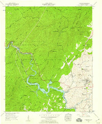 1957 Ducktown1959 Print · USGSThe copper industry and mountain wilderness met in the late fifties near the Tennessee-Georgia border. Genealogists and industrial historians can trace the Burra Burra Mine, the Louisville and Nashville rail line, and the waters of Ocoee No 3 Lake.4 unique versions available
 - 1957 Map of Isabella, 1959 Print
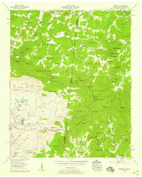 1957 Isabella1959 Print · USGSThe copper-rich Copper Basin of Tennessee and North Carolina is captured here in the late fifties, showing a landscape shaped by industrial extraction and rail. Genealogists and historians can locate the Isabella Mine, the London Flotation Plant, and family landmarks like Padgett Cem or Burger Town.4 unique versions available
 - 1957 Map of Mecca, 1959 Print
 1957 Mecca1959 Print · USGSThe borderlands of Monroe and McMinn Counties are shown here during the mid-fifties as the forest and ridge-top settlements maintained their traditional character. Researchers can trace rural congregation sites like Rural Vale Ch and Union Grove Ch or locate family burial grounds such as Holly Springs Cem.4 unique versions available
 - 1957 Map of Mc Farland, 1959 Print
 1957 Mc Farland1959 Print · USGSThe Hiwassee River valley in the late fifties shows a landscape of industrial utility and deep-rooted settlements. Trace family history through Morgan Cem and Springtown (Servilla), or follow the Louisville and Nashville Railroad past Maggies Mill.3 unique versions available
 - 1957 Map of Chattanooga, 1966 Print
 1957 Chattanooga1966 Print · USGSEast Tennessee in the mid-1960s shows a landscape of massive hydroelectric reservoirs and emerging industrial sites like the Atomic Energy Commission (Oak Ridge Area). Trace the rail networks of the Southern Ry through Chattanooga or locate family-named ridges across the Cumberland Plateau.3 unique versions available
 - 1958 Map of Rome, 1966 Print
 1958 Rome1966 Print · USGSNorthwest Georgia and neighboring Tennessee and Alabama are captured here in the late fifties, showcasing a landscape of high ridges and river valleys. Researchers can trace historic rail lines like the Seaboard Air Line RR and explore the bounds of Cloudland Canyon State Park or Fort Oglethorpe.3 unique versions available
 - 1959 Map of Chattanooga
 1959 Chattanooga1959 Print · USGSSoutheast Tennessee is shown here during a decade of industrial growth and hydroelectric development. Trace the regional rail networks of the Southern Ry and find landmark sites like Lookout Mountain, Fall Creek Falls State Park, and Chattanooga.
 - 1959 Map of Hemp Top, 1961 Print
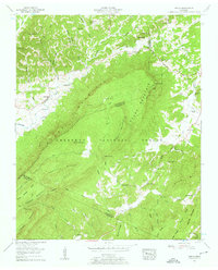
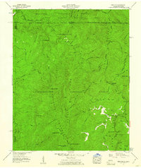 1959 Hemp Top1961 Print · USGSThe high ridges of the Georgia-Tennessee border are documented here in the late fifties, where forest management and deep river valleys meet. Genealogists and hikers can trace old landmarks like Jones Cem, Bethlehem Ch, and the Pounding Mill site.4 unique versions available
End of results
Showing maps 1-11 of 11
Top cities of Polk County
Frequently asked questions
- What are the different types of historical maps available for Polk County?
- What is the oldest map of Polk County?
- Where can I purchase historical maps of Polk County for my home or office?
- Where can I download high-res historical maps of Polk County?
- Are there historical topographic maps available for Polk County?
- Is there historical aerial imagery available for Polk County?
- Where are historical maps of Polk County sourced from?