Old Maps of Polk County, Tennessee for Metal Detecting
Plan your next treasure hunt with 178 historic maps of Polk County. Find old homesites, ghost towns, trails, and gathering spots that may be lost to time — perfect for identifying promising metal detecting locations.
- Locate forgotten sites: Uncover places like long-lost settlements, abandoned rail lines, or gathering spots.
- Plan better hunts: Use map overlays combined with LiDAR or satellite views to narrow in on historically rich areas.
- Made for detectorists: Thousands of hobbyists use these maps to discover relics, coins, and hidden history.
Use these historic maps to boost your research and find new opportunities beneath the surface of Polk County.
Polk County, TN maps
(178)- 1886 Map of Dalton
 1886 Dalton1886 Print · USGSNorthwest Georgia in the 1880s is a landscape of mountain gaps and vital river ferries. Trace family roots and vanished infrastructure from Dalton to Spring Place, including named landmarks like Shackelfords Ferry and Fort Mountain.
 - 1886 Map of Cleveland
 1886 Cleveland1886 Print · USGSSoutheast Tennessee in the mid-1880s was a landscape defined by the iron rails and winding rivers that fueled the region's growth. You can trace early river crossings like Savannah Ford and Kincannons Ferry or locate old community centers like Chestua Mills.
 - 1888 Map of Ellijay
 1888 Ellijay1888 Print · USGSNorth Georgia in the late 1880s was a land of high peaks and emerging rail lines as the mountains were first being methodically surveyed. You can trace the Marietta and North Georgia Railroad through Blue Ridge and locate vanished stops like Vanzants Store or the rural community of Cherry Log.
 - 1892 Map of Cleveland
 1892 Cleveland1892 Print · USGSSoutheast Tennessee is captured in the late nineteenth century as a landscape of river ferries and emerging rail junctions. Genealogists and historians can locate early settlements like Charleston and Riceville or trace the original river crossings at Kincannons Ferry and Helderbrand Ford.
 - 1892 Map of Ellijay
 1892 Ellijay1892 Print · USGSNorth Georgia's mountain communities were primarily connected by river valleys and the winding Marietta and North Georgia Railroad in the late nineteenth century. Genealogists can trace early homesteads and centers of trade like Vanzant's Store, Mineral Bluff, and Cherry Log.
 - 1892 Map of Dalton
 1892 Dalton1892 Print · USGSNorthwest Georgia in the late nineteenth century was defined by its river crossings and the emerging rail lines through Dalton. Researchers can trace the Federal Road and locate family landmarks like Newtown Ferry or Talking Rock Mills.
 - 1893 Map of Murphy
 1893 Murphy1893 Print · USGSThe Unaka Mountains and Hiwassee River valley are captured here in the late 19th century, showing a landscape of remote mountain gaps and early industry. Researchers can find old mining sites like Isabella Mine, river crossings such as Prince Fy., and rail stops at Hiwassee Sta..5 unique versions available
 - 1895 Map of Cleveland
 1895 Cleveland1895 Print · USGSSoutheast Tennessee thrived along the Hiwassee River and its rail corridors during the 1890s. Genealogists and historians can trace defunct river crossings like Bunker Hill Ferry and milling sites including Chestuee Mills and Longs Mills.
 - 1897 Map of Dalton
 1897 Dalton1897 Print · USGSNorthwest Georgia in the late nineteenth century was a rugged landscape of river crossings and mountain gaps. Genealogists can trace early homesteads and commerce at Praters Mill, Spring Place, and historic river crossings like Montgomery Ferry.4 unique versions available
 - 1898 Map of Ellijay
 1898 Ellijay1898 Print · USGSNorth Georgia’s mountain country is captured here in the late nineteenth century, showing the early development of Gilmer and Fannin counties. Genealogists can trace family homesteads near old river crossings like Centers Ferry and settlements such as Mineral Bluff and Whitepath.2 unique versions available
 - 1901 Map of Cleveland
 1901 Cleveland1901 Print · USGSSoutheast Tennessee was a thriving hub of river and rail commerce at the dawn of the twentieth century. Genealogists can trace family homesteads near vanished landmarks like Marble Switch, Bunker Hill Ferry, or the early settlements of Riceville and Benton.4 unique versions available
 - 1911 Map of Ellijay
 1911 Ellijay1911 Print · USGSNorth Georgia and the Tennessee border are captured here at the turn of the century, showing a mountain landscape of river ferries and early rail. Genealogists can locate family landmarks like Higdons Store, the Pisgah church, or crossings at Bakers Ferry and Shallow Ford.4 unique versions available
 - 1911 Map of Cohutta Mtn
 1911 Cohutta Mtn1911 Print · USGSThe Georgia-Tennessee borderlands in the early twentieth century were defined by mountain rail and timber. Genealogists can trace family roots through settlements like Tennga and Crandall or locate historic operations like Hassler Mill along the rail line.2 unique versions available
 - 1913 Map of Cohutta Mtn.
 1913 Cohutta Mtn.1913 Print · USGSThe Georgia and Tennessee borderlands appear here in the years before the Great Depression, centered on the high peaks of the Blue Ridge. Researchers can trace early railroad life along the Louisville & Nashville RR or locate old sites like Cohutta Springs and Hassler Mill.3 unique versions available
 - 1914 Map of Murphy
 1914 Murphy1914 Print · USGSThe Tennessee-North Carolina borderlands come to life in this early twentieth-century survey, showcasing a landscape of mountain ridges and river-driven commerce. Researchers can trace the Louisville and Nashville Railroad to old stops like Apalachia Sta or locate the historic Prince Ferry and White Cliff Springs.3 unique versions available
 - 1934 Map of Mecca
 1934 Mecca1934 Print · USGSMonroe County was a land of steep ridges and creek-side settlements in the mid-1930s. Genealogists and local historians can trace the foundations of mountain life through landmarks like White Cliff Springs, Oldman Mill, and the Rural Vale School.
 - 1935 Map of Epworth
 1935 Epworth1935 Print · USGSNorth Georgia and the Tennessee borderlands are captured here in the mid-1930s, showing a landscape defined by copper mining and mountain farming. Researchers can locate vanished landmarks like Higdons Store, trace the Louisville and Nashville rail line, or find family roots at Madola Sch and Hipp Chapel.
 - 1935 Map of Tellico
 1935 Tellico1935 Print · USGSMonroe County was a landscape of mountain ridges and remote outposts in the mid-1930s, anchored by the rail hub at Tellico Plains. Genealogists and researchers can trace family landmarks like Carpenter Cem, Oldman Mill, and the Rural Vale School.
 - 1935 Map of Calhoun
 1935 Calhoun1935 Print · USGSEastern Tennessee in the mid-thirties was a region of small farming settlements and growing power networks. Researchers can trace early family landmarks like Squire Liner Hollow, the community at Sanford, and historic congregations at South Liberty Ch or Britton Ch.
 - 1935 Map of Benton
 1935 Benton1935 Print · USGSThe river valleys of Polk County come alive in the mid-1930s as the Tennessee Valley Authority maps the transition from ferry crossings to modern power grids. Genealogists can trace family footprints at Chestuee Mills, Benton Station, and rural landmarks like Wiregrass Chapel.
 - 1935 Map of Hemp Top
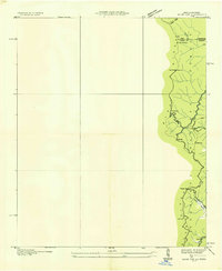 1935 Hemp Top1935 Print · USGSHigh in the mountains along the Georgia-Tennessee border in the mid-1930s, this survey documents the ridge-line terrain of the Blue Ridge. Researchers can locate remote landmarks like the Fire Tower on Hemp Top, Ashe Mill, and Dally Gap.
 - 1935 Map of Felker
 1935 Felker1935 Print · USGSEastern Bradley County was a network of rural creek valleys and community crossroads in the mid-1930s. Family historians can trace local landmarks like Taylors Sch, Kinsers Tabernacle, and the Union Grove Ch cemetery.
 - 1935 Map of Mineral Bluff
 1935 Mineral Bluff1935 Print · USGSThe tri-state border region of Georgia, Tennessee, and North Carolina comes alive in the mid-1930s as industry and infrastructure reshape the mountain landscape. Genealogists can locate family landmarks like Paintertown Sch, Shady Grove Ch, and the homes near Mineral Bluff.
 - 1935 Map of Parksville
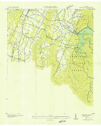 1935 Parksville1935 Print · USGSPolk County in the mid-1930s was a landscape in transition as the Tennessee Valley Authority reshaped the Ocoee River. Genealogists and local historians can trace family locations near Horns Creek Sch, Beech Springs Ch, and the early settlement at Oldfort.
 - 1935 Map of Oswald Bald
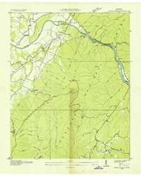 1935 Oswald Bald1935 Print · USGSThe Hiwassee River valley in the mid-1930s shows a landscape of mountain ridges and early Tennessee Valley Authority infrastructure. Trace family history at Taylor Sch and Benton Springs, or locate old industrial sites like Harrison Mill.
Showing maps 1-25 of 178
Top cities of Polk County
Frequently asked questions
- What are the different types of historical maps available for Polk County?
- What is the oldest map of Polk County?
- Where can I purchase historical maps of Polk County for my home or office?
- Where can I download high-res historical maps of Polk County?
- Are there historical topographic maps available for Polk County?
- Is there historical aerial imagery available for Polk County?
- Where are historical maps of Polk County sourced from?